How to Read the Byeonsan Peninsula: From Chaeseokgang’s 87-Million-Year-Old Strata to Jikso Falls in Inner Byeonsan
Byeonsanbando National Park began as a provincial park in 1971 and was elevated on June 11, 1988, to become South Korea’s 19th national park—the country’s only peninsula-shaped national park combining mountains with the coast of the Yellow Sea. Using Gyeokpo Port as a base, an efficient itinerary is to visit Chaeseokgang, Jeokbyeokgang, and the Byeonsan Masil-gil, then, if time allows, travel separately to Jikso Falls and Naesosa Temple in Inner Byeonsan.

I’ve been here?
Your check-in helps the next traveler.
No one has checked in yet Be the first
One tap — no writing needed
Why the Mountains and the West Sea Became One Park on June 11, 1988
Byeonsanbando National Park was designated as a provincial park in December 1971, centered on the hilly areas around Byeonsan-myeon, Buan-gun, Jeonbuk. Recognized for the conservation value of its terrestrial and marine natural resources as well as its historical and cultural resources, it was promoted to become the Republic of Korea's 19th national park on June 11, 1988. As the only peninsula-style national park in Korea that embraces both mountains and the sea, it determines how visitors should plan their itinerary.
The park is divided into Naebyeonsan and Oebyeonsan. Naebyeonsan features Uisangbong Peak at 508 m, Sinseonbong Peak at 486 m, Ssangseonbong Peak at 459 m, and Jikso Falls, while Oebyeonsan includes Chaeseokgang, Jeokbyeokgang, Gosapo Beach, and Gyeokpo Beach. Rather than trying to see everything in one day, it is better to divide the itinerary into three to four hours around the Gyeokpo coast and a half day in Naebyeonsan or the Naesosa Temple area.
The Order for Viewing 87 Million-Year-Old Strata at Chaeseokgang North of Gyeokpo Port
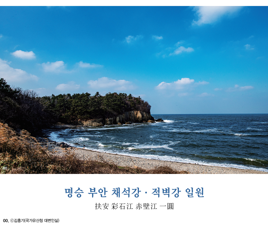
Chaeseokgang is a coastal rock formation reached by descending stairs near the breakwater north of Gyeokpo Port. The approximately 20-meter-high coastal cliff was exposed through wave erosion, and the Gyeokpori Formation is described as having formed from about 87 million years ago during the Cretaceous Period, based on Jurassic granite dating to approximately 170 million years ago.
Chaeseokgang is an outdoor natural attraction with no admission fee, so no separate regular viewing hours or closing days have been confirmed. However, visitors can reach the edge of the rock formations only when the tide is out. Check the day's tide times before departure, and for wet strata and rocks covered with seaweed, wearing shoes with good traction is safer than wearing sandals.
- Access reference point: Entrance to the breakwater north of Gyeokpo Port
- Viewing points: Layered sedimentary strata and sea-eroded cliffs
- Recommended stay: 40–60 minutes for Chaeseokgang alone
- Caution: Avoid entering the coastal rocks during high tide or strong waves, and do not go beyond the railings
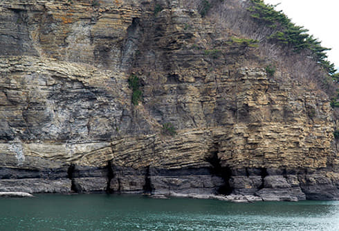
The Coastline of Course 3 of the Byeonsan Masil-gil Trail Connecting Jeokbyeokgang and Suseongdang
The Buan Byeonsan Masil-gil is a 66-kilometer coastal trail running from the Saemangeum Exhibition Hall to Buan Natural Ecology Park. Among its sections, the route that is well suited to viewing the coastal scenery together links Gosapo Campground, Haseom Observatory, Banwol Village, Jaeundang Sand Dune, Jeokbyeokgang, Suseongdang, Gyeokpo Beach, Chaeseokgang, and Gyeokpo Port.
Jeokbyeokgang, together with Chaeseokgang, is introduced as a major site in the Jeonbuk West Coast National Geopark. For a short itinerary, a realistic option is to start at Chaeseokgang, travel toward Gyeokpo Beach and Suseongdang–Jeokbyeokgang, and then return based on your fitness level and the location where you need to retrieve your vehicle. This is not a place where the entire 66 kilometers should be planned as a one-day walking route.
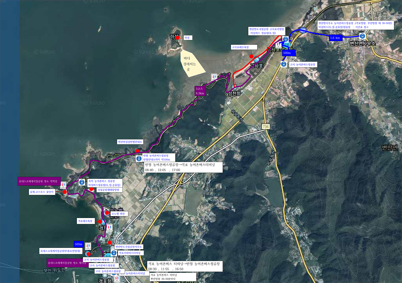
Bus and Driving Routes from Gyeokpo Terminal to Chaeseokgang
For public transportation users, Gyeokpo Terminal is an easy reference point for the coastal area. Available stop information lists Seat Bus No. 100 and rural buses No. 200, 200-201, 201, 210-301, 211-201, 213, 213-201, 214, 215, 216, 330-501, and 350-201 at Gyeokpo Terminal. Schedules and service availability may change by season and day of the week, so check again on the day of departure.
For drivers, the simplest route is to use public or tourist parking areas around Gyeokpo Port and Chaeseokgang, although parking fees and operating conditions may differ on site. The national park office address is 11 Bangpaje-gil, Byeonsan-myeon, Buan-gun, Jeonbuk State Special Self-Governing Province, and the main telephone number is 063-582-7808. Since the office is different from the starting point for a coastal walk at Chaeseokgang, setting the navigation destination separately to “Chaeseokgang” or “Gyeokpo Port” can help avoid confusion.
- Gyeokpo Terminal: Reference point for bus transfers in the coastal area
- National park office: 11 Bangpaje-gil, Byeonsan-myeon, Buan-gun, Jeonbuk State Special Self-Governing Province
- Main telephone: 063-582-7808
- National park reservations and facility inquiries: 1670-9201, 09:00–18:00
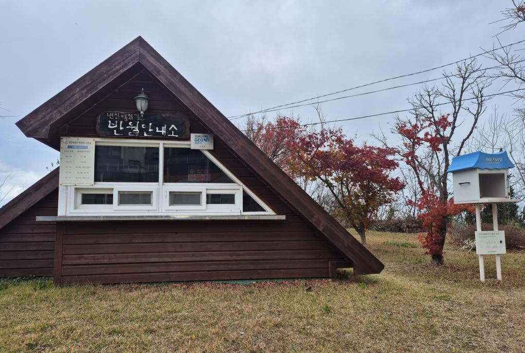
Why the Chaeseokgang Itinerary Should Be Separated When Heading to Jikso Falls and Uisangbong Peak
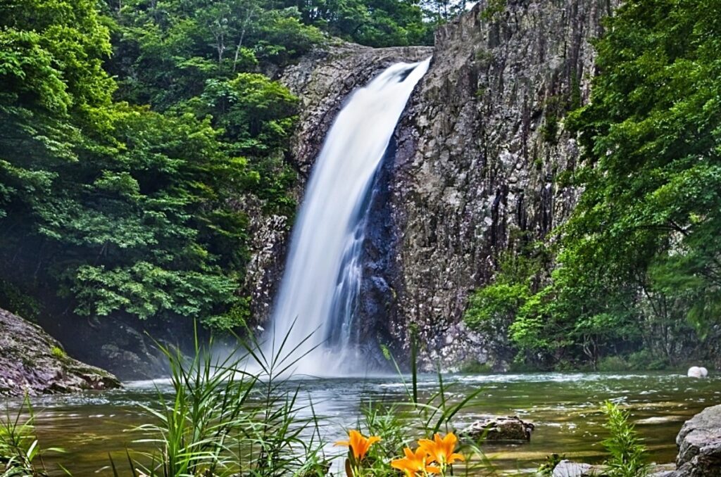
Naebyeonsan is different in character from the coastal walking areas. The Korea National Park Service lists the following Byeonsanbando exploration routes: Ugeumam, Soetppulbawi, Naesosa Wonam, Naesosa, Gyeokpo, Naebyeonsan Namyeochi, Naebyeonsan Naesosa, Wonam Namyeochi, and Jikso Falls. To see Jikso Falls and Uisangbong Peak, you need to allow separate time for driving and hiking from the Gyeokpo coastal area.
In the national park trail rating guide, “Moderate” is described as a short hike of approximately two to four hours requiring light hiking equipment. “Difficult” is four to seven hours, while “Very Difficult” is described as seven hours or more. Rather than connecting a long hike while wearing the same clothing used for the flat coastal viewing at Chaeseokgang, prepare hiking shoes, drinking water, and rain protection, and first check the day's trail restrictions and designated hiking hours.
Reservations and Fitness Planning When Adding Naesosa Temple and Gosapo Campground
If you are planning an overnight trip within Byeonsanbando, Gosapo Campground is a facility operated through the national park reservation system. The foreign-language reservation information states that 69 general pitches at Gosapo Beach operate year-round on a reservation basis. During peak season and on weekends, it is better not to rely on paying at the campground and instead check the remaining spaces for your dates through the national park reservation system first.
If you also want to see cultural heritage, Naesosa Temple can be planned as a separate half-day visit. Byeonsanbando combines coastal geology such as Chaeseokgang and Jeokbyeokgang, temples such as Naesosa and Gaeamsa, and mountain scenery such as Jikso Falls within one park. Even if the travel distances appear short, coastal tide schedules and hiking times follow different standards, so a stable one-night, two-day plan is to visit Gyeokpo Port, Chaeseokgang, and Jeokbyeokgang on the first day, and Naesosa or Naebyeonsan on the following day.
Five Things to Check Before Departure as of August 5, 2026
The official Byeonsanbando National Park webpage provides real-time restriction information, and in June 2026, an announcement was posted about inconvenience caused by repair work on damaged trails. Heavy summer rain, strong winds, and high waves can change coastal accessibility and the sections available for hiking, so checking the restriction information first on the day of departure is essential.
The park itself is a large outdoor area, so no unified opening or closing hours, regular closing days, or general admission fee have been confirmed. Chaeseokgang and Jeokbyeokgang can be viewed free of charge, but separate fees and operating hours may apply to campgrounds, ecological exploration programs, temples, and parking areas. Wheelchair and stroller users should choose a flatter section in advance rather than Chaeseokgang or Jeokbyeokgang, where there are many coastal stairs and rocky areas. The national park website provides Korean, English, Japanese, and Chinese menus.
- Tide: Essential to check before approaching the rocks at Chaeseokgang
- Weather: Shorten the coastal viewing route when rain, strong winds, or high waves are forecast
- Trails: Check the designated hiking hours and restriction information
- Reservations: Check advance reservations for Gosapo Campground and programs
- Inquiries: Byeonsanbando National Park Office, 063-582-7808
Before You Go
- Address
- 11 Bangpaje-gil, Byeonsan-myeon, Buan-gun, Jeonbuk State Special Self-Governing Province
- Admission
- Free
- Phone
- 063-582-7808
- Official site
- https://www.knps.or.kr/front/portal/visit/visitCourseMain.do?menuNo=7020091&parkId=121800
- Transport
- Take transportation to Gyeokpo Terminal and then travel to the Chaeseokgang and Gyeokpo Port area. Seat Bus No. 100 and rural buses No. 200, 200-201, 201, 210-301, 211-201, 213, 213-201, 214, 215, 216, 330-501, and 350-201 may be available; service must be reconfirmed on the day of departure.
- Parking
- Availability and fees for parking areas around Chaeseokgang and Gyeokpo Port must be checked on site and on the day of departure.
- Time needed
- Two to three hours for Gyeokpo Port, Chaeseokgang, and Gyeokpo Beach; three to four hours including Jeokbyeokgang; at least a separate half day is recommended for hiking in Naebyeonsan.
- Accessibility
- Chaeseokgang and Jeokbyeokgang have stairs and rocky areas, making wheelchair and stroller access limited. The national park website provides Korean, English, Japanese, and Chinese menus.
The above information is current as of the time of writing. Check the official guidance again before visiting.

Places
Nearby Attractions 5
-
 1
1
-
 2
2
-
 3
3
-
 4
4
-
 5
5
Food & Dining 5
-
 6
6
-
 7
Gunsan Sikdang
7
Gunsan Sikdang -
 8
8
-
 9
Masikdang
9
Masikdang -
10
More Travel Guides in This Area
 Travel Guide
How to Walk Along Jeokbyeokgang’s Red Coast and Visit Suseongdang
 Travel Guide
How to Safely Visit the Chaeseokgang Cliffs and Sea Caves at Low Tide
 Travel Guide
Reading a Thousand Years of Celadon Color, Beginning at the Yucheon-ri Kiln Site
 Travel Guide
From the Camellia Forest to the Rock-Carved Buddha of Dosolam: A One-Day Route at Gochang Seonunsa Temple
Korea News
 News
News
TWS heightens comeback excitement with kitschy charm… Anticipation for “plot twist” rises
 News
News
BTS, Six Months After Its Release… ‘Arirang’ Climbs the U.S. Billboard 200
 News
News
'The Nation's Girl Group' RESCENE, Five Girls Transformed into Guardians… Additional Concept Photos for Their 4th Mini Album Revealed
 News
News