33.9 km Straight Line over the Sea: Where to Stop along Gunsan’s Saemangeum Seawall
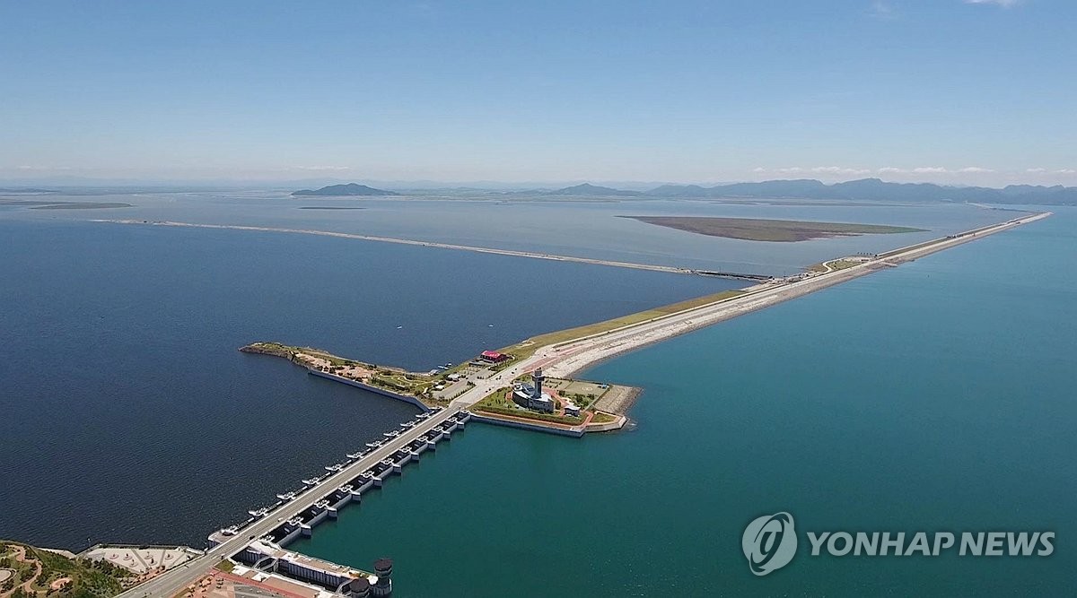
Starting at Bieungdo in Gunsan, the Saemangeum Seawall is a 33.9 km offshore seawall linking Gunsan, Gimje, and Buan. Rather than treating it as merely a road to drive through, stop at Bieung Port, the Sinsi Island rest area and completion tower, Yami Island, and the Gogunsan Islands to take in both the scale of the reclamation project and the geography of Korea’s west coast.

I’ve been here?
Your check-in helps the next traveler.
No one has checked in yet Be the first
One tap — no writing needed
From construction beginning in 1991 to completion in 2010: the background behind the name ‘Saemangeum’
The Saemangeum Seawall is a 33.9-kilometer marine seawall connecting Daehang-ri, Byeonsan-myeon, Buan-gun, with Bieungdo, Gunsan-si. Construction began in November 1991 and was completed in April 2010, while the road opened to the public on April 27, 2010. The Saemangeum Development Authority describes it as a structure with an average width of 290 meters and a maximum width of 535 meters, and an average height of 36 meters and a maximum height of 54 meters.
‘Saemangeum’ is a place name formed by combining ‘sae’ with ‘man’ from the Mangyeong Plain and ‘geum’ from the Gimje Plain. The Saemangeum Development Authority states that the name was created around 1986. When you understand that the seawall was not simply a coastal road but the first stage of a national reclamation project that changed the waterways and land use off Gunsan, Gimje, and Buan, the contrast between the outer waters of the West Sea and the inner waters becomes even more distinct.
Starting at Bieungdo in Gunsan: why to set coordinates as the destination rather than an address for Seawall No. 4
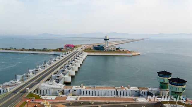
The provided address, 65 Bieungdong-ro, Gunsan-si, Jeonbuk State, is the address of a restaurant near Bieung Port, not a single entrance address for the seawall itself. The reference point for entering from the Gunsan side is near Bieung Port and the endpoint of Seawall No. 4, while the provided coordinates, 35.940068, 126.533837, correspond to this departure area on the Gunsan side. Rather than entering only ‘Saemangeum Seawall’ as the navigation destination, it is better to set an intermediate stop such as Bieung Port or the Sinsi-do Rest Area separately.
Bieung Port is introduced by the Saemangeum Development Authority as a tourist fishing port built on Bieungdo, the endpoint of Seawall No. 4. Gunsan City’s cultural tourism information states that the Saemangeum Comprehensive Fish Market near Bieung Tourist Fishing Port has parking for approximately 300 cars. If you want to take care of meals, restrooms, and parking in one place before or after driving along the seawall, using Bieung Port as your departure or return point is practical.
Rather than driving all 33.9 kilometers at once, how to divide the route at Sinsi-do Rest Area and the completion monument
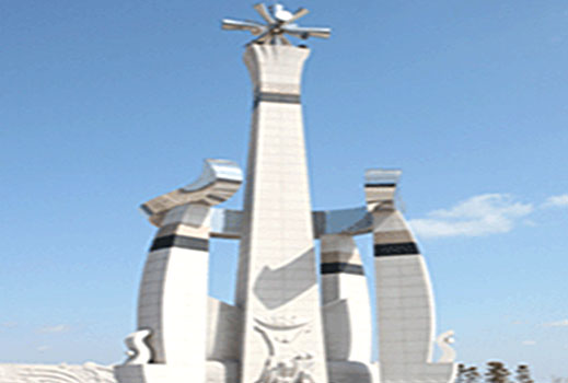
When traveling from Gunsan toward Buan, the clearest candidate for an intermediate stop is the Sinsi-do area. The Korea Tourism Organization introduces a Saemangeum Seawall construction monument located opposite the Saemangeum Rest Area beneath Sinsi-do’s Peak 199. Rather than simply passing the straight section of the seawall, it is a good idea to divide your views here between the sea side and the Gogunsan Islands side.
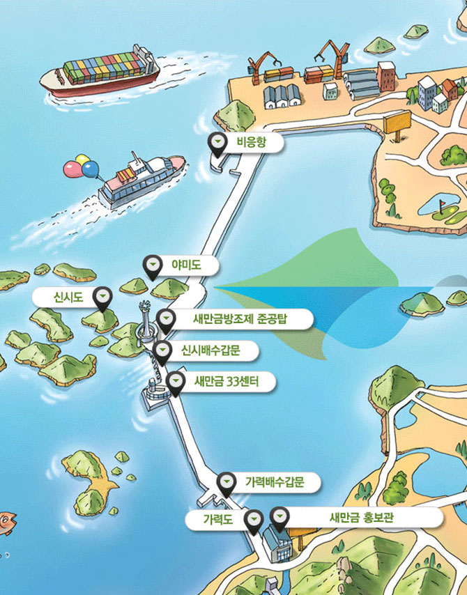
The Saemangeum Development Authority’s tourism guide marks the Public Relations Exhibition Hall, Garyeok Sluice Gate, and Garyeok Plaza on Seawall No. 1; Neoul Rest Area, Sori Rest Area, and Baram Rest Area on Seawall No. 2; Yami Plaza on Seawall No. 3; and Dolphin Rest Area and Sunset Rest Area on Seawall No. 4. Road access and parking conditions may differ at each stopping place, so do not stop suddenly while driving and use only designated rest areas and plazas.
Where the outer sea and inner waters divide: reading the scale of the seawall in numbers
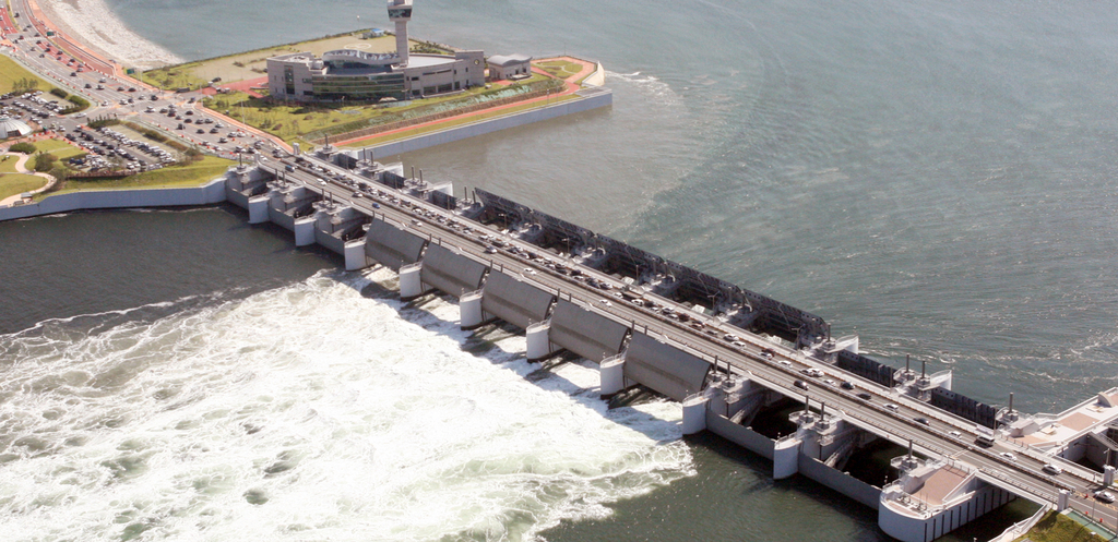
According to the Saemangeum Development Authority, the seawall is 1.4 kilometers longer than the 32.5-kilometer Afsluitdijk in the Netherlands and was listed in the Guinness World Records in August 2010. The portion visible above the average sea level is said to average 11 meters. Although the scenery viewed from inside a car may appear flat, you are in fact traveling across a huge civil-engineering structure that includes both the seabed and the area above the water.
The overall Saemangeum development area is described as 409 square kilometers, comprising 291 square kilometers of reclaimed land and 118 square kilometers of lakes. From the seawall, one side faces the open sea and the other faces the inner waters and development areas behind the seawall. Therefore, this is less a place for approaching waves along a beach promenade than a route for observing how the terrain of the West Sea coast has been reshaped by an artificial structure.
Rather than going directly by bus from downtown Gunsan, use Bieung Port and GSCO as hubs
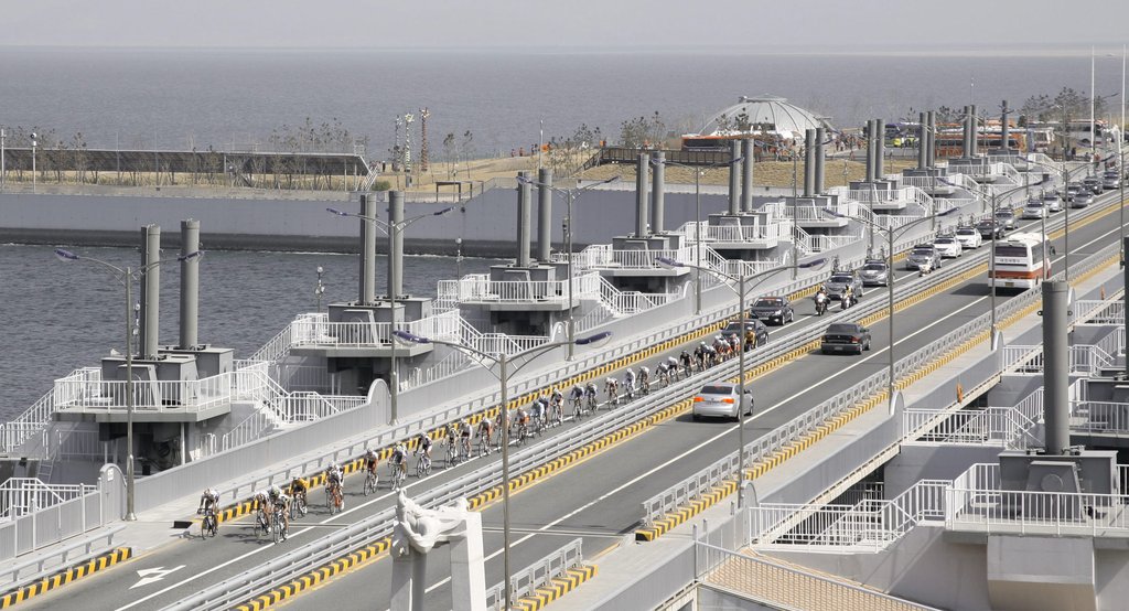
The Saemangeum Seawall is 33.9 kilometers long, so it cannot be accessed like a tourist attraction reached on foot from a subway station exit. City buses 08, 09, 86, and 99 are listed for travel from the Gunsan Intercity and Express Bus Terminal toward the Gunsan Saemangeum Convention Center (GSCO), with the route described as operating approximately every 60 minutes. GSCO is located at 437 Saemangeumbuk-ro, Gunsan-si, and is a useful urban-side hub for reaching the Gunsan-side entrance area of the seawall and Bieung Port.
If you continue toward the Gogunsan Islands, the information for the Muneodo Auto Camping Site states that buses departing from Bieung Port run at 35 minutes past every hour via the Saemangeum Seawall and Yami-do to Muneodo, Seonyudo Beach, and Jangjado. However, tourist transportation can change depending on the season and the operator’s circumstances, so check Gunsan’s bus information and whether the route is operating again on the day of departure. If you have a lot of luggage or plan to travel after sunset, a private car or taxi is more reliable.
Although passage is free, this is not a facility open for sightseeing at all times: distinguishing hours, admission fees, and parking
The Saemangeum Seawall consists of a road and outdoor viewing sections, so it is not a tourist facility that requires a separate admission ticket, and admission is free. No designated opening or closing hours or regular closing days have been confirmed for the seawall itself, which is used for transit. However, individual facilities around the seawall, such as rest areas, restaurants, exhibition halls, and fish markets, each have their own business hours and closing days, so restroom, dining, and indoor-rest options may be limited late in the day.
No single representative telephone number serving as a tourist information line for the entire seawall has been confirmed, so it is more accurate to leave this blank. Official information can be checked on the Saemangeum Development Authority website through the menu ‘About Saemangeum–Saemangeum Travel Information–Attractions–Seawall.’ For parking, check availability at each destination facility, such as the 300-car parking lot at the Bieung Port fish market, and do not park on traffic lanes, shoulders, or bridge sections.
Four precautions for strong sea winds and straight roads, and who is better suited to a stop-based visit than walking
Because the seawall is a long, exposed marine road, there are few places to escape the wind. Regardless of the season, a windproof outer layer, a way to secure your hat, and sun protection are useful. If rain or strong winds are forecast, it is safer to keep viewing stops short. Walking the entire route round trip would total 67.8 kilometers, which is excessive for most visitors; traveling by car and dividing the visit among two to four rest areas is more suitable.
Cases of speeding and illegal racing have occurred because the route is straight, so obeying the speed limit and preventing drowsy driving are important. Especially at night, prioritize travel safety over appreciating the scenery, and avoid stopping on the shoulder, walking in the roadway, or crossing outside designated crossings. Wheelchair and stroller users can access paved, level areas such as Bieung Port, rest areas, and plazas relatively easily, but the entire seawall was not designed as a continuous walking tourist route, so it is better to keep the itinerary short.
From Bieung Port to Sinsi-do, Yami-do, and Seonyudo: two itineraries of two hours and half a day
For an itinerary of around two hours, a practical plan is to start at Bieung Port, pass in the direction of Seawall No. 4 and Sunset Rest Area, and turn back near Sinsi-do Rest Area and the completion monument. This itinerary is not intended to complete all 33.9 kilometers; it is designed to examine the structure of the Gunsan-side entrance and the central section of the seawall. If you combine it with the Bieung Port fish market, it is better to allow about three hours including a meal.
If you have half a day or more, you can cross the seawall and continue along the road connecting the Gogunsan Islands to Yami-do, Sinsi-do, Muneodo, and Seonyudo. A bus guide is also available for the route Bieung Port–Yami-do–Muneodo–Seonyudo Beach–Jangjado, which can be useful if you do not have a private car. However, visitors who only want to see the seawall should first decide when they need to return before sunset and where to park and eat, rather than forcing an island itinerary into the schedule.
Before You Go
- Address
- 65 Bieungdong-ro, Gunsan-si, Jeonbuk State, Ariul Jjajang Ilbeonji
- Admission
- Free
- Official site
- https://www.saemangeum.go.kr/sda/content.do?key=2010083671336
- Transport
- Buses 08, 09, 86, and 99 can take you from the Gunsan Intercity and Express Bus Terminal toward the Gunsan Saemangeum Convention Center (GSCO), with service described as approximately every 60 minutes. Bus information is available for the route Bieung Port–Saemangeum Seawall–Yami-do–Muneodo–Seonyudo Beach–Jangjado; checking service on the day of departure is recommended.
- Parking
- Parking for 300 cars is available at the Saemangeum Comprehensive Fish Market near Bieung Port. Along the seawall, use only parking lots at designated rest areas and plazas.
- Time needed
- 2–3 hours based on driving and 2–4 stops; half a day when combined with the Gogunsan Islands
- Accessibility
- Paved, level areas such as Bieung Port, rest areas, and plazas are relatively easy for wheelchair and stroller access, but the entire seawall is not a continuous walking tourist route. Foreign-language information must be checked with each individual facility.
The information above is accurate as of the time of writing. Check the official guidance again before visiting.

Places
Nearby Attractions 5
-
 1
1
-
 2
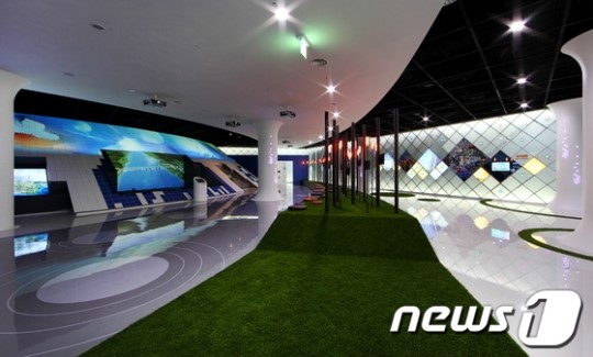
Korea Rural Community Corporation Saemangeum Exhibition HallExhibition hall and trade center
2
Korea Rural Community Corporation Saemangeum Exhibition HallExhibition hall and trade center -
 3
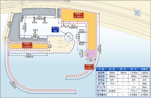
Saemangeum Garyeok Plaza
3
Saemangeum Garyeok Plaza -
 4
4
-
 5
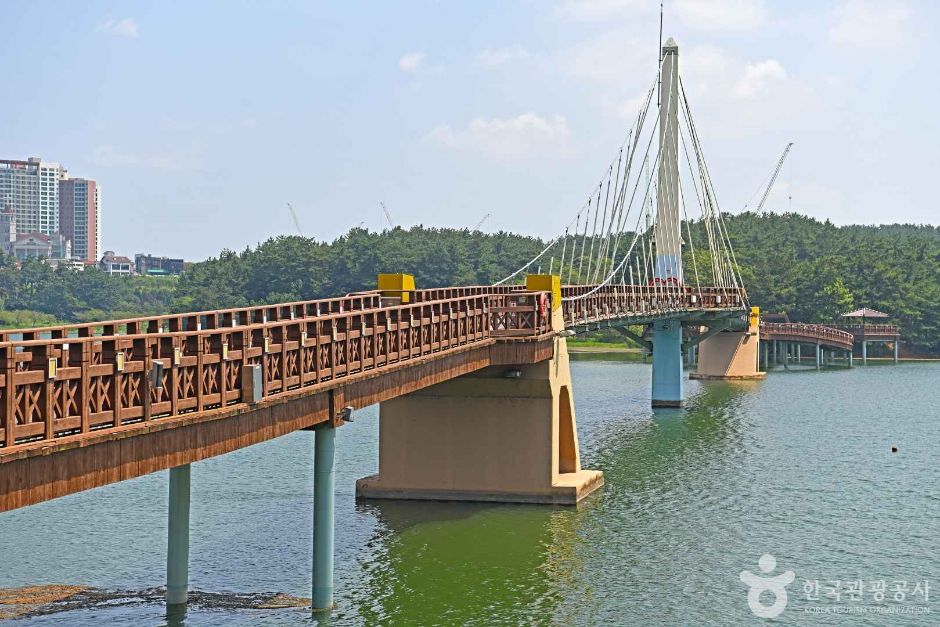
Eunpa Lake Park Mulbit Bridge
5
Eunpa Lake Park Mulbit Bridge
Food & Dining 5
-
 6
6
-
 7
7
-
 8
8
-
 9
9
-
 10
10
Events in This Area


Festivals in This Area

More Travel Guides in This Area
 Travel Guide
A 2.5-Hour Walking Route Tracing Colonial Exploitation, Starting at Gunsan Inner Harbor
 Travel Guide
Reading the Map of Exploitation in Jo Jeong-rae’s Arirang amid the Fields of Juksan-myeon, Gimje
 Travel Guide
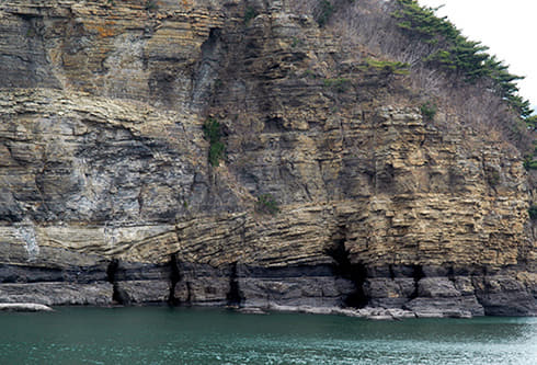
How to Read the Byeonsan Peninsula: From Chaeseokgang’s 87-Million-Year-Old Strata to Jikso Falls in Inner Byeonsan
 Travel Guide
Reading a Thousand Years of Celadon Color, Beginning at the Yucheon-ri Kiln Site
Korea News
 News
News
'Rami Controversy' NewJeans' Hyein Has Grown More Mature, Yet Is Still Adorable… A Cat Draped in Luxury Brands
 News
News
“If you get too close, I’ll bite”… BTS’s V issues a chilling warning to Jungkook
 News
News
“BTS No Longer Needs the Grammys”… Kim Tae-hoon Assesses the ‘Grammys Boycott’
![[Exclusive] Oh My Girl’s YooA, who switched to acting, parts ways with Saram Entertainment after just one year](https://kotourlive-images.s3.ap-northeast-1.amazonaws.com/news/1787658671060_036c47f7_news_8a403746-8bba-4e3c-8827-19d99be6d4fb.jpg) News
News