From Oryukdo to Busan Station: How Namparang-gil Course 1 Connects the Sea, Harbor, and Hillside Roads
Namparang-gil is a 1,470-kilometer, 90-course walking trail that stretches from Oryukdo Haemaji Park in Busan to Ttangkkeut Village in Haenam, Jeonnam. Busan Course 1 covers 23.2 kilometers, running from the sea cliffs at the starting point to Shanghai Street near Busan Station. For a short outing, visit just Oryukdo Haemaji Park and the starting sign; for a full-day walk, follow the route past Sinseondae, the UN Memorial Cemetery, and Choryang Ibagu-gil.

I’ve been here?
Your check-in helps the next traveler.
12 people viewed this week Be the first
One tap — no writing needed
A 1,470-km Azure Southern Trail Beginning at Oryukdo Sunrise Park
Namparang-gil means ‘a trail walked alongside the azure sea of the south,’ connecting the southern coast from Oryukdo Sunrise Park in Busan to Ttangkkeut Village in Haenam, Jeollanam-do, through 90 courses spanning a total of 1,470 km. The Busan section consists of Courses 1–5, and the official length of Course 1 is 23.2 km.
The starting point is the area around Oryukdo Sunrise Park at 137 Oryukdo-ro, Nam-gu, Busan Metropolitan City. This is known as the point where the Haeparang-gil toward the East Sea and the Namparang-gil toward the South Sea diverge. The directions of the two trails can be distinguished at the ‘Korea Dulle-gil Starting Point’ information sign in front of Oryukdo Pier.
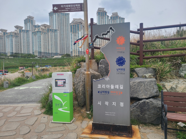
Why the Name Oryukdo and Seungdumal Cliff Became the Starting Point
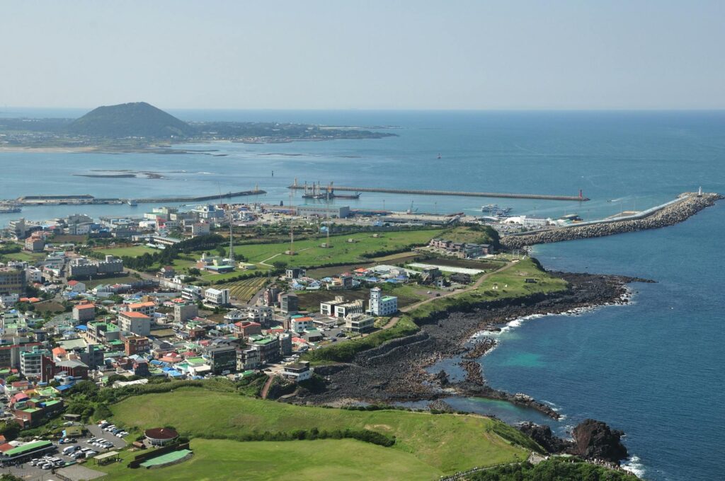
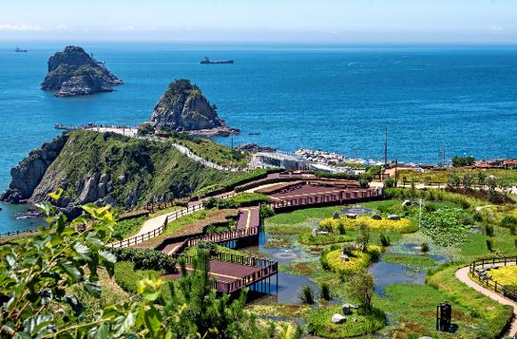
Oryukdo was given its name because the islands appear as either five or six islands depending on the viewing position and tidal conditions. The reason the first scenery of Namparang-gil consists of islands and cliffs is that the starting point lies around Seungdumal, a projection on the Yongho-dong coast recognized as the reference point separating the East Sea and the South Sea.
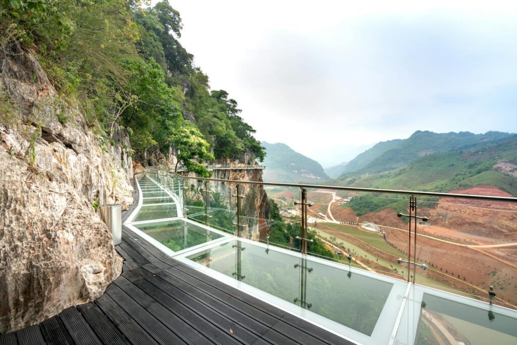
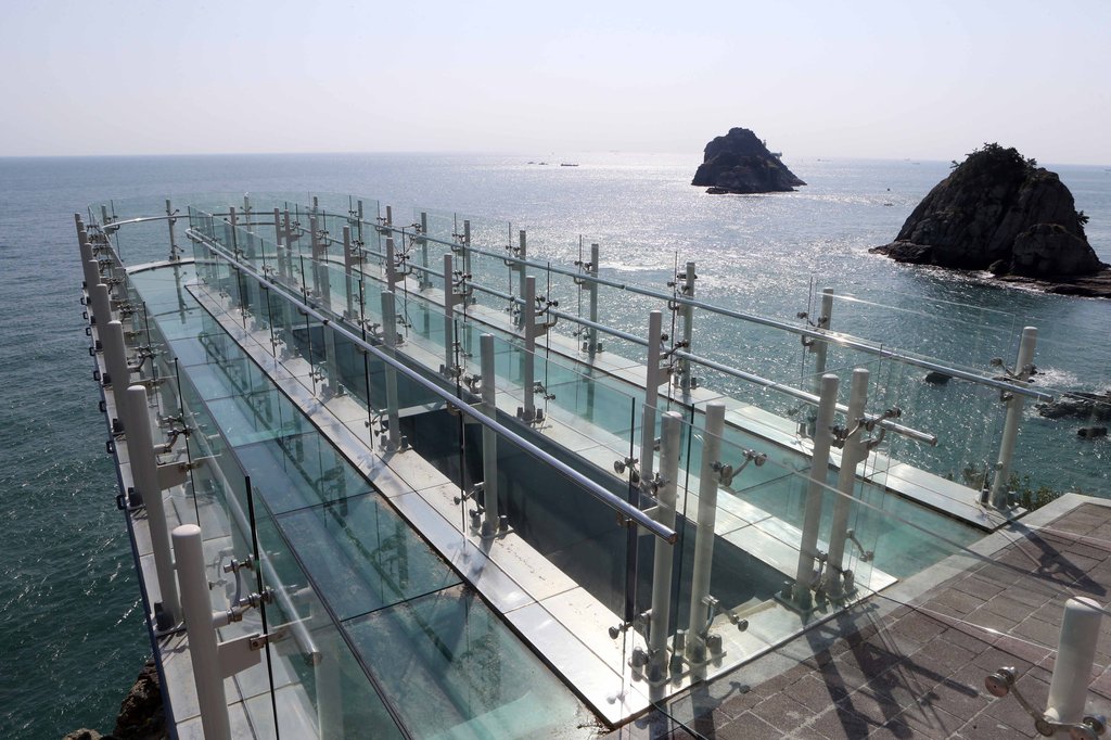
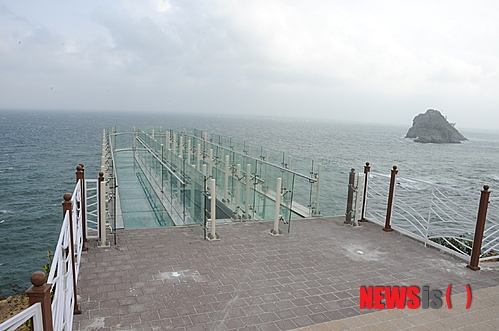
The Oryukdo Sunrise Park Skywalk is a U-shaped glass viewing facility installed above a coastal cliff approximately 35 m high. Access to the glass-floor section may be restricted depending on the weather and safety conditions. Even if you only plan to take a photo confirming your start, it is safer to check on-site first whether the facility is operating on windy days.
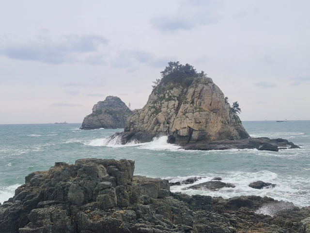
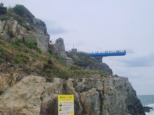
Namparang-gil Course 1: 23.2 km from Sinseondae to Choryang Shanghai Street
The main connecting points of Busan Course 1 introduced by Visit Busan are Oryukdo Sunrise Park, Sinseondae, Webtoon Igagu-gil, Yoo Chi-hwan Postbox, Choryang Igagu-gil, and Shanghai Street. Walking the entire course at once takes you through changing scenery, from coastal views to the port, residential areas, hillside roads, and the Busan Station district. This is important for travelers expecting only a coastal promenade, as the route includes a long urban walking section.
If you have less than half a day, a practical option is to see the starting-point sign and Skywalk at Oryukdo Sunrise Park rather than attempt the full 23.2 km. Near the finish, Busan Station and Metro Line 1 are available, so walking Course 1 from east to west makes planning your return by public transportation easier.
- Official distance of Course 1: 23.2 km
- Busan Namparang-gil section: Courses 1–5
- Course 2: 19.5 km, Taejongdae–Jagalchi Market
- Course 3: 17.1 km, Songdo Beach–Amnam Park
- Course 4: 21.0 km, Molundae–Jangnim Port
- Course 5: 18.7 km, Eulsukdo–Sinho Port
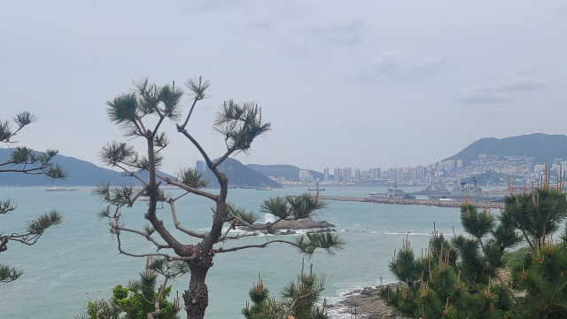
Red Markers Lead Toward Haenam; Blue Markers Lead Back to Busan
The forward direction of Namparang-gil runs from Busan to Haenam and is marked with red-colored signs. Conversely, the reverse direction from Haenam to Busan is marked with blue-colored signs. When beginning Course 1 at Oryukdo, follow the red directional markers for the official forward route.
The Durunubi signage system uses ground- and wall-mounted direction markers, logo stickers, forest-path ribbons, and facility-style directional signs. Although wooden panels indicating Namparang-gil are also to be installed at 1.5 km intervals from the starting point, construction and road conditions in urban sections may interrupt visibility of the markers, so it is advisable to prepare a GPS map and a portable charger.
Bus 27 from Busan Station and a 2–3-Minute Walk from the Oryukdo Skywalk Stop
From the Busan Station stop, take city bus 27 and get off at the ‘Oryukdo Skywalk’ stop. From the stop, it takes approximately 2–3 minutes on foot to the starting point, Oryukdo Sunrise Park and the Skywalk area. City buses 24, 27, and 131, as well as the Nam-gu 2 village bus, are also mentioned as ways to access the Oryukdo area.
The starting point cannot be reached by metro alone. You need to transfer to a bus at stations such as Kyungsung University–Pukyong National University Station on Line 2. If you take bus 27 from Busan Station, the journey may take approximately 40–50 minutes depending on traffic. After completing the course, you can use Line 1 and the railway near Busan Station, so it is better to consider luggage-storage services at Busan Station before departure.
- Starting-point address: 137 Oryukdo-ro, Nam-gu, Busan Metropolitan City
- Bus from Busan Station: Bus 27
- Alighting stop: Oryukdo Skywalk
- Stop to starting point: Approximately 2–3 minutes on foot
- Additional access routes: Buses 24, 131, and Nam-gu 2
Departing in Time for the Skywalk’s 09:00–18:00 Hours and 17:50 Last Admission
The Oryukdo Skywalk is listed as operating from 09:00 to 18:00, with last admission at 17:50. Admission is free, but some information states that it is closed every Monday and on the day of Seollal and Chuseok, so advance confirmation is necessary for Monday departures or holiday schedules. Namparang-gil itself is an outdoor walking trail, but Skywalk access hours are separate.
Inquiries can be directed to the Haeparang-gil Tourist Information Center at 051-607-6395 or the Nam-gu Facilities Management Office at 051-607-4937. If you want to take a starting-point confirmation photo and visit the Skywalk, arrive after 09:00. If you plan to see the glass observatory around sunset, make sure to arrive before the 17:50 last-admission deadline.
Public Parking at 300 Won per 10 Minutes and an 8,000-Won Daily Maximum
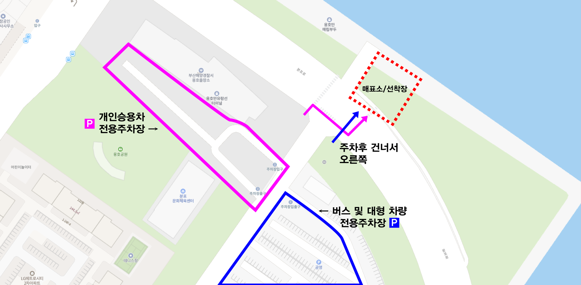
Drivers can use the Oryukdo Sunrise Park Skywalk public parking lot. For passenger cars in Grade 2 parking areas, the listed rates are 300 won per 10 minutes, 8,000 won for daytime daily parking, and 8,000 won for nighttime daily parking. On weekends, demand for parking at the starting point may be high. If you plan to complete the 23.2 km course, you must carefully calculate the route for leaving your car at the starting point and returning from Busan Station.
The nearby Oryukdo Waterfront Park public parking lot is also listed at 300 won per 10 minutes and 8,000 won per day for passenger cars in Grade 2 areas. Buses cost 900 won per 10 minutes or 24,000 won per day. Paid parking at Oryukdo Pier is introduced as costing 3,000 won per day regardless of parking time, but only passenger cars and vans are permitted, so larger vehicles should be checked separately for eligibility.
If You Only Want to Walk 4.7 km Along the Coast: The Option to Dongsaengmal in Igidae
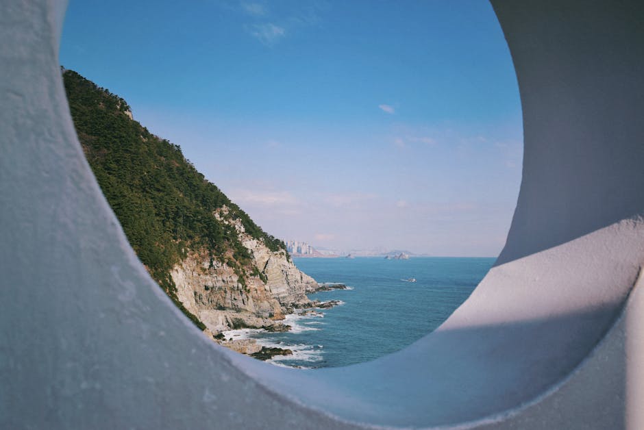
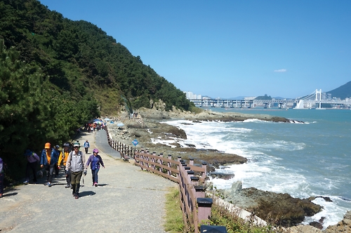
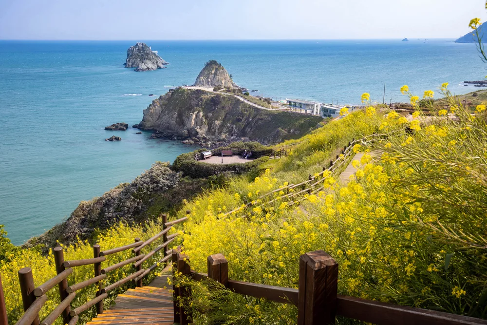
If the entire Namparang-gil Course 1 feels too demanding, you can simply enjoy the scenery around the starting point at Oryukdo Sunrise Park before entering the Sinseondae and urban sections. Another option is the coastal section from Oryukdo Sunrise Park to Dongsaengmal in Igidae, which is known to be approximately 4.7 km long and includes deck stairs and coastal cliff sections.
In the Igidae area, some sections overlap with walking trails different from the official completion route of Namparang-gil Course 1. If your goal is to complete the official forward route, prioritize the red markers and the Durunubi route. If the glass floor is uncomfortable or you need wheelchair or stroller access, it is more suitable to keep your route short and focus on the flatter areas around Sunrise Park rather than entering the Skywalk.
Before You Go
- Address
- 137 Oryukdo-ro, Nam-gu, Busan Metropolitan City
- Hours
- Oryukdo Skywalk 09:00–18:00, last admission 17:50
- Closed
- Oryukdo Skywalk: Every Monday and the day of Seollal and Chuseok (confirmation before visiting recommended)
- Admission
- Namparang-gil: Free / Oryukdo Skywalk: Free
- Phone
- Haeparang-gil Tourist Information Center 051-607-6395 / Nam-gu Facilities Management Office 051-607-4937
- Official site
- https://www.durunubi.kr/namparang-introduction.do
- Transport
- Bus 27 from Busan Station stop → get off at Oryukdo Skywalk stop, then walk approximately 2–3 minutes. Buses 24, 131, and Nam-gu 2 are also available.
- Parking
- Oryukdo Sunrise Park Skywalk public parking lot: passenger cars 300 won per 10 minutes, 8,000 won per day. Congestion is possible on weekends.
- Time needed
- Starting point and Skywalk visit: approximately 30–60 minutes / Busan Namparang-gil Course 1, 23.2 km: a full-day itinerary is recommended
- Accessibility
- The Skywalk has a glass floor and controlled-access facilities, while the coastal and urban sections include stairs and sloped areas. For information in foreign languages, refer to the multilingual pages of Durunubi and Visit Busan.
The information above is current as of the time of writing. Please check the official information again before visiting.

Places
Nearby Attractions 5
-
 1
1
-
 2
2
-
 3
3
-
 4
4
-
 5
Oryukdo Sunrise Park
5
Oryukdo Sunrise Park
Food & Dining 1
-
 6
Lee Jae-mo Pizza Main Branch
6
Lee Jae-mo Pizza Main Branch
Events in This Area




Festivals in This Area


More Travel Guides in This Area
 Travel Guide
A Glass Walkway 15 m Beyond the Edge of Seungdumal Cliff, with Oryukdo Beneath Your Feet
 Travel Guide
From Millak Bridge to Oryukdo: 11.4 km Linking Gwangan Bridge and the Cliffs of Igidae
 Travel Guide
Between Oryukdo and Gwangan Bridge: Diamond Bay Boarding Route and Yacht Tour
 Travel Guide
Old Art and Busan Night Views at Haeseong Art Bay in the Yongho Bay Cruise Terminal
Korea News
 News
News
‘NewJeans Expulsion’ Danielle Releases Her First YouTube Video… “We Don’t Know What Will Happen Next”
![aespa’s North American Tour Has Remaining Seats Despite ‘$49’ Bargain Prices… A Stark Popularity Gap with KATSEYE [TEN Starfield]](https://kotourlive-images.s3.ap-northeast-1.amazonaws.com/news/1788485037424_a59b1932_naver_rank_thumb_0000774618_1788485037424.jpg) News
News
aespa’s North American Tour Has Remaining Seats Despite ‘$49’ Bargain Prices… A Stark Popularity Gap with KATSEYE [TEN Starfield]
![[Photo] TWICE’s Dahyun attends a film festival red carpet as an actress](https://kotourlive-images.s3.ap-northeast-1.amazonaws.com/news/1788485316508_edd43ecd_news_870a60a6-6f11-4d73-aa7c-48d91318a0f7.jpg) News
News
[Photo] TWICE’s Dahyun attends a film festival red carpet as an actress
![[On-Site Video] “We’re Departing Separately Together”… BIGBANG Begins ‘COSMOS’ World Tour](https://kotourlive-images.s3.ap-northeast-1.amazonaws.com/news/1788485226518_c5719641_news_fdd4764a-0f4e-4968-8e4e-e98a02872f88.jpg) News
News