From Millak Bridge to Oryukdo: 11.4 km Linking Gwangan Bridge and the Cliffs of Igidae
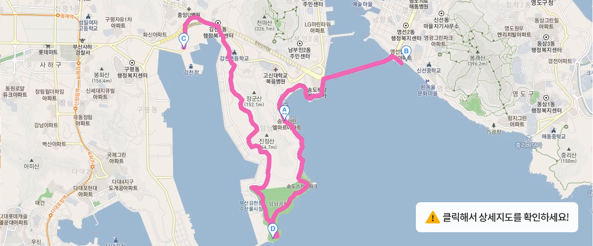
Section 2 of Course 2 on Busan’s Galmaet-gil Trail is a coastal route that starts at Millak Bridge and heads to the Oryukdo cruise ship terminal via Gwangalli, Namcheon-dong Beach Park, and the Igidae Coastal Walk. According to the official guide, this moderately challenging course covers 11.4 km and takes about four hours, connecting urban beaches and rocky coastlines in a single stretch.

I’ve been here?
Your check-in helps the next traveler.
No one has checked in yet Be the first
One tap — no writing needed
The 11.4 km from Minrak Bridge to Oryukdo: how the landscape changes from an “urban sea” to a “rocky coast”
The official starting point of Section 2 of Course 2 of Busan Galmaet-gil is on the Suyeong-gu side of Minrak Bridge (Suyeong 2nd Bridge), and the endpoint is the Oryukdo access deck near the Oryukdo excursion boat pier. Busan’s Galmaet-gil guide lists this section as a coastal trail of moderate difficulty, 11.4 km long, taking about 4 hours. If walking the entire route at once is difficult, it is easier to plan the itinerary by dividing it into Minrak Bridge–Gwangalli Beach, 2.8 km (60 minutes); Gwangalli–Dongsaengmal, 3.9 km (80 minutes); Dongsaengmal–Igidae Eoulmadang, 2.3 km (45 minutes); and Eoulmadang–Oryukdo access deck, 2.4 km (50 minutes).
The early section is relatively flat, with commercial facilities and beach promenades continuing through places such as Minrak Waterfront Park and Gwangalli Beach. After Dongsaengmal, the route centers on Igidae’s rocky coast, forest paths, and stair sections. The official course guide indicates restrooms at Minrak Waterfront Park, Gwangalli Beach, Namcheondong Beach Park, Igidae Dongsaengmal, Igidae Eoulmadang, and near the Oryukdo excursion boat pier, so it is safer to prepare water and use the restroom before entering Igidae.
Gwangalli’s 2.8 km and Namcheondong’s 3.9 km: why to start earlier
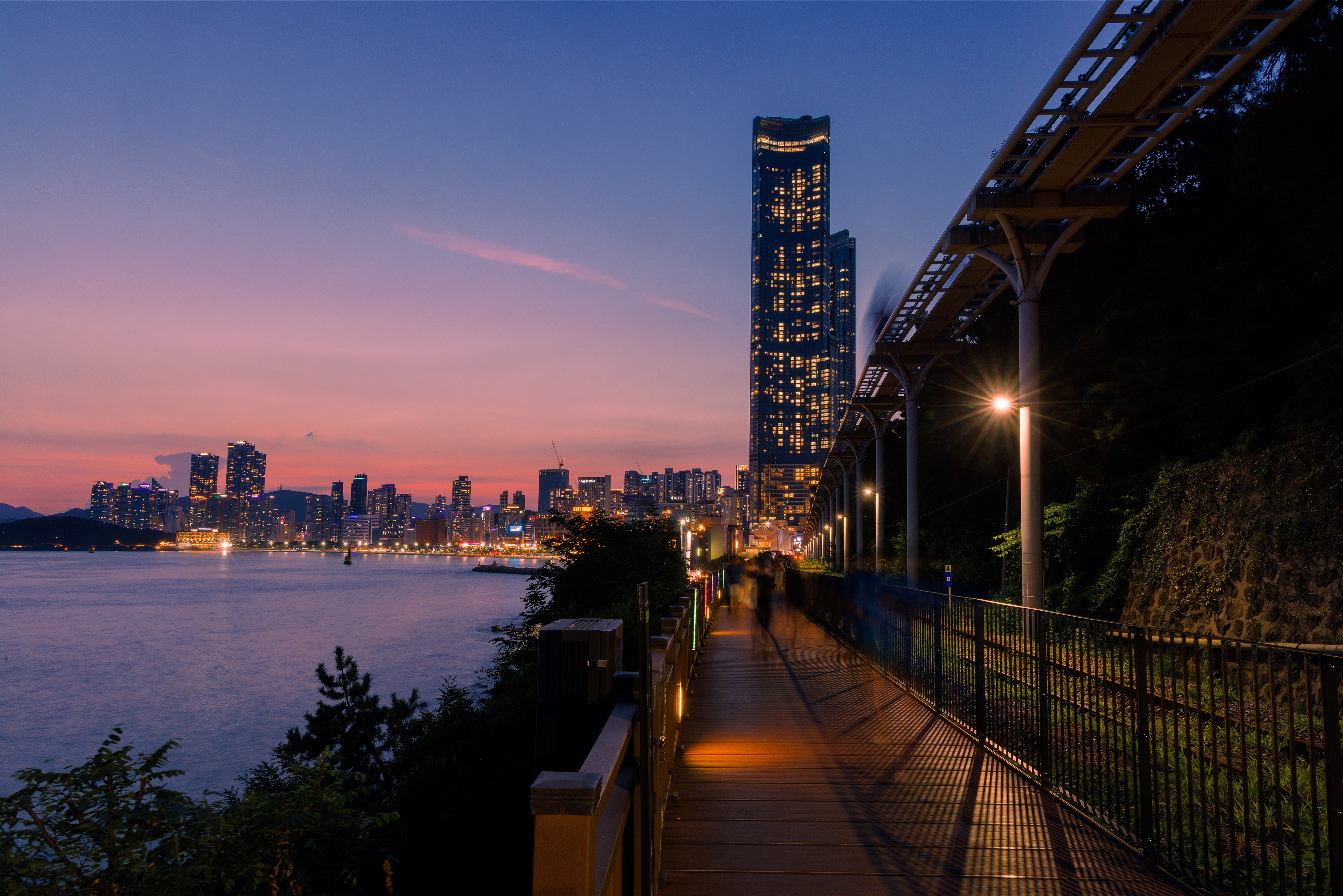
The official distance from Minrak Bridge to Gwangalli Beach is 2.8 km, with an estimated travel time of 60 minutes. From Minrak Waterfront Park, you can see the mouth of the Suyeong River, Marine City, and Gwangan Bridge together, and after passing Gwangalli Beach, the route continues toward Namcheondong Beach Park. The address of the starting certification post is 446 Gwangalli Beach-ro, Millak-dong, Suyeong-gu, Busan.
The route from Gwangalli to Dongsaengmal is listed as 3.9 km, taking about 80 minutes. There are many options for drinking water and meals along the beach promenade and urban sections, but it is difficult to expect the same conditions after entering the Igidae section. Since the 4-hour estimate is close to a nonstop walking time, if you plan to eat or take photographs at Gwangalli, it is more realistic to allow at least 5 hours from the start.
Igidae’s rocky coast begins on the 2.3 km from Dongsaengmal to Eoulmadang
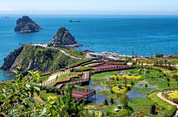
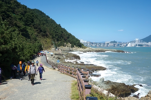
The distance from Dongsaengmal to Igidae Eoulmadang is 2.3 km, with an official estimated time of 45 minutes. Igidae is described as a rocky coast formed along the eastern sea at the foot of Jangsanbong in Yongho-dong, and from this section onward you encounter terrain different from Gwangalli’s sandy beach. The main points on the course presented by Busan include Dongsaengmal, Igidae Eoulmadang, and Nongbawi.
The intermediate walking certification post is Igidae Eoulmadang, at San 28-1, Yongho-dong, Nam-gu, Busan. This section is suitable for trekking shoes with grippy soles rather than ordinary walking sneakers, and you should slow down around rocks and stairs immediately after rain or on days when strong winds are forecast. The route is not suitable for continuous travel over the full 11.4 km by stroller or wheelchair because it includes coastal cliffs, stairs, and unpaved sections.
Nongbawi and Oryukdo: islands that appear as five or six depending on the tide
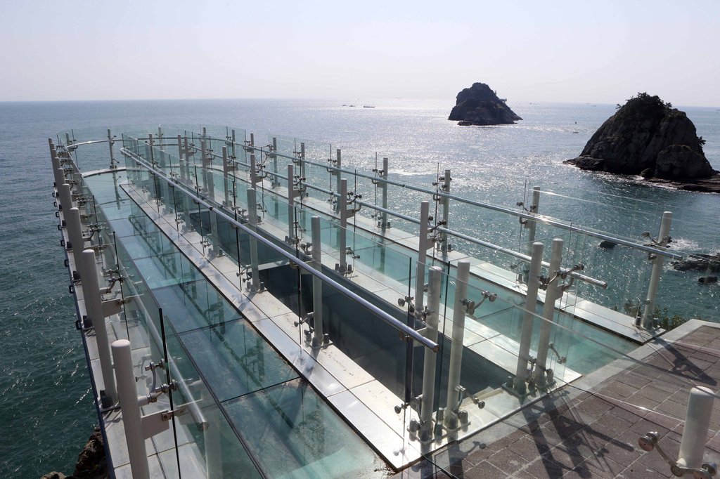
The distance from Igidae Eoulmadang to the Oryukdo access deck is 2.4 km, taking about 50 minutes. Busan’s guide identifies Chimabawi, Bakgols Bird, and Nongbawi as scenic points on the Igidae course, and explains that Scenic Site No. 24, Oryukdo, comes into view after passing Satae-gol. This section continues to Oryukdo Sunrise Park and Oryukdo Skywalk, and also connects with the starting area of Section 1 of Course 3 of Galmaet-gil.
Oryukdo consists of Bangpae Island, Sol Island, Suri Island, Songgot Island, Gul Island, and Lighthouse Island (Bat Island). Busan explains that its name comes from the fact that Bangpae Island and Sol Island join or separate according to the tide, making the group appear to comprise five or six islands. The area is also introduced as the dividing point between the East Sea and the South Sea. The address of the endpoint certification post is San 196-10, Yongho-dong, Nam-gu, Busan, while the Yongho-dong San 8-1 coordinate area provided by the user corresponds to the coastal access area of Igidae and Oryukdo.
Buses 38, 41, 83-1, and 210 to Minrak Bridge; buses 24, 27, 131, and Nam-gu 2 to the Oryukdo endpoint
The official course page lists buses 38, 41, 83-1, 210, and Suyeong-gu 2-1 as transportation options near Minrak Bridge. Gwangalli Beach is marked with urban railway connections, a city tour, and a tourist information center, so first-time visitors to Busan may find it convenient to check restrooms, drinking water, and return transportation at Gwangalli before entering Igidae.
Buses 24, 27, 131, and Nam-gu 2 are available in the endpoint area near the Oryukdo excursion boat pier. Since this is a one-way walking route, if you bring a car, you need to calculate a separate vehicle-retrieval plan because the starting point and endpoint are different. Galmaet-gil itself is an outdoor walking trail, so there is no separate admission fee or regular closing day. For course inquiries, you can contact Busan’s 120 call center (051-120).
1.2 km of night lighting from Dongsaengmal to Eoulmadang and the limits of the 4-hour course
According to Busan’s September 2025 guide, night lighting has been installed along the 1.2 km from Dongsaengmal to Eoulmadang. The Minrak Waterfront Park–Gwangalli section is an urban area that is good for viewing the night scenery, but after Igidae the route passes coastal cliffs and forest paths, so it is better to plan to leave the key rocky coastal section before sunset. Rather than relying only on your phone’s light, it is advisable to bring a power bank and a small flashlight.
The official guide states that the course may change depending on conditions on site. Check the notices and course map on the official Busan Galmaet-gil website again just before departure, and if there are coastal trail closures, strong winds, or a heavy rain forecast, consider shortening the itinerary to a shorter section centered on Gwangalli. The official Galmaet-gil website is https://www.busan.go.kr/galmaetgil.
Why Section 2-2 of Galmaet-gil condenses Busan’s coastal urban history
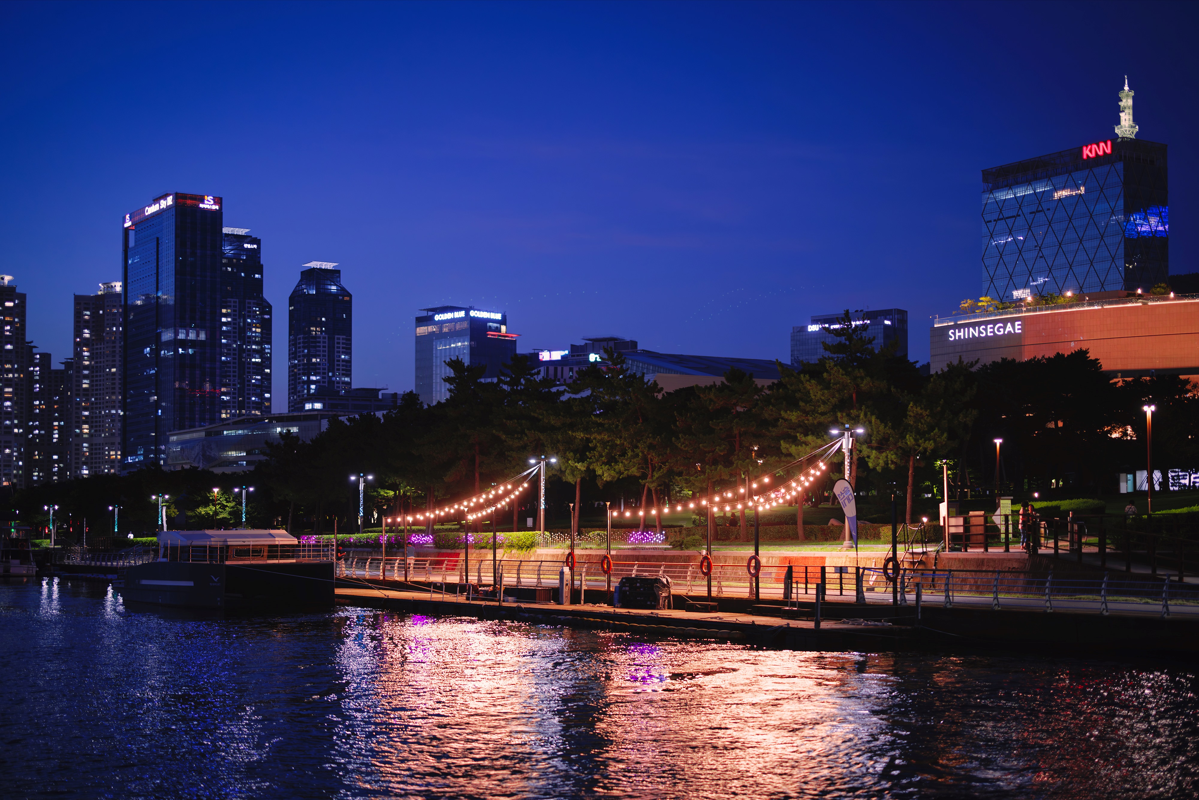
This trail connects Millak’s waterfront park and fishing port, Gwangalli’s urban beach, the rocky coast of Igidae in Yongho-dong, and Oryukdo’s seascape in a single direction. As Busan explains, Millak Port is a fishing village within the city, and from Minrak Waterfront Park you can see Marine City and Gwangan Bridge up close. In other words, the structure of this section is that a fishing port, beach, high-rise residential and commercial districts, and preserved coastal cliffs appear successively along the same shoreline.
Section 2 of Course 2 of Galmaet-gil is introduced by Busan as a designated “slow city tourist attraction.” However, this trail is not a flat beach promenade throughout. Considering the standard of walking 11.4 km in 4 hours and the elevation changes at Igidae, people who are not accustomed to long-distance walking or who have difficulty using stairs should consider choosing divided sections such as Minrak Bridge–Gwangalli or Dongsaengmal–Eoulmadang.
- Recommended items: at least 500 ml of water, slip-resistant shoes, an outer layer for rain, and a power bank
- Walking certification posts: Minrak Bridge start, Igidae Eoulmadang intermediate point, and Oryukdo access deck endpoint
- Video searches were attempted, but the results could not be retrieved because the daily quota for the YouTube search service had been exceeded.
Before You Go
- Address
- San 8-1, Yongho-dong, Nam-gu, Busan
- Hours
- Outdoor walking trail open at all times
- Closed
- No regular closing days
- Admission
- Free
- Phone
- 051-120
- Official site
- https://www.busan.go.kr/galmaetgil
- Transport
- Starting point, Minrak Bridge (Suyeong side): buses 38, 41, 83-1, 210, and Suyeong-gu 2-1. Endpoint, Oryukdo excursion boat pier area: buses 24, 27, 131, and Nam-gu 2.
- Parking
- As this is a one-way route, drivers must plan a separate vehicle-retrieval route between the starting point and endpoint.
- Time needed
- Official standard: 11.4 km, about 4 hours
- Accessibility
- Some beach sections, including Gwangalli, are relatively flat, but the Igidae section includes rocky coast, stairs, and forest paths, making continuous travel over the entire route by wheelchair or stroller difficult.
The information above is current as of the time of writing. Check the official guide again before visiting.

Places
Nearby Attractions 4
-
 1
1
-
 2
2
-
 3
3
-
 4
4
Food & Dining 5
-
 5
5
-
 6
6
-
 7
7
-
 8
8
-
 9
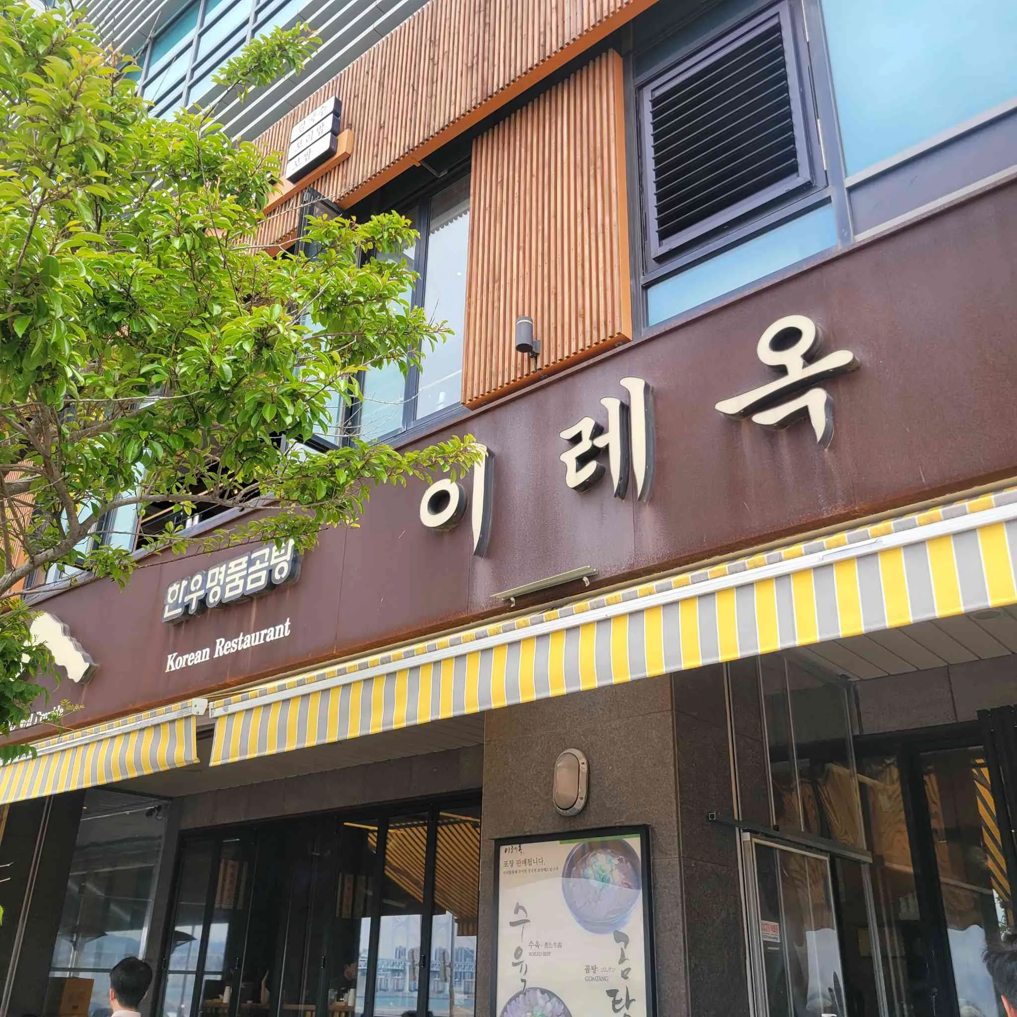
Ireo Ok
9
Ireo Ok
Events in This Area


Festivals in This Area

More Travel Guides in This Area
 Travel Guide
Between Oryukdo and Gwangan Bridge: Diamond Bay Boarding Route and Yacht Tour
 Travel Guide
Old Art and Busan Night Views at Haeseong Art Bay in the Yongho Bay Cruise Terminal
 Travel Guide
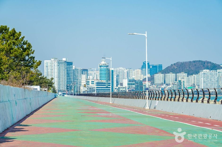
The End of Namcheon-dong, with a Side View of Gwangan Bridge
 Travel Guide
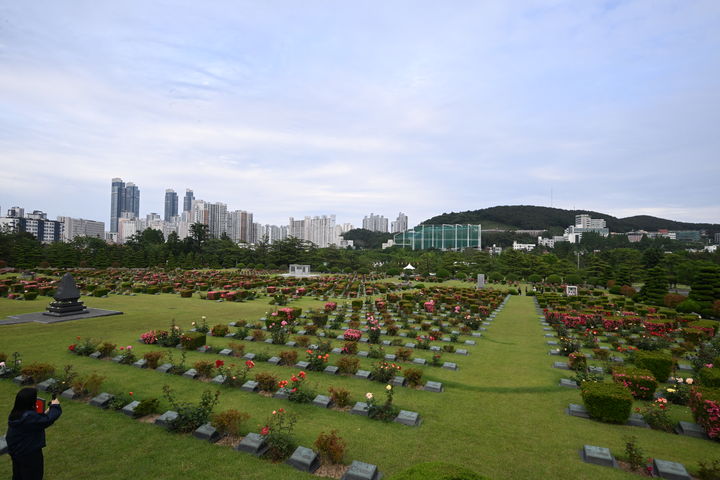
From a 1951 War Cemetery to the World’s Only UN Cemetery: UN Memorial Cemetery in Korea, Busan
Korea News
 News
News
"Overcoming the Getty curse" Jang Wonyoung, with unreal proportions and beauty straight out of a Barbie doll
 News
News
A2O LITE Tops Melon TOP100 Just 29 Hours After Debut, Setting the Fastest Record for a Debut Song
![Billlie's Tsuki 'Makes an Entrance Showing Off Her Beautiful Figure' [MK Photo]](https://kotourlive-images.s3.ap-northeast-1.amazonaws.com/news/1792027947835_957f0cb8_news_5c0023c5-e9a0-4640-9154-cb0b69d810c4.jpg) News
News
Billlie's Tsuki 'Makes an Entrance Showing Off Her Beautiful Figure' [MK Photo]
![ENHYPEN ‘Fighting for the Macau performance too!’ [★Video]](https://kotourlive-images.s3.ap-northeast-1.amazonaws.com/news/1792027887815_5057637d_news_8041e5cd-8b22-4193-bb46-880c65d944f7.jpg) News
News