A 68.9 km Trail Connecting Malti Pass and the Dalcheon River: Songnisan Dulle-gil Boeun Route
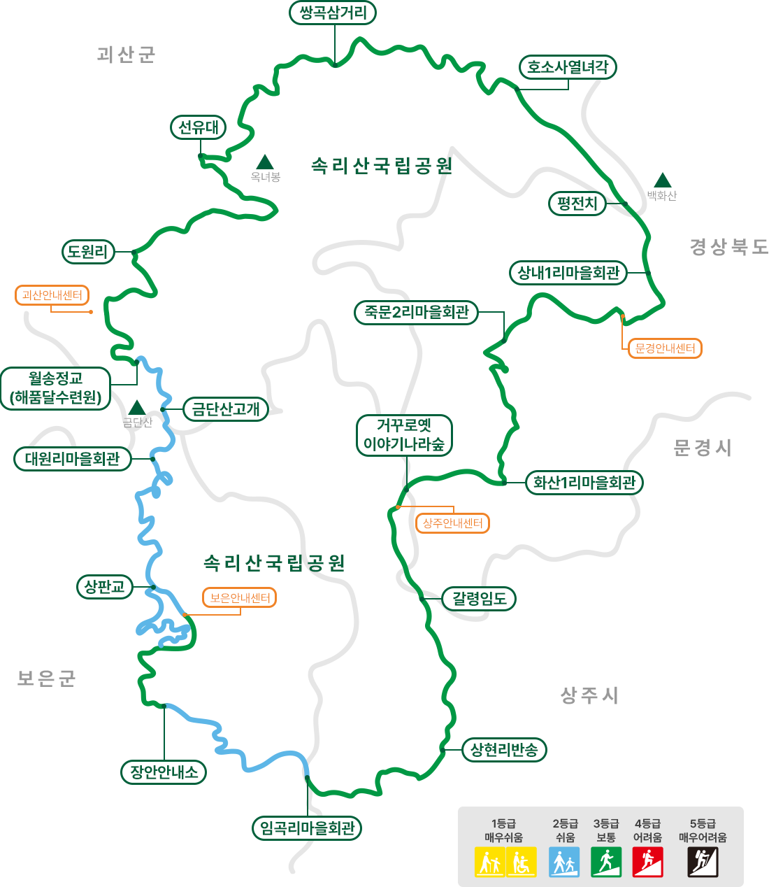
The Songnisan Dulle-gil Boeun Route is a 68.9 km hiking trail consisting of the Gugbyeongsan Old Trail, Malti Pass Crossing Trail, Dalcheon Fields Trail, and Geumdansan Immortal Trail. It is free and open year-round, but individual sections can take up to six hours, so plan your starting point and return transportation in advance.

I’ve been here?
Your check-in helps the next traveler.
No one has checked in yet Be the first
One tap — no writing needed
How is the 68.9 km Boeun Trail divided?
The Songnisan Dulle-gil is a 209 km walking trail connecting Boeun and Goesan counties in Chungcheongbuk-do with Mungyeong and Sangju cities in Gyeongsangbuk-do. The Boeun Trail consists of Sections 1–4 and is 68.9 km in total, while the Boeun section is listed as 63.5 km. The sections expanded beginning with the Boeun Trail in 2017, and the entire Songnisan Dulle-gil was designated a national forest trail in 2023.
Section 1, Gubyeongsan Old Trail, is 14.3 km; Section 2, Crossing Malti Pass Trail, is 13.1 km; Section 3, Dalcheon Fields Trail, is 18.1 km; and Section 4, Geumdansan Immortal Trail, is 9.4 km. The Maro Branch Trail, 2.5 km, and Jungpan Branch Trail, 11.5 km, are also listed separately. Therefore, an itinerary covering the entire Boeun Trail at once should be distinguished from one covering a specific section.
What should you prepare at 20 Gaean-gil, the Jangan-myeon Dulle-gil Information Center?
The address of the Jangan-myeon Dulle-gil Information Center is 20 Gaean-gil, Jangan-myeon, Boeun-gun, Chungcheongbuk-do, and its telephone number is 043-542-3330. It is listed as the endpoint of Section 1 of the Boeun Trail and the starting point of Section 2. Songnisan Dulle-gil leaflets and road maps are available at each information center, so obtaining a paper map before setting out on a long section is practical.
The trail is listed as open at all times, open year-round, and free of charge. However, confirmed information does not specify parking availability or fees, wheelchair and stroller accessibility, photography restrictions, cash-only payment, English-language assistance, or audio-guide availability. The official website is http://songnisangil.com. For questions about facility operations or trail conditions, contact the Jangan-myeon Dulle-gil Information Center at 043-542-3330.
14.3 km Gubyeongsan Old Trail starting in Imgok-ri, Sangju
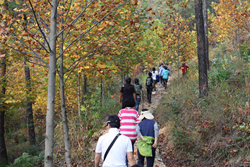
Section 1, Gubyeongsan Old Trail, starts at the Imgok-ri Village Hall at 294 Imgok-gil, Hwanam-myeon, Sangju, Gyeongsangbuk-do, and continues to the Jangan-myeon Dulle-gil Information Center. The official route passes successively through the Imgok-ri Senior Citizens’ Hall, Jeogam-ri Senior Citizens’ Center, Galpyeong 1-ri Senior Citizens’ Hall, Bulmok Village Hall, and Bongbi-ri Senior Citizens’ Hall, covering 14.3 km.
The official website lists this section as taking approximately 4 hours 10 minutes and having an easy difficulty level. After crossing Malmokjae in Imok Village, the nine peaks of Gubyeongsan unfold before you, followed by village scenery along the old trail through Jeogam-ri, Galpyeong-ri, Sumun-ri, Bulmok-ri, and Bongbi-ri. Because the starting point is in Hwanam-myeon, Sangju, rather than in Boeun-gun, first ask the Boeun Public Bus Terminal at 043-542-0160 and Sinheung Transportation at 043-542-2510 about access to the departure point.
The uphill climb of Section 2: 3.4 km to the summit of Malti Pass
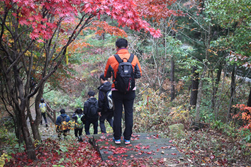
Section 2, Crossing Malti Pass Trail, is a 13.1 km section running from the Jangan-myeon Dulle-gil Information Center through Ochang 1-gu Village Hall, the summit of Malti Pass, and Solhyang Park to the Boeun Information Center of the Songnisan Dulle-gil. Detailed information lists the distances as 5.8 km from the Daechu Promotion Hall in Gaean-ri to Ochang 1-ri, 3.4 km from Ochang 1-ri to the summit of Malti Pass, 1.4 km from the summit to Solhyang Park, and 2.9 km from Solhyang Park to Sangpan Bridge.
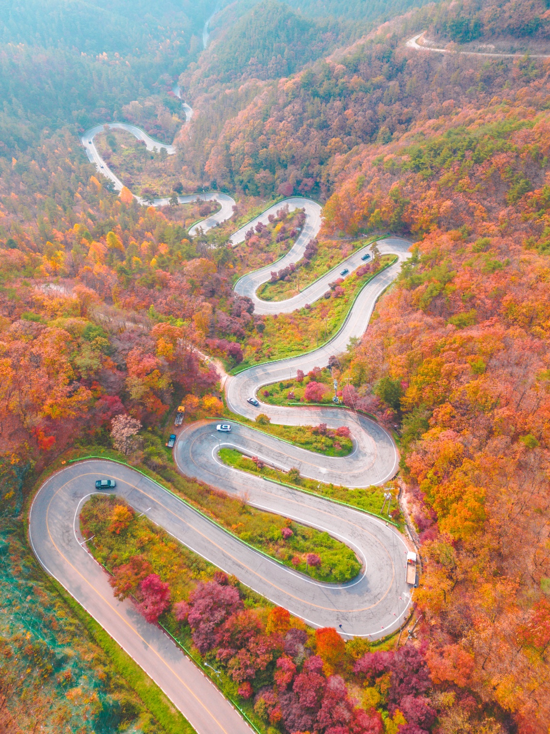
The official duration is 4 hours 30 minutes, and the difficulty is intermediate. This section passes through Jangan Village, the birthplace of the Donghak organization, and includes views of the twelve bends of Malti Pass extending from Daegwol Site, as well as autumn foliage. Those who want a loop route can also use the Kkoburang-gil, starting and ending at the summit of Malti Pass; its official distance is 17.4 km and its duration is 5 hours 30 minutes.
How to plan the 18.1 km Dalcheon Fields Trail from the Boeun Information Center
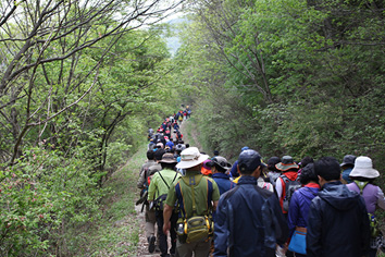
Section 3, Dalcheon Fields Trail, runs 18.1 km from the Boeun Information Center of the Songnisan Dulle-gil to Daewon-ri Village Hall. The route passes through Jungpan-ri Cultural Village Hall, the former Bukam Elementary School site, Baekhyeon-ri Village Hall, Baekseok 1 Bridge, Chungbuk Alps Natural Recreation Forest, and Sinjeong-ri Cultural Hall before arriving at Daewon-ri Village Hall in Dume Village.
The official duration is listed as 6 hours, so plan it as a full-day itinerary. This trail follows the area where water from Cheonwangbong Peak of Songnisan becomes the Dalcheon River, along with broad fields. The guide notes that various birds come down around the stream and that the wildflowers in the fields change with the seasons. The address of the Boeun Information Center is 51 Sangpan-gil, Songnisan-myeon, Boeun-gun, Chungcheongbuk-do, and its telephone number is 043-542-7330.
Geumdansan Immortal Trail from Daewon-ri to Wolsongjeong Bridge
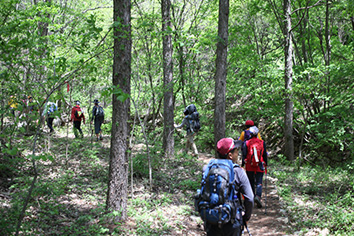
Section 4, Geumdansan Immortal Trail, starts at Dume Village, the location of Daewon-ri Village Hall, passes through Hwal mokjae and the Geumdansan mountain pass, and continues to the Haepumdal Training Center at Wolsonggyo Bridge in Sinwon-ri, Goesan. The official distance by section name is 9.4 km, while another detailed guide lists the distance from Daewon-ri Village Hall to Wolsonggyo Bridge in Sinwon-ri, Goesan, as 8.9 km, so the stated distances differ.
The detailed guide lists a duration of 3 hours and an easy difficulty level. It is therefore suitable for those looking for a relatively short itinerary among Sections 1–4 of the Boeun Trail. However, because the starting and ending points differ, anyone leaving a vehicle at only one end must arrange return transportation separately. Boeun Taxi is listed at 043-542-2266, Boeun Private Taxi (Samsan) at 043-544-4688, and Songnisan Taxi at 043-543-2340.
How to navigate on site without missing signs and ribbons
Guide signs on the Songnisan Dulle-gil vary in shape by area and are used to check your current location and the distance and direction to the next point. Comprehensive information boards are generally installed at starting or ending points so that visitors can view detailed maps of the entire route by section. If you miss a sign at a fork while walking, look for ribbon strips hanging from tree branches and utility poles to confirm the direction of travel.
Actual operating timetables and intervals for public transportation by section were not available in the guide. Before departure, ask the Boeun Public Bus Terminal at 043-542-0160 and Sinheung Transportation at 043-542-2510 about bus services. If you need to retrieve a vehicle at the end of a section, you can use Boeun Taxi at 043-542-2266 or Gwan-gi (Maro) at 043-543-870. The official website does not specify whether English guidance covering the entire Boeun Trail or audio guides are available.
Choosing a section suitable for first-time hikers
If you want a full day of walking rather than a short stroll, Section 4, officially listed as 3 hours and 9.4 km, is the simplest choice. To see villages and the Gubyeongsan ridge together, choose Section 1, which takes approximately 4 hours 10 minutes, covers 14.3 km, and is rated easy. If you want elevation changes and historical context around Malti Pass, Section 2 is an intermediate route taking 4 hours 30 minutes and covering 13.1 km.
If you want to connect the Dalcheon River and fields, a former school site, and a natural recreation forest in one outing, choose Section 3, but note that its official duration is 6 hours. As of the 2026 information check, the information-center telephone numbers and transportation contacts are as listed above. Because parking, accessibility for people with disabilities, cash payments, and photography restrictions have not been confirmed, travelers by car should first make a vehicle-retrieval plan for the starting and ending points.
Before You Go
- Address
- 20 Gaean-gil, Jangan-myeon, Boeun-gun, Chungcheongbuk-do
- Hours
- Open at all times
- Closed
- Open year-round
- Admission
- Free
- Phone
- Jangan-myeon Dulle-gil Information Center 043-542-3330; Songnisan Dulle-gil Boeun Information Center 043-542-7330
- Official site
- http://songnisangil.com
- Transport
- Official website contacts: Boeun Public Bus Terminal 043-542-0160, Sinheung Transportation 043-542-2510, Boeun Taxi 043-542-2266, Boeun Private Taxi (Samsan) 043-544-4688, Gwan-gi (Maro) 043-543-870, Songnisan Taxi 043-543-2340
- Time needed
- The recommended time for visiting the entire Boeun Trail could not be confirmed. Official durations by section: Section 1, approximately 4 hours 10 minutes; Section 2, 4 hours 30 minutes; Section 3, 6 hours; Section 4, 3 hours
The information above is based on the time of writing. Check the official guidance again before visiting.

Places
Nearby Attractions 2
-
 1
Maltijae ObservatoryA place offering views of the winding road over Maltigogae Pass and the surrounding mountain foothills
1
Maltijae ObservatoryA place offering views of the winding road over Maltigogae Pass and the surrounding mountain foothills -
 2
2
Food & Dining 3
-
 3
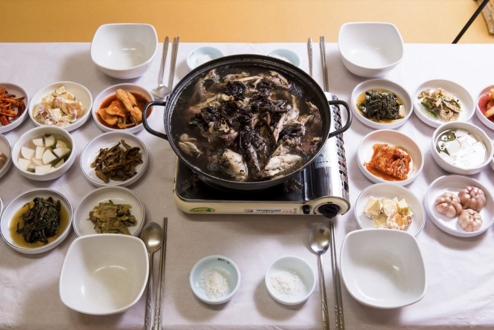
Bokhae GardenA Korean restaurant serving chicken dishes such as pine mushroom chicken soup and samgyetang.
3
Bokhae GardenA Korean restaurant serving chicken dishes such as pine mushroom chicken soup and samgyetang. -
 4
Hyeongje Butcher RestaurantA restaurant where you can enjoy doenjang jjigae and pork cutlets together
4
Hyeongje Butcher RestaurantA restaurant where you can enjoy doenjang jjigae and pork cutlets together -
 5
5
Events in This Area

Festivals in This Area

More Travel Guides in This Area
 Travel Guide
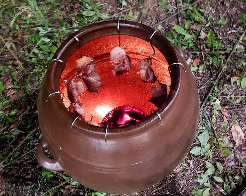
20 m Observatory Overlooking Malti Pass’s 12 Hairpin Turns
 Travel Guide
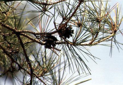
The Place Where King Sejo’s Procession Came to a Halt: Jeongipumsong Pine Tree in Boeun
 Travel Guide
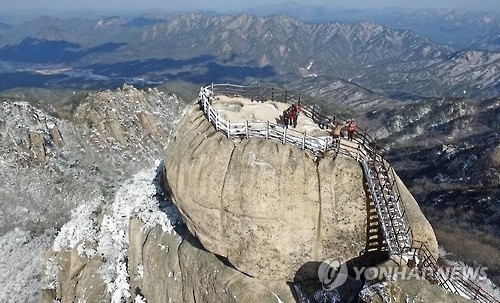
How to Hike Songnisan in Boeun, from 1,058.4 m Cheonwangbong Peak to Beopjusa Temple and Sejogil
 Travel Guide
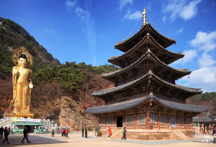
Songnisan Route Combining Beopjusa Temple and Sejo Road
Korea News
![BLACKPINK’s Lisa Dominates the VMA Red Carpet in a Sheer Corset Dress and Red Fur [Star Issue]](https://kotourlive-images.s3.ap-northeast-1.amazonaws.com/news/1790557894714_010e956a_news_94409db1-fab6-40bf-bc7b-4b985b1fbac7.jpg) News
News
BLACKPINK’s Lisa Dominates the VMA Red Carpet in a Sheer Corset Dress and Red Fur [Star Issue]
![BLACKPINK’s Jisoo Spotted by Surprise with BIGBANG in London… Their Special Loyalty as Labelmates [IS High Cut]](https://kotourlive-images.s3.ap-northeast-1.amazonaws.com/news/1790557854683_6ea979f5_news_caab62e5-8462-43c8-8622-da794f3df9de.png) News
News
BLACKPINK’s Jisoo Spotted by Surprise with BIGBANG in London… Their Special Loyalty as Labelmates [IS High Cut]
 News
News
Tattoos All Over Her Body… AOA’s Jimin Draws Shocked Attention After Kwon Mina’s ‘Bullying’ Allegations
![You’ll Have to Look Twice… Choi Min-a-soo Perfectly Pulls Off Everything from a Daring Illusion Dress at the Awards Ceremony to Long Braided Hair [RE:STAR]](https://kotourlive-images.s3.ap-northeast-1.amazonaws.com/news/1790492384850_1f293dad_news_d834c50e-0685-43ef-9aa5-6995cd6d8848.jpg) News
News