Two Routes Up Gwangju’s Mudeungsan Mountain, Whose Stone Pillars Were Left by a Volcano 87 Million Years Ago
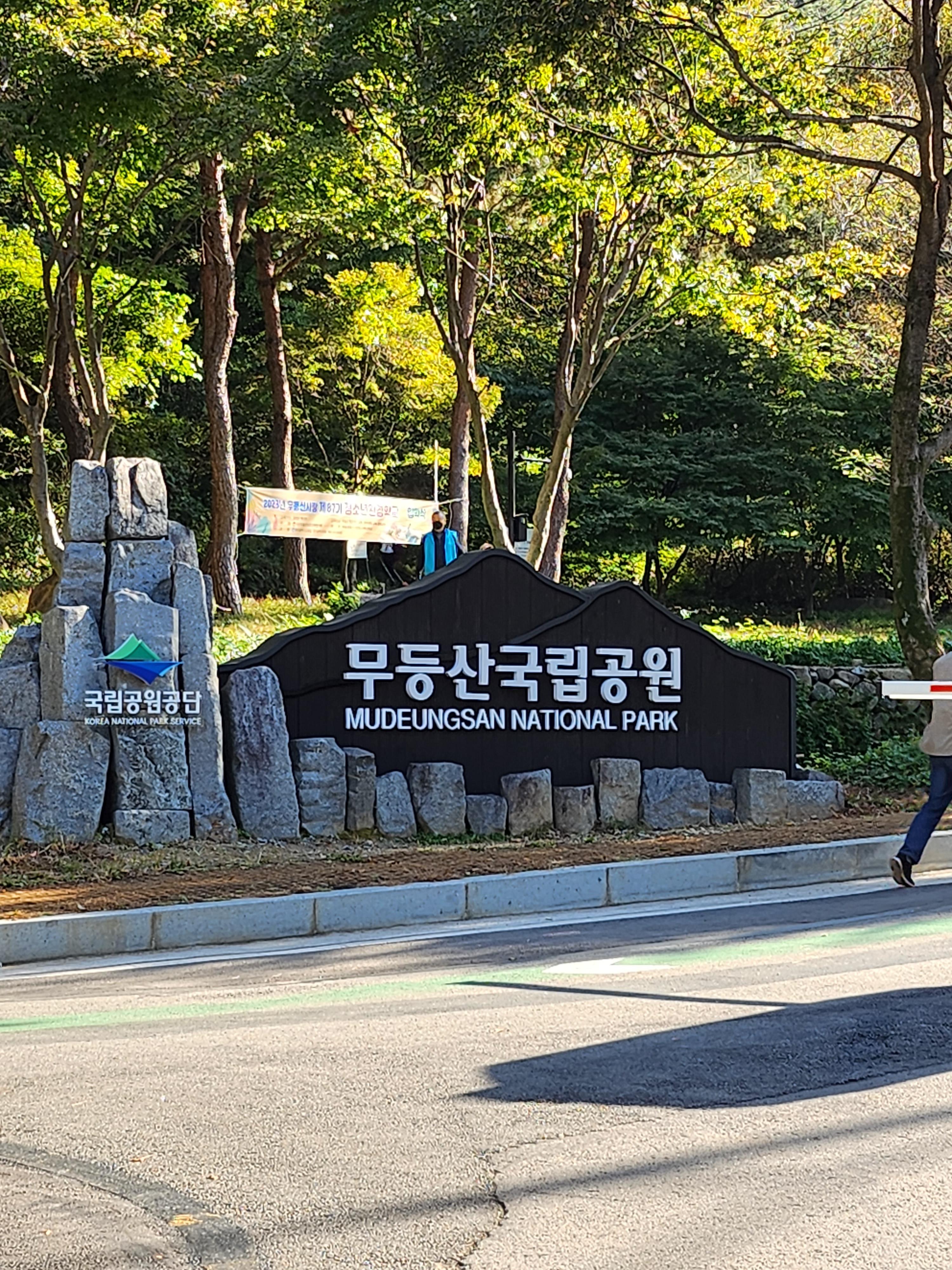
Mudeungsan Mountain, standing at 1,187 m above sea level, is the iconic mountain of Gwangju and South Jeolla Province. Even after it became a national park in March 2013, military facilities around Cheonwangbong Peak mean that Seoseokdae effectively serves as the highest viewpoint open to ordinary visitors. First-time visitors should choose their starting point based on their fitness and transportation: either take the route from Jeungsimsa Temple to Jangbuljae or the route from Wonhyosa Temple to Ipseokdae and Seoseokdae.

I’ve been here?
Your check-in helps the next traveler.
23 people viewed this week Be the first
One tap — no writing needed
The Name ‘Mudeung,’ Meaning ‘Unequaled,’ at 1,187 m Above Sea Level, and Its Designation as a National Park in 2013
Mudeungsan is the guardian mountain of Gwangju and Jeonnam, as well as the central mountain range of the Honam Jeongmaek, and it embraces Cheonwangbong Peak, which rises 1,187 m above sea level. The Korea National Park Service explains Mudeungsan as meaning “a mountain so high and vast that it has no equal,” or a mountain so noble that it cannot be ranked. In March 2013, its total area of 75.425㎢ was designated as Korea’s 21st national park.
The mountain was also called Mujinak during the Baekje period and Seoseoksan during the Goryeo period. The name “Seoseoksan” is associated with the stone pillars around Seoseokdae and Ipseokdae. The Sinjeung Dongguk Yeoji Seungnam records that stone pillars approximately 100 cheok high once stood in a sunny area on the western side of the mountain. It is also worth noting that this was not merely a hiking destination but a historic place where the people of Gwangju prayed to the mountain deity for well-being during droughts, floods, and epidemics.
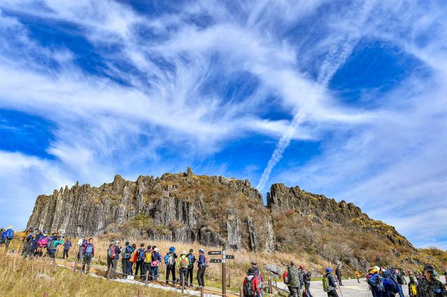
How the 200 Stone Pillars of Seoseokdae and 40 of Ipseokdae Were Formed
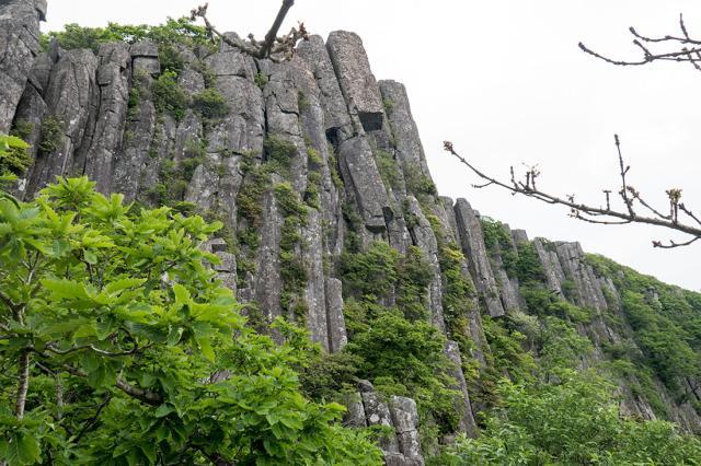
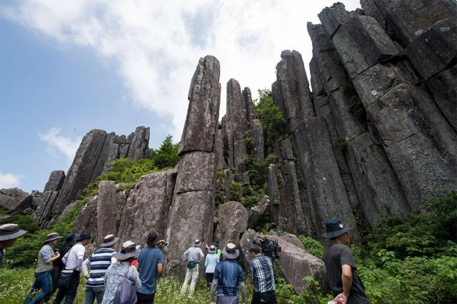
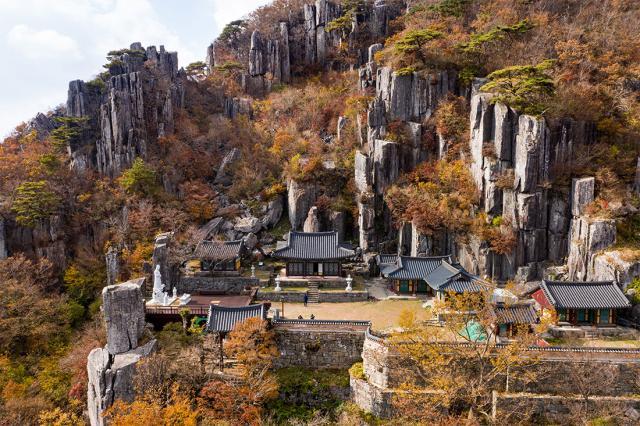
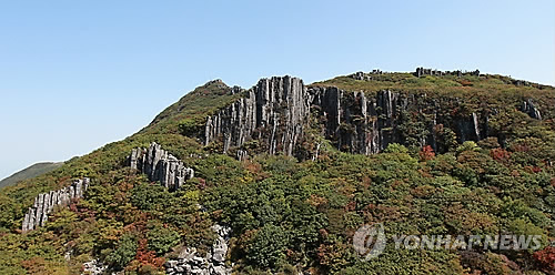
The defining scenery of Mudeungsan consists not of granite rocks but of columnar joints in welded tuff. The Mudeungsan tuff, deposited by at least three volcanic eruptions approximately 87–85 million years ago, cooled and fractured before being exposed at the surface through weathering after around 110,000 years ago. Seoseokdae is a geological attraction made up of approximately 200 connected stone pillars, and together with Ipseokdae it is included in Mudeungsan Columnar Joint Zone Natural Monument No. 465.
Ipseokdae lies at an elevation of approximately 950 m on the southwestern side of the summit area, where about 40 polygonal stone pillars stand across a stretch approximately 120 m wide. The pillars are about 20 m high, and the joint surfaces are approximately 0.6–1.2 m wide. Above them is Seungcheonam, a small columnar joint formation approximately 10 m high and tilted at an angle. Rather than climbing the stone pillars or approaching the rock walls closely, it is safer to observe the overall pattern from the designated trail.
From Jeungsimsa to Jangbuljae: An 11 km Geotrail for Travelers in Downtown Gwangju
The Jeungsimsa district is the easiest area to reach by public transportation from downtown Gwangju. Mudeungsan Course 2 in the Mudeungsan Geopark is an 11 km geotrail consisting of 4.0 km from Jeungsimsa to Jangbuljae, 1.6 km from Jangbuljae to Jigong Neodeol, 0.2 km from Jigong Neodeol to the Gyubong Columnar Joint Zone, and a further 2.3 km to Simujigi Falls. The park rates the difficulty as “moderate,” while the time required for the full route varies depending on the sections selected.
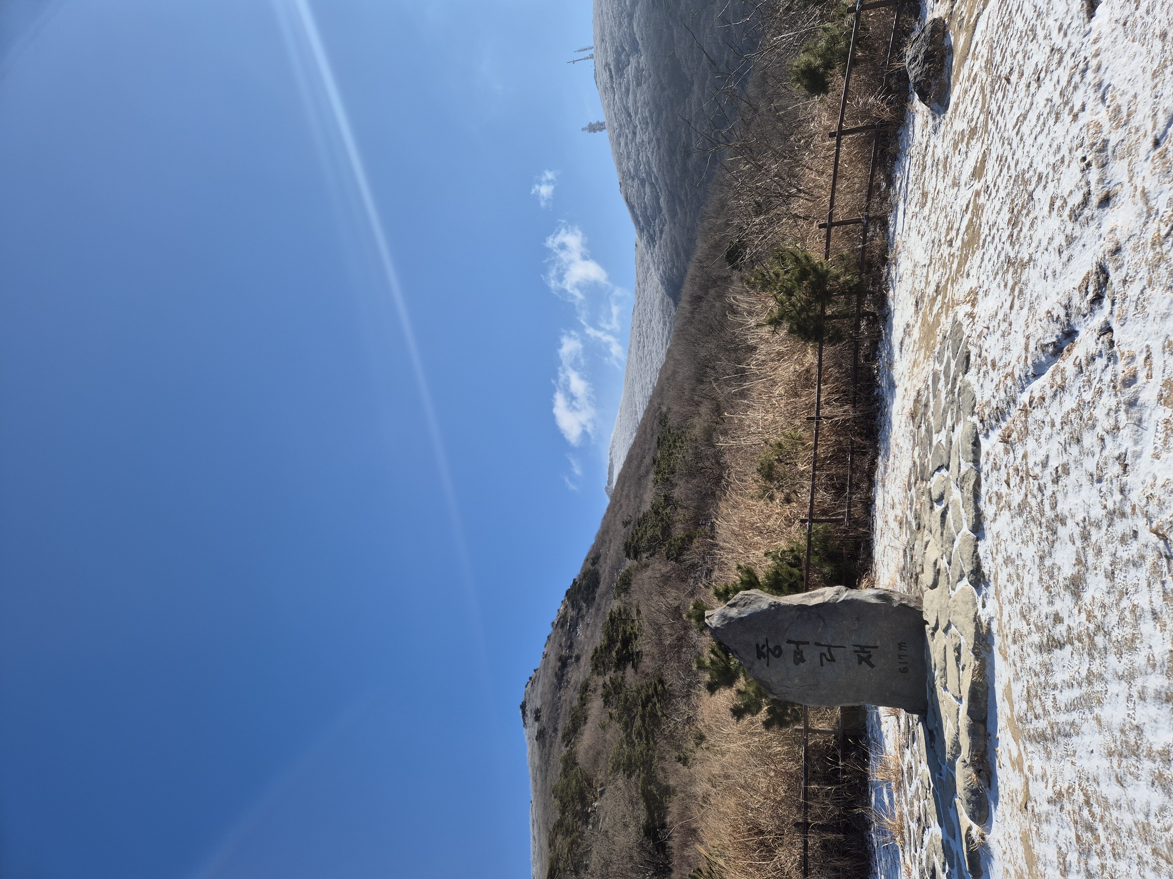
If you only want to see Seoseokdae and Ipseokdae, the usual route is to climb from the Jeungsimsa parking lot toward Jungmeorijae and Jangbuljae. However, first-time visitors should allow plenty of time, including for the descent to the finishing point. An introductory guide from the Korea Tourism Organization states that a round-trip hike to the summit area from the Wonhyosa district can take 5–7 hours. This is why hiking shoes, water, a windproof layer, and a plan to descend before sunset are necessary.
From Wonhyosa to Ipseokdae and Seoseokdae: The Northern Trailhead Served by Bus 1187
The Wonhyosa district is a northern trailhead accessible by Bus 1187. According to Mudeungsan Geopark guidance, the journey takes approximately 54 minutes from Gwangju Station by Bus 1187 to the “Mudeungsan National Park (Wonhyosa)” stop, about 1 hour 9 minutes from Gwangju Bus Terminal, and about 1 hour 5 minutes from Songjeong Station by taking Subway Line 1 and transferring at the National Asian Culture Center. Bus number 1187 serving the Wonhyosa area takes its number from Mudeungsan’s elevation of 1,187 m.
Mudeungsan Course 1, which starts in the Wonhyosa district, is described as a total of 15.4 km, with 5.2 km from Wonhyosa to Ipseokdae, 0.5 km from Ipseokdae to Seoseokdae, and 1.2 km from Seoseokdae to the three summit peaks. Although the distances may appear short, the perceived difficulty changes significantly depending on elevation and weather. In particular, the area toward Cheonwangbong after Seoseokdae should not be regarded as a freely accessible trail at all times. Check the military area restrictions and whether the summit area is open before setting out.
Cheonwangbong Is Not Accessible Every Day: The 1.4 km and 1.8 km Rules on Summit Opening Days
Mudeungsan’s highest peak, Cheonwangbong, is adjacent to military facilities, so normal unrestricted access is limited. When the summit area is opened once a year, online reservations and on-site registration are conducted in accordance with notices from the National Park reservation system. Operating hours are listed as 09:00–16:00, with entry closing at 15:00. Opening dates and reservation procedures may change each year, so check notices from the Korea National Park Service immediately before departure.
On summit opening days, the route from Mokgyo consists of Mokgyo–Seoseokdae–the rear gate of the military base–the summit area–the main gate of the military base, totaling 1.4 km and taking about 1 hour. The route from Jangbuljae consists of Jangbuljae–Ipseokdae–Seoseokdae–the rear gate of the military base–the summit area–the main gate of the military base, totaling 1.8 km and also taking about 1 hour. The reservation capacity was 7,000 people according to the notice, and identity verification may be required because this is a military area. It is advisable to bring a passport or photo ID.
40–60 Minutes from Songjeong or Gwangju Station to Jeungsimsa; Plan for Parking Before Planning the Drive
For the Jeungsimsa district, the recommended route is to travel from Gwangju Songjeong Station on Subway Line 1 to the National Asian Culture Center, then transfer to Cheomdan 09, Unrim 51, or Suwan 12 and get off at “Mudeungsan National Park (Jeungsimsa),” taking approximately 1 hour. From Gwangju Station, the journey takes about 40 minutes using Seat 02 or Suwan 49, while from Gwangju Bus Terminal, Cheomdan 09 takes about 46 minutes. Overseas visitors will find transfers between the subway and city buses more convenient if they prepare a single transportation card.
For drivers, departure points can be set at Jeungsimsa Parking Lot (423 Unnim-dong, Dong-gu, Gwangju) or Wonhyosa Parking Lot (San 209-1 Geumgok-dong, Buk-gu, Gwangju). During special summit-opening events, notices have announced enforcement against illegal parking between Unnim Middle School and the entrance to Jeungsimsa, and between Chungjangsa and Wonhyosa Parking Lot, as well as additional services of Buses 1187 and 1187-1. On weekends and event days, buses may therefore be preferable to passenger cars. If you need to return to your original parking lot after the hike, choosing an out-and-back route is safer than traversing the entire ridgeline.
Autumn Silver Grass and Winter Rime: Check Restrictions Before the Season
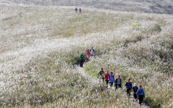
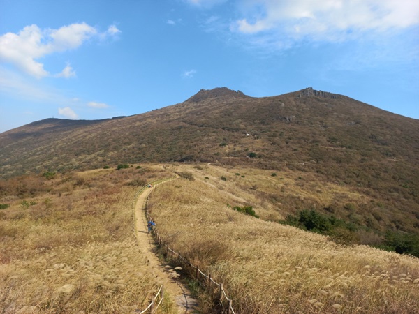
Mudeungsan is described as a mountain with distinct seasonal scenery: azaleas in spring, tiger lilies in summer, autumn foliage and silver grass, and winter snow scenes. In autumn, visitors can see the open ridges around Jangbuljae together with the stone pillars of Seoseokdae, but many sections are directly exposed to the wind. Winter scenery with snow and rime is well known, but ice, strong winds, and trail closures can change the difficulty of a hike, making the mountain unsuitable for visitors wearing light clothing for a casual photography outing.
The Korea National Park Service advises visitors to check the designated mountain entry times and real-time trail control status before hiking. Sections may be closed during heat waves, heavy rain, typhoons, or heavy snow advisories, and reaching the summit area by bypassing a restricted section is not permitted. A fully barrier-free route allowing wheelchair and stroller access to Seoseokdae and Ipseokdae has not been confirmed. Visitors with mobility needs should therefore contact the Mudeungsan National Park Office before departure to ask about facilities that can actually be used.
Mudeungsan Becomes Clearer When Read Together with Jeungsimsa, Wonhyosa, and ChungHyodong
Jeungsimsa is described as a temple founded during the Unified Silla period and is a meeting point of Mudeungsan’s mountain faith and Buddhist culture. Wonhyosa is a temple associated with the tradition that it was founded by the Silla monk Wonhyo, and it was rebuilt after being destroyed during anti-guerrilla operations in the Korean War. Rather than ending your visit with the hike alone, first exploring the temples and valleys in the Jeungsimsa or Wonhyosa district makes it easier to understand why long-established trails and places of worship overlap on this mountain.
Chunghyodong, on the road to Wonhyosa, is the birthplace of Kim Deok-ryeong, a militia commander during the Imjin War, and Chungjangsa and related historic sites remain there. On the foothills of Mudeungsan, Heo Baek-ryeon cultivated Samaedawon and produced “Chunseol” tea, while the native Mudeungsan watermelons of the Chunghyodong area are generally harvested from late August to late September. The regional context of a Mudeungsan journey lies in the fact that Gwangju’s urban history, memories of the militia, and mountain-foothill livelihoods involving tea and watermelons remain together around one mountain.
Before You Go
- Address
- 5 Dongsan-gil 7beon-gil, Dong-gu, Gwangju Metropolitan City (Mudeungsan National Park Office)
- Hours
- Open year-round. Check the National Park Service before departure for permitted entry times by trail and for weather advisories and closures. During special summit openings: 09:00–16:00, with entry closing at 15:00.
- Closed
- No regular closing days. Trails or the summit area may be closed due to weather advisories, maintenance work, or military facility operations.
- Admission
- General visits to Mudeungsan National Park are free. Reservations and identity verification may apply during special summit openings.
- Phone
- 062-227-1187
- Official site
- https://www.knps.or.kr/front/portal/visit/visitCourseMain.do?menuNo=7020090&parkId=122000
- Transport
- Jeungsimsa: Gwangju Songjeong Station → Subway Line 1 to the National Asian Culture Center → transfer to Cheomdan 09, Unrim 51, or Suwan 12; approximately 1 hour. Wonhyosa: Bus 1187 from Gwangju Station; approximately 54 minutes.
- Parking
- Jeungsimsa Parking Lot (423 Unnim-dong, Dong-gu, Gwangju) and Wonhyosa Parking Lot (San 209-1 Geumgok-dong, Buk-gu, Gwangju) are available. Congestion is possible on weekends and summit-opening days.
- Time needed
- Allow approximately 5–7 hours for a hike focused on Seoseokdae and Ipseokdae, depending on the round-trip and descent route. For special summit-opening sections, allow about 1 hour for the 1.4 km route from Mokgyo or the 1.8 km route from Jangbuljae.
- Accessibility
- The summit area, Seoseokdae, and Ipseokdae are mountain trails with limited wheelchair and stroller access. Advance inquiries are recommended regarding foreign-language assistance and facilities usable by visitors with mobility needs.
The information above is current as of the time of writing. Check the official guidance again before visiting.

Places
Nearby Attractions 5
-
 1
1
-
 2
2
-
 3
3
-
 4
4
-
 5
5
Food & Dining 5
-
 6
6
-
 7
7
-
 8
8
-
 9
Jeonbuk Sikdang
9
Jeonbuk Sikdang -
 10
10
Events in This Area

Festivals in This Area


More Travel Guides in This Area
 Travel Guide
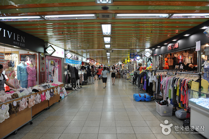
Reading the 360-Meter Underground Shopping Route at Gwangju Geumnam Underground Shopping Center
 Travel Guide
The Main Protest Site of 1980, Today’s May 18 Democracy Square
 Travel Guide
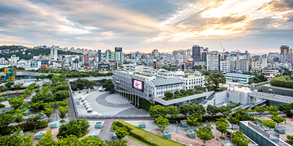
From the Memories of the Former Jeonnam Provincial Office to an Underground Cultural City: Asia Culture Center
 Travel Guide
Reading May 10, 1980 at the Former Gwangju Catholic Center
Korea News
 News
News
TWS heightens comeback excitement with kitschy charm… Anticipation for “plot twist” rises
 News
News
BTS, Six Months After Its Release… ‘Arirang’ Climbs the U.S. Billboard 200
 News
News
'The Nation's Girl Group' RESCENE, Five Girls Transformed into Guardians… Additional Concept Photos for Their 4th Mini Album Revealed
 News
News