Wolryubong’s 400-Meter Peak Where the Moon Rests and the Chogangcheon Wolryubong Loop Trail
Wolryubong in Hwanggan-myeon, Yeongdong-gun, Chungcheongbuk-do, is a scenic landscape featuring six peaks rising along the waters of the Chogangcheon River and Wolryujeong Pavilion. Open year-round with free admission, it offers a choice between an approximately one-hour round-trip course to the observatory and the 8.4-kilometer Wolryubong Loop Trail, depending on your plans.

I’ve been here?
Your check-in helps the next traveler.
29 people viewed this week Be the first
One tap — no writing needed
The ‘Peak Where the Moon Rests’ Encountered in Wonchon-ri, Hwanggan-myeon
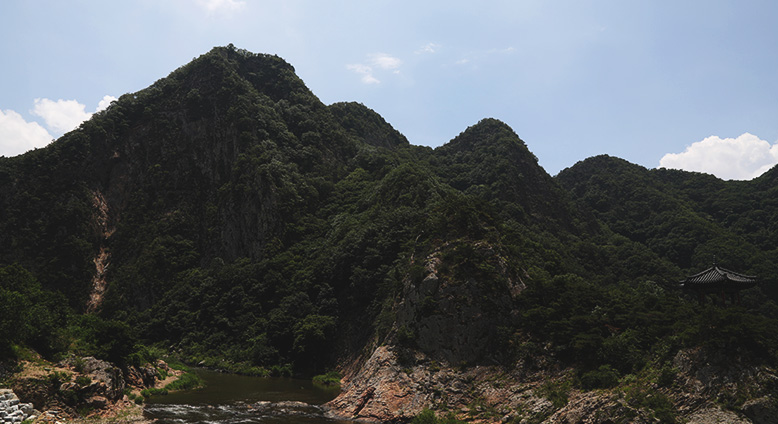
Wollyubong is a peak approximately 400 m high in Wonchon-ri, Hwanggan-myeon, Yeongdong-gun, Chungcheongbuk-do. Its name means ‘the peak where the moon rests,’ and it is introduced as the first of Yeongdong-gun’s Eight Scenic Views of Hancheon. The ridge extending east to west from Wollyubong continues through six peaks.
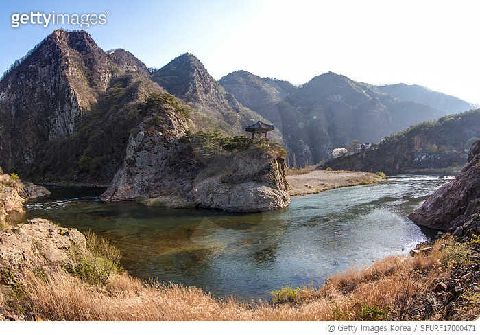
Below Wollyubong flows the Chogangcheon Stream, a branch of the upper Geumgang River. Because the six peaks, waterway, and Wollyujeong Pavilion halfway up the first peak are visible together, Chungbuk tourism guides describe this place as a landscape resembling a traditional Korean landscape painting. The address is Wonchon-ri, Hwanggan-myeon, Yeongdong-gun, Chungcheongbuk-do.
Why Song Si-yeol’s Hancheonjeongsa and the Eight Scenic Views of Hancheon Remain
The names of the Wollyubong area are connected not only with its natural scenery but also with the late Joseon scholar Uam Song Si-yeol. Song Si-yeol built and stayed at Hancheonjeongsa, a small scholarly retreat below Wollyubong, where he pursued his studies. Across the way, Hancheonjeongsa and a monument marking Song Si-yeol’s former residence remain.
The Eight Scenic Views of Hancheon consist of Wollyubong, Sanyangbyeok, Cheonghakgul, Yongyeondae, Naengcheonjeong, Beopjonam, Sagunbong, and Hwahyeonak. Yeongdong-gun explains that these eight scenic sites took their names from Hancheonjeongsa, where Song Si-yeol stayed. Thus, the present landscape is a heritage landscape combining not only peaks and streams but also a pavilion and a monument marking a former residence.
The Deep Pool in Front of Wollyujeong and the Cliff Names of the Eight Scenic Views of Hancheon
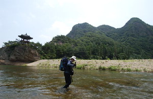
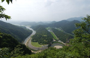
Wollyujeong Pavilion stands halfway up Wollyubong’s first peak. The deep pool in front of the pavilion is called Yongyeondong or Yongyeondae, the third of the Eight Scenic Views of Hancheon. Because Chogangcheon Stream below Wollyubong and the pool in front of the pavilion lie close together, visitors can see the mountains and water at the same time from the viewpoint.
Sanyangbyeok or Sanyangam is the name referring to Wollyubong’s steep cliff. Hwahyeonak describes Wollyubong’s red-tinted appearance when azaleas and royal azaleas bloom. To the northeast, visitors can view the ridge of the Baekhwasan Range, where Juhaengbong and Hanseongbong (Poseongbong) continue, as well as the confluence of Seokcheon Stream and Chogangcheon Stream below.
From Wollyubong Square to the Viewpoint: A Short Hike and a Long Circular Trail
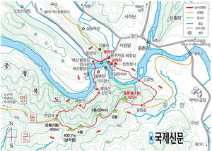
According to visitor reviews, the round trip to Taehyeonjeong, the Wollyubong viewpoint, takes about one hour. Since this is a mountain trail rather than a sightseeing attraction reached directly from a ticket office, it is practical to prepare walking shoes and water even though admission is free. Hiking records describe a ridge route from the viewpoint to the summit peak, Peak 5, followed by Peaks 4, 3, and 2, Wollyubong or Peak 1, and a junction.
The official total length of the Wollyubong Circular Trail is approximately 8.4 km. The summit ridge hike and the riverside circular trail are not the same route, so visitors should decide first whether to see only Wollyujeong and the viewpoint or walk as far as Banyasa Temple. Hiking records also include sections crossing Chogangcheon Stream, so after rain, particular attention should be paid to water conditions and footwear.
Walking Along the Seokcheon Waterway on the 2.7 km Yeoul Sound Trail
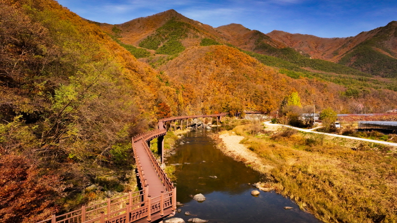
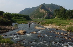
The Yeoul Sound Trail is approximately 2.7 km long and passes Wollyubong Square, Wonchon-ri Village, Wonchon Bridge, the Seokcheon Waterway, and Wanjeong Bridge. Since it is a course for enjoying the sound of rapids where Seokcheon Stream meets Chogangcheon Stream, it suits travelers who want to see the riverside scenery up close rather than climb only Wollyubong’s peaks.
After crossing Wonchon Bridge, a Bokgyo section along Kalsan above Seokcheon has been developed, and the official guide also introduces deck paths and wooden bridge sections. The wooden bridge leading to the Songs of Mountain Birds Trail is 60 m long and 2.0 m wide. Some descriptions mention people catching freshwater snails in Seokcheon, but anyone considering entering the water should separately check on-site safety conditions and whether it is permitted.
The Difference Between the 3.2 km Songs of Mountain Birds Trail and the 2.5 km Sounds of Scenery Trail
The Songs of Mountain Birds Trail is approximately 3.2 km long and connects Wanjeong Bridge, the wooden bridge, and Umae-ri. It passes quiet village roads, pastoral rural scenery, and unnamed wildflowers, with sections where Seokcheon Stream and the wooden bridge are visible together. Because it includes a long bridge section, travelers with strollers or wheelchairs should not assume that the entire course has uniform accessibility conditions.
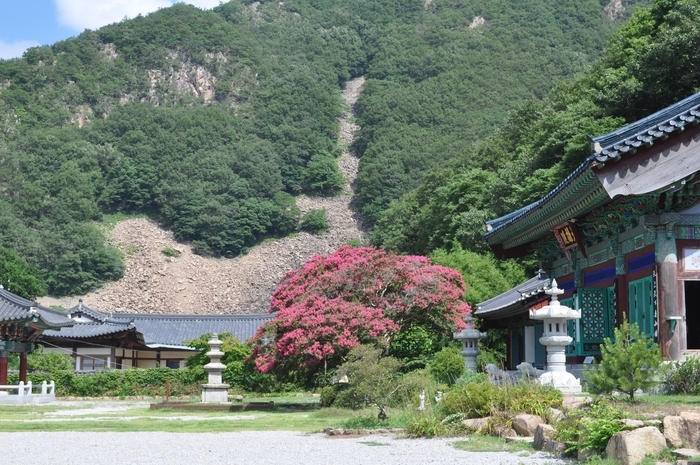
The Sounds of Scenery Trail is approximately 2.5 km long and connects Umae-ri, Banyagyo Bridge, and Banyasa Temple. From Umae-ri, the route crosses stepping stones and passes through a Japanese cedar forest. Guides state that on the mountainside behind Banyasa Temple, visitors can see a crushed-stone formation resembling a tiger with its tail raised. The Wollyubong Circular Trail is divided into three courses: the 2.7 km Yeoul Sound Trail, the 3.2 km Songs of Mountain Birds Trail, and the 2.5 km Sounds of Scenery Trail.
The Actual Route from Wollyubong Square to Banyasa Temple
The official route is divided as follows: the first section is Wollyubong Square–Wonchon-ri Village–Wonchon Bridge–Seokcheon Waterway–Wanjeong Bridge; the second is Wanjeong Bridge–wooden bridge–Umae-ri; and the third is Umae-ri–Banyagyo Bridge–Banyasa Temple. Therefore, starting at Wollyubong Square makes it possible to connect the river, rural village, wooden bridge, stepping stones, and Banyasa Temple in one direction.
However, a plan to walk the entire approximately 8.4 km from Wollyubong Square to Banyasa Temple should be scheduled separately from the roughly one-hour viewpoint round trip. Some sections of the circular trail have decks, Bokgyo bridges, and wooden bridges, but records also mention stepping stones and crossing Chogangcheon Stream. When it rains or the water level is high, it may be necessary to switch to the shorter viewpoint course. The latest information should be checked with the official information department and contact point.
Free and Open Year-Round, but On-Site Conditions Require Preparation
Wollyubong is an outdoor attraction described as open at all times, every day of the year, and free of charge. Since it is not an indoor attraction with a separate ticket office and admission fee, there is no need to prepare an adult admission fee or cash payment. Parking is available and described as free, but separate information about parking congestion and mountain-trail conditions was not confirmed.
No separate representative telephone number is provided. Visitors should check the latest contact details for the local administrative inquiry office and the department responsible for the circular trail. The official website is the Wollyubong Circular Trail page on the Yeongdong-gun tourism website. No information is provided about English guidance, audio guides, photography restrictions, or cash-only policies. Do not assume that the presence of decks and wooden bridges means the route is fully barrier-free.
},The 2026 Monorail and Suspension Bridge Plans Are Not Currently Usable Facilities
Yeongdong-gun is known to be promoting Wollyubong as a tourism attraction, and plans to build a monorail and suspension bridge have been reported (the timing requires confirmation). The planned monorail cars were introduced as having a capacity of 60 passengers. This is a development plan, not information about completed facilities currently available to visitors.
Therefore, current visits to Wollyubong should accurately be planned around the existing hike and circular trail along Wollyujeong, Chogangcheon Stream, and Seokcheon Stream. Visitors expecting a monorail or suspension bridge may find that these facilities are not available on-site, so it is safer not to include planned facilities in the travel itinerary.
},Traveling to Wollyubong from the Gyeongbu Railway and Gyeongbu Expressway Area
The Gyeongbu railway and Gyeongbu Expressway pass near Wollyubong, and the Hwanggan-myeon area has long served as a transportation hub. International travelers can first approach the Hwanggan-myeon area via the Gyeongbu railway or expressway, then plan to use Wollyubong Square as their starting point. However, station names, exit numbers, bus route numbers, and service intervals are not included in the available information.
Because a specific bus number cannot be stated with certainty, those traveling by public transportation should separately check the latest transport information and same-day connections to Wollyubong Square. After arrival, the first point on the official circular trail is Wollyubong Square, followed by the direction of Wonchon-ri Village and Wonchon Bridge.
},Sections First-Time Travelers May Easily Miss at Wollyubong
The essence of Wollyubong is not a single summit but the terrain where six peaks, Wollyujeong, Chogangcheon Stream, and the confluence of Seokcheon Stream and Chogangcheon Stream fit into one view. Wollyujeong is halfway up the first peak, while Yongyeondong or Yongyeondae refers to the deep pool in front of it. Visitors who turn back after seeing only the pavilion may miss the water landscape of the Eight Scenic Views of Hancheon.
Conversely, along the circular trail, waterways and villages are more central than the peak summit. The Yeoul Sound Trail is approximately 2.7 km, the Songs of Mountain Birds Trail approximately 3.2 km, and the Sounds of Scenery Trail approximately 2.5 km, so a day covering all three courses should allow for a total of about 8.4 km. An itinerary for someone who needs only the roughly one-hour viewpoint round trip differs from one for someone walking onward to Banyasa Temple.
},Official Contact Details and Address Needed for Visiting Wollyubong
The address is Wonchon-ri, Hwanggan-myeon, Yeongdong-gun, Chungcheongbuk-do, and the site is described as open at all times, every day of the year, and free of charge. Free parking is available. The recommended time is about one hour for the viewpoint round trip, but the entire circular trail connecting Wollyubong Square and Banyasa Temple is approximately 8.4 km, so additional time should be allocated according to the purpose of the walk.
Official information about the Wollyubong Circular Trail is available on the Yeongdong-gun tourism website. Visitors should check the latest contact details for the local administrative inquiry office and the department responsible for the circular trail. Apart from the address and operating information, no separate details are provided about English guidance, audio guides, photography restrictions, or seasonal closures.
- Official website: https://tour.yd21.go.kr/tour/html/sub01/0102.html
- Address: Wonchon-ri, Hwanggan-myeon, Yeongdong-gun, Chungcheongbuk-do
- Operation: Open at all times, year-round, free
- Parking: Available, free parking
- Inquiries: Check the latest contact details
35 Key Facts About Wollyubong
Wollyubong is approximately 400 m high, with six peaks along a ridge extending east to west. Chogangcheon Stream is a branch of the upper Geumgang River, and the confluence of Seokcheon Stream and Chogangcheon Stream is also a viewpoint. Wollyujeong stands halfway up the first peak, and the deep pool in front of Wollyujeong is called Yongyeondong or Yongyeondae.
The Eight Scenic Views of Hancheon consist of Wollyubong, Sanyangbyeok, Cheonghakgul, Yongyeondae, Naengcheonjeong, Beopjonam, Sagunbong, and Hwahyeonak. Sanyangbyeok refers to a steep cliff, while Hwahyeonak describes the red-tinted scenery created by azaleas and royal azaleas. Hancheonjeongsa and the monument marking Song Si-yeol’s former residence are heritage sites connected with the scholarly activities of Uam Song Si-yeol.
The circular trail has three courses: the Yeoul Sound Trail, the Songs of Mountain Birds Trail, and the Sounds of Scenery Trail. Their approximate lengths are 2.7 km, 3.2 km, and 2.5 km, and the main connecting points are Wollyubong Square, Wonchon-ri Village, Wonchon Bridge, the Seokcheon Waterway, Wanjeong Bridge, the wooden bridge, Umae-ri, Banyagyo Bridge, and Banyasa Temple. The wooden bridge is 60 m long and 2.0 m wide, and the Sounds of Scenery Trail features stepping stones, a Japanese cedar forest, and a tiger-shaped formation at Banyasa Temple.
Before You Go
- Address
- Wonchon-ri, Hwanggan-myeon, Yeongdong-gun, Chungcheongbuk-do
- Hours
- Open at all times
- Closed
- Open year-round
- Admission
- Free
- Phone
- Check the latest contact details
- Official site
- https://tour.yd21.go.kr/tour/html/sub01/0102.html
- Transport
- Main points in the official Wollyubong Circular Trail guide: Wollyubong Square–Wonchon-ri Village–Wonchon Bridge–Seokcheon Waterway–Wanjeong Bridge; Wanjeong Bridge–wooden bridge–Umae-ri; Umae-ri–Banyagyo Bridge–Banyasa Temple
- Parking
- Parking available, free parking
- Time needed
- About one hour for the Wollyubong viewpoint round trip based on reviews; official total circular-trail length approximately 8.4 km
- Accessibility
- Some sections of the circular trail have deck paths, wooden bridges, Bokgyo bridges, and stepping stones; hiking records confirm a section crossing Chogangcheon Stream.
The information above is current as of the time of writing. Check the official information again before visiting.

Places
Nearby Attractions 1
-
 1
Banyasa TempleEnjoy a stroll through the historic temple grounds, among the crape myrtles, and to Munsujeon Hall.
1
Banyasa TempleEnjoy a stroll through the historic temple grounds, among the crape myrtles, and to Munsujeon Hall.
Food & Dining 3
-
 2
2
-
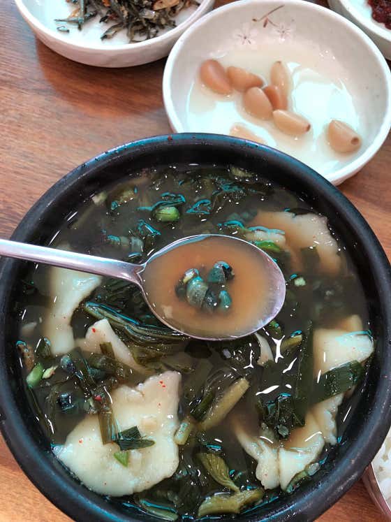 3
Anseong SikdangEnjoy the local specialty of olbaengi gukbap, a soup with rice and freshwater snails.
3
Anseong SikdangEnjoy the local specialty of olbaengi gukbap, a soup with rice and freshwater snails. -
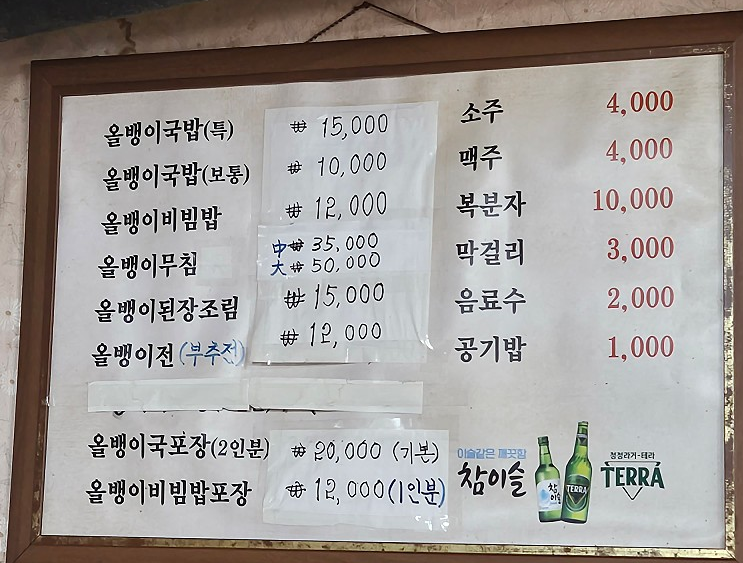 4
Wonjo Donghae RestaurantEnjoy Hwanggan specialties such as olgaengi-guk (marsh snail soup) and olgaengi-jeon (marsh snail pancakes).
4
Wonjo Donghae RestaurantEnjoy Hwanggan specialties such as olgaengi-guk (marsh snail soup) and olgaengi-jeon (marsh snail pancakes).
Events in This Area
Festivals in This Area

More Travel Guides in This Area
 Travel Guide
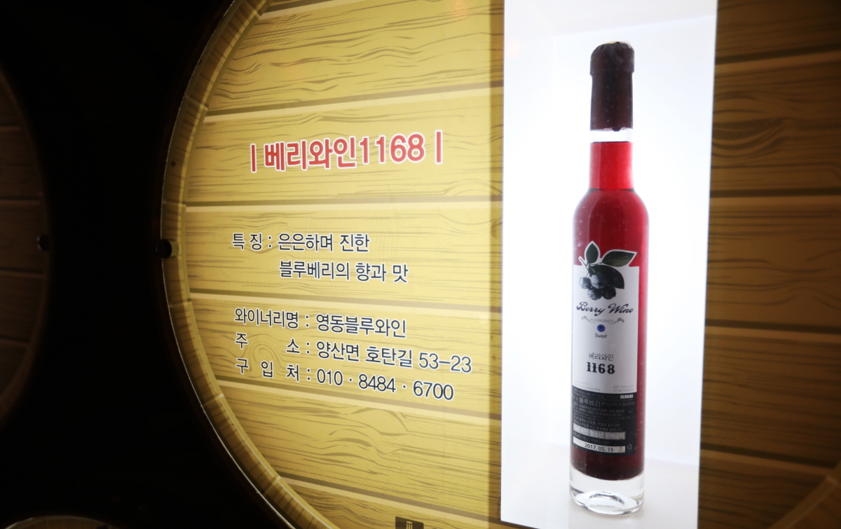
A Journey Through Chungbuk Grape Wine Inside the 420-Meter Yeongdong Wine Tunnel
 Travel Guide
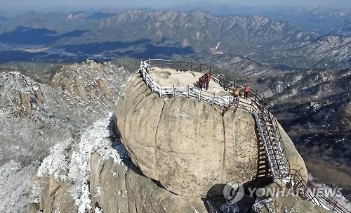
How to Hike Songnisan in Boeun, from 1,058.4 m Cheonwangbong Peak to Beopjusa Temple and Sejogil
 Travel Guide
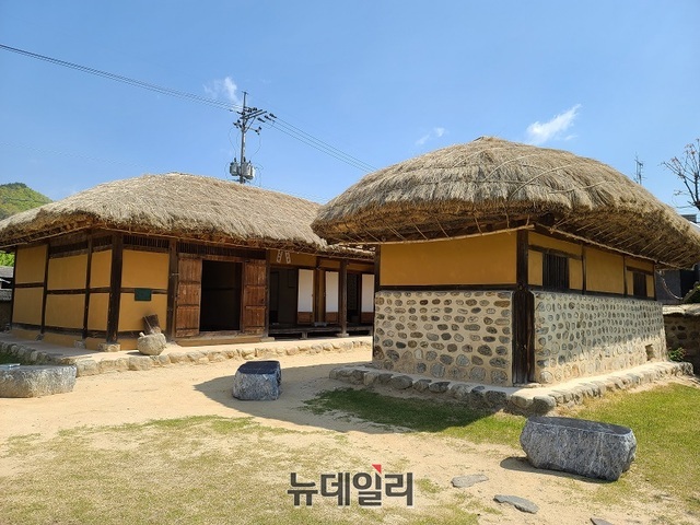
Jeong Ji-yong’s Birthplace by the Stream of Nostalgia
 Travel Guide
20 m Observatory Overlooking Malti Pass’s 12 Hairpin Turns
Korea News
 News
News
‘NewJeans Expulsion’ Danielle Releases Her First YouTube Video… “We Don’t Know What Will Happen Next”
![aespa’s North American Tour Has Remaining Seats Despite ‘$49’ Bargain Prices… A Stark Popularity Gap with KATSEYE [TEN Starfield]](https://kotourlive-images.s3.ap-northeast-1.amazonaws.com/news/1788485037424_a59b1932_naver_rank_thumb_0000774618_1788485037424.jpg) News
News
aespa’s North American Tour Has Remaining Seats Despite ‘$49’ Bargain Prices… A Stark Popularity Gap with KATSEYE [TEN Starfield]
![[Photo] TWICE’s Dahyun attends a film festival red carpet as an actress](https://kotourlive-images.s3.ap-northeast-1.amazonaws.com/news/1788485316508_edd43ecd_news_870a60a6-6f11-4d73-aa7c-48d91318a0f7.jpg) News
News
[Photo] TWICE’s Dahyun attends a film festival red carpet as an actress
![[On-Site Video] “We’re Departing Separately Together”… BIGBANG Begins ‘COSMOS’ World Tour](https://kotourlive-images.s3.ap-northeast-1.amazonaws.com/news/1788485226518_c5719641_news_fdd4764a-0f4e-4968-8e4e-e98a02872f88.jpg) News
News