A Walk on Goehwasan Connecting the Geumgang River and Jiphyeon Rock
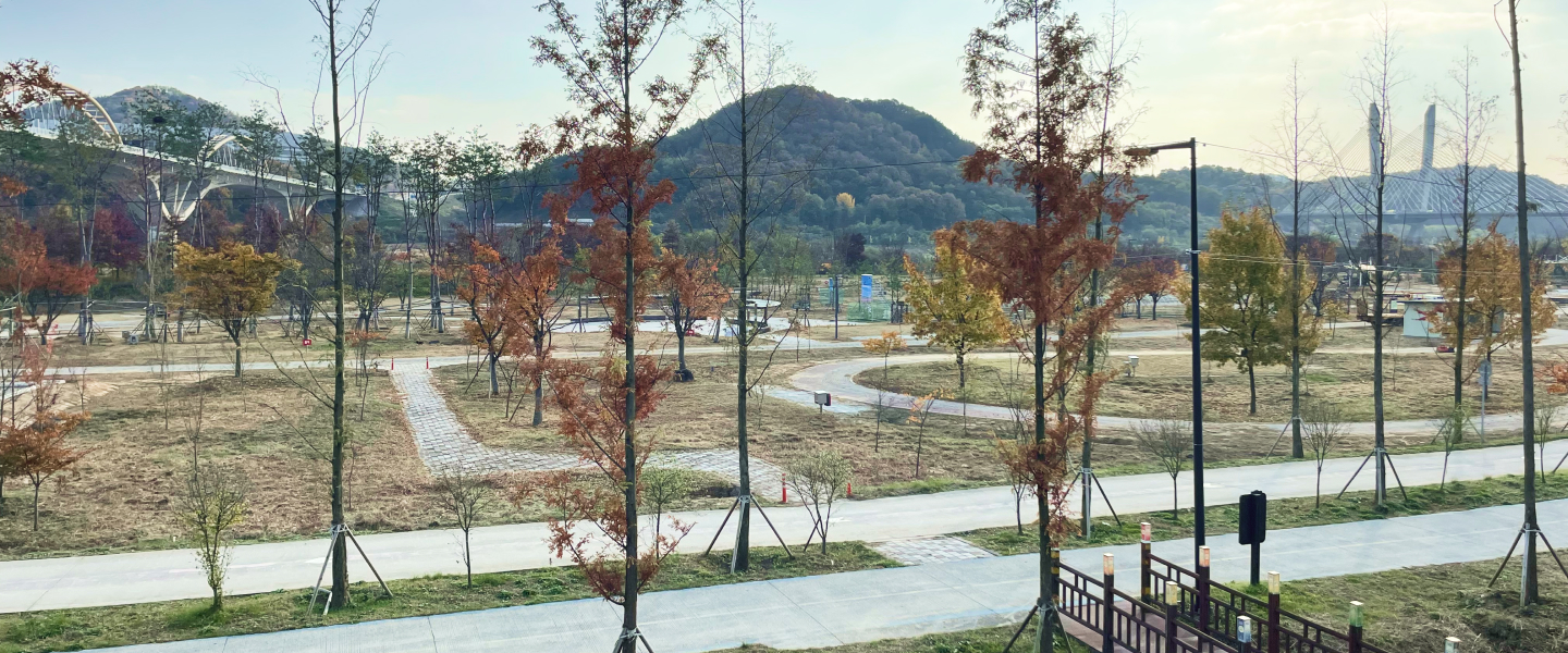
Goehwasan is a low mountain about 201 meters above sea level in Bangok-dong, Sejong City, offering a walking route with views of the Geumgang River and the new downtown area. Along the way, you can see the summit stonework ruins believed to be a Goryeo-era altar, Jiphyeon Rock, and a children's forest experience center, although views from the summit are limited by the surrounding forest.

I’ve been here?
Your check-in helps the next traveler.
21 people viewed this week Be the first
One tap — no writing needed
Ban-gok-dong San 112, the 201 m Mountain Supporting Sejong’s New Downtown
Goehwa-san is a mountain about 201 m above sea level, located at San 112, Ban-gok-dong, Sejong Special Self-Governing City. The Encyclopedia of Korean Geographical Names, Chungcheong Edition, recorded it in 2010 as a 201 m-high mountain on the boundary of Ban-gok-ri, Seoksam-ri, Jangjae-ri, and Seokgyo-ri in Geumnam-myeon, Yeongi-gun, former South Chungcheong Province. The Encyclopedia of Korean Culture gives its height as 201.2 m.
Goehwa-san, Won-su-san, and Jeonwol-san form the three mountains of Sejong’s new downtown. The Geum River flows to the north, and several trailheads around the mountain make it accessible from the Sodam-dong and Jiphyeon-ri directions. The fact that the mountain once marked the boundary of four villages, before the new city was developed, provides a clue to understanding today’s urban forest landscape.
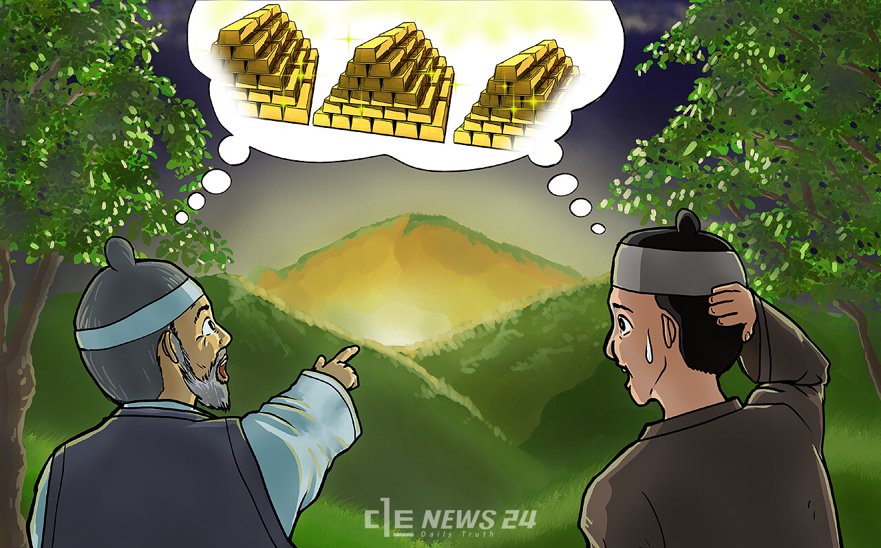
The Name Goehwa-san and the Legend of the Golden Jar in the 1988 Yeongi County Gazetteer
Sejong City’s official introduction explains that the name Goehwa-san originated from a propitious site shaped like a hanging lamp, appearing as though it were brightly lit even at night. This place name is not simply the name of a mountain; it is connected to how the villages around the Geum River have interpreted the mountain’s terrain.
There is also a legend called the “Jiljae Golden Jar Legend,” which says that a gold ingot—or a golden jar measuring 1 m in length, width, and height, equivalent to three cheok and three chon—was buried somewhere on the mountain. This tale was included in The Yeongi County Gazetteer, published by the Yeongi County Gazetteer Compilation Committee in 1988. Stories of a wild animal severing the bowstring of Japanese forces and helping allied troops win, along with records of mountain-spirit rituals, also reveal the local culture surrounding Goehwa-san.
Records introduced in 1995 state that residents of Seokgyo, Seoksam, and Ban-gok-ri held village mountain-spirit rituals separately every year on the first day of the tenth month of the lunar calendar. Rather than assuming that travelers can currently witness a ritual, it is better to understand the context that this mountain was a place of village boundaries and religious belief even before the administrative city was relocated here.
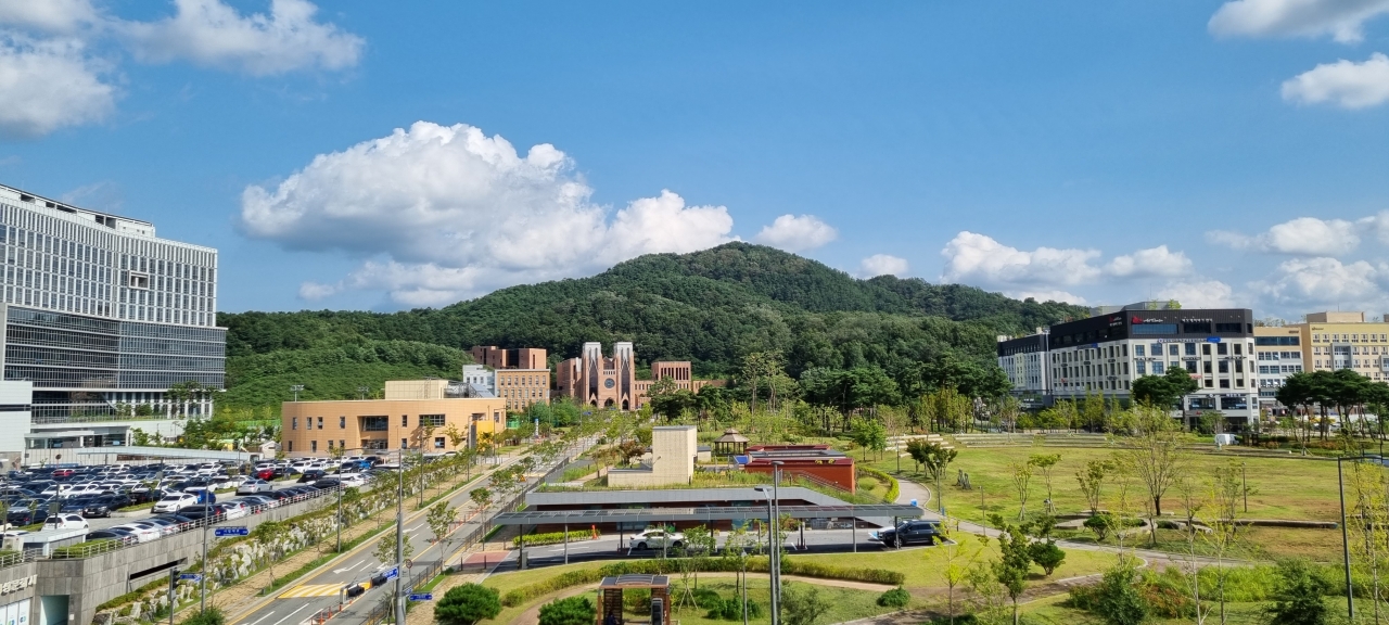
Finding the Goryeo-period Stonework Remains at the Summit
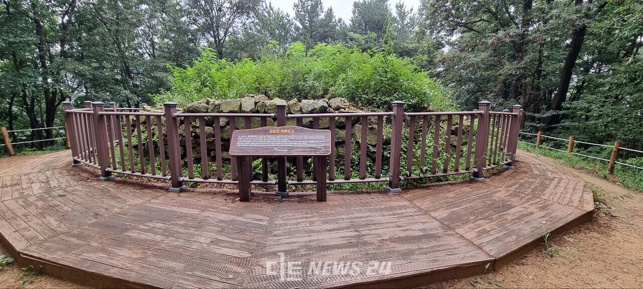
Stonework remains believed to have been constructed during the Goryeo period survive at the summit of Goehwa-san. Sejong City and local sources presume that the structure served as an altar and explain that the remains were identified through an excavation survey conducted during the construction of the Administrative City.
A 2022 hiking record introduces the stonework remains as measuring 10 m in diameter and 1.8 m in height. Do not expect a tourist facility where you can enter a fortress or the interior of a building simply because you have reached the summit. This is a viewing and exploration point for the remains at the mountain’s peak, and information about access restrictions, photography bans, separate interpretation, or audio guides has not been confirmed.
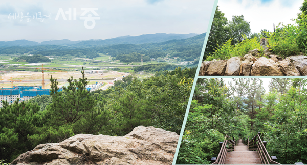
The summit is around 201 m high, but views in all four directions are limited because surrounding forests block the sightlines. If you want a broad panorama, it is better to include Jiphyeonbawi, a rocky lookout about two-thirds of the way to the summit, in your itinerary.
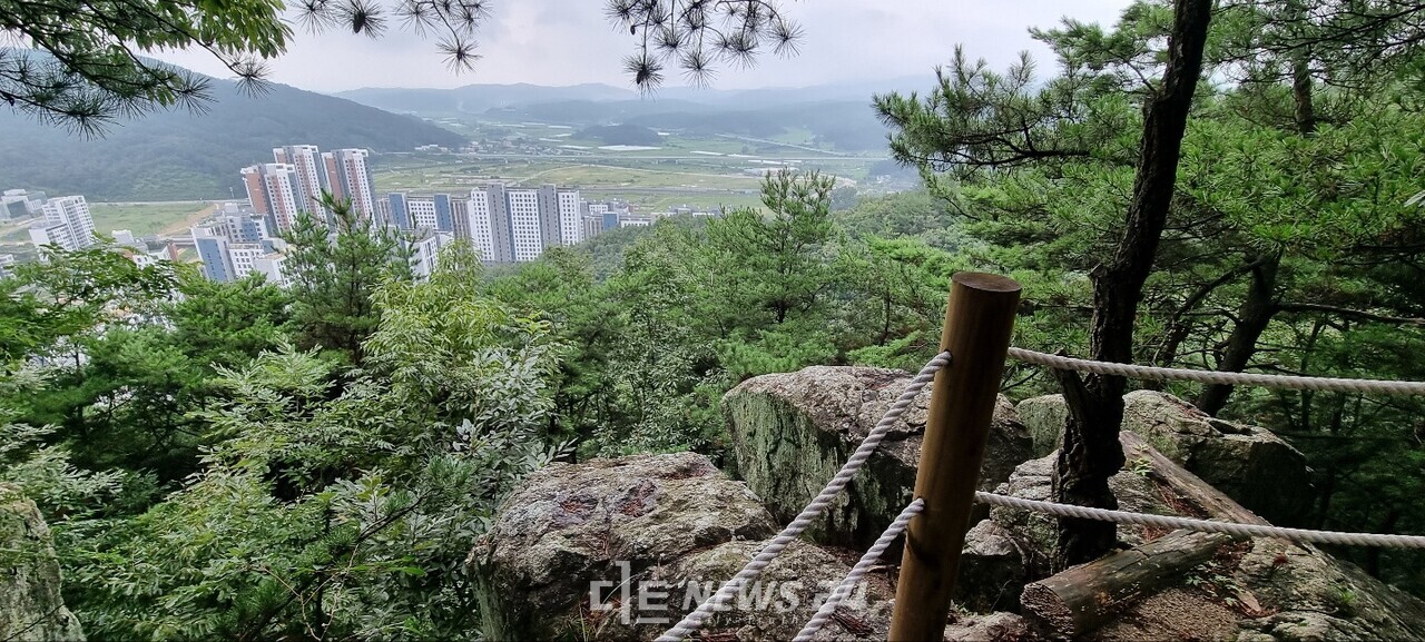
A Viewpoint from Jiphyeonbawi Overlooking KTX Viaducts and Jiphyeon-dong
Jiphyeonbawi is a rocky lookout encountered before reaching the summit of Goehwa-san. A 2022 visit review introduces this location as offering views over present-day Jiphyeon-dong, formerly Seokgyo-ri in Geumnam-myeon, Hwangnyong-ri in Geumnam-myeon, KTX viaducts, and the planned site of a future agricultural and marine products distribution complex.
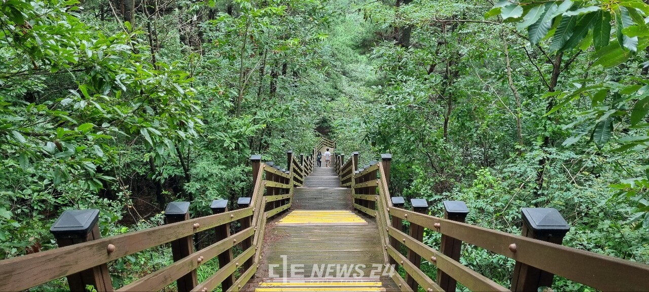
Although there is also a deck-stair section near the summit, Jiphyeonbawi is a natural rocky lookout, so watch your footing on wet days. The reason it is difficult to expect an unobstructed panorama from Goehwa-san’s summit itself is also the surrounding forest. If your goal is to view the city and viaducts together, allocating time at Jiphyeonbawi is the practical choice.
Photographic materials also show a stairway leading down toward KDI and Sodam-dong, as well as a view of the planned courthouse and prosecutors’ office site. However, no information has been provided about seasonal or weather-related visibility changes or restrictions on nighttime access, so it is safer not to plan on hiking at night.
An Official 1.9 km Walking Route from the Sejong National Research Complex
For first-time foreign visitors, the most specific starting point is the temporary parking lot at the Sejong National Research Complex. Sejong City’s official route runs about 1.9 km from the temporary parking lot through the fitness facilities, Goehwa-san summit, deck stairs, observation deck, and KDI Korea Development Institute, taking approximately one hour.
The distance from the trailhead near the Sejong National Research Complex to the summit is about 1 km, while the distance from the trailhead near KDI Korea Development Institute is about 900 m. Both directions have similar route lengths, and the walking trails include sections surfaced with core mats installed along with the development of the neighborhood park.
This site is described as free of charge, and no separate ticket office or admission ticket information has been confirmed. No official information specifying whether it is open at all times was found, and regular closing days have also not been confirmed, so it is best to plan a hike during daylight hours.
The 4.5 km Loop Route and Trail-Finding Issues for First-Time Visitors
For a longer walk, you can use an approximately 4.5 km loop route starting at the courthouse and prosecutors’ office site access road, passing the fitness facilities, Goehwa-san summit, deck stairs, and observation deck, and returning to the starting point. Sejong City estimates the duration at about two hours. After walking through the forest for about 30 minutes, the trail meets the walking route toward the Sejong National Research Complex near the fitness facilities.
The hiking trails around Goehwa-san’s summit divide into several branches, and trailheads continue around the mountain. Sejong City’s official guidance recommends the core-mat walking trail for first-time visitors because the forest is dense and there are many junctions. It also explains that smartphone tracking applications can be used to check directions.
One route documented in a July 19, 2022 hiking record ran from the national research institute parking lot through the ridge, summit, KDI direction, children’s forest experience center, observation deck, and Daejeon Diocese of the Catholic Church before returning. It covered 3.5 km in 1 hour 20 minutes, with energy expenditure recorded as 293 kcal. The same record mentions junctions without directional signposts, so do not underestimate the route and prepare a map application.
Forest Playground and Barefoot Trail: Who Is It Suitable For?
A children’s forest experience center has been established on one side of Goehwa-san, and there are three or four forest playgrounds for children in the direction of Solbit Forest Kindergarten. Ministry of Education materials from 2019 explain that the area has six forest classrooms and that thorny trees, grassy areas, and chestnut burrs around the trails and forest classrooms were managed to ensure children’s safe play.
A 2023 visit review says that the perimeter trail is generally gently sloped, with stairs and dirt paths mixed together, along with narrow paths suitable for one person at a time. It also mentions sections with views of a small valley and forests rich in acacia trees and bracken, although water levels may be affected by drought.
Some visitors remove their shoes and walk barefoot. However, not every path is a barefoot trail, and the route includes Jiphyeonbawi, deck stairs, and narrow dirt paths, so hiking shoes are recommended. Because core mats, deck stairs, dirt paths, and narrow trails are mixed together, access to the summit and main lookouts for strollers and wheelchairs has not been confirmed.
Parking and Visitor Information to Know Before a Free Hike
The address is San 112, Ban-gok-dong, Sejong Special Self-Governing City, and the area near the temporary parking lot at the Sejong National Research Complex is mentioned as the starting point for the official walking route. However, official parking availability and fees have not been confirmed. Several other trailheads around the mountain are also introduced, including near KDI Korea Development Institute, the courthouse and prosecutors’ office site access road, and in the direction of Solbit Forest Kindergarten.
Goehwa-san is free to visit, and no information about a ticket office, admission ticket, or main telephone number has been confirmed. The official information URL is Sejong City News’ walking information for Goehwa-san. No confirmed information is available about English signs, audio guides, cash-only facilities, or photography restrictions.
A 2022 hiking record says that a trailhead information board and an insect-repellent storage box were visible. In seasons with many insects, prepare long pants and water. Instead of the loop route, where it is easy to get lost, begin with the approximately 1.9 km core-mat walking route. The limited summit views and narrow paths may not suit stroller users or travelers seeking expansive panoramas.
Before You Go
- Address
- San 112, Ban-gok-dong, Sejong Special Self-Governing City
- Hours
- No official information specifying whether it is open at all times was found
- Admission
- Free
- Official site
- https://news.sejong.go.kr/news/articleView.html?idxno=2293
- Transport
- Accessible from several trailheads around the mountain, including the Sejong National Research Complex temporary parking lot, near KDI Korea Development Institute, the courthouse and prosecutors’ office site access road, and the direction of Solbit Forest Kindergarten
- Parking
- Parking space near the Sejong National Research Complex temporary parking lot is mentioned, but official availability and fees could not be confirmed
- Time needed
- Official walking route: about 1 hour; loop route: about 2 hours; one route in a visitor review: about 1 hour 20 minutes
- Accessibility
- The walking trails combine core mats, deck stairs, dirt paths, and narrow trails; a visitor review says the perimeter trail is gently sloped overall. However, access for strollers and wheelchairs could not be confirmed because some sections have long stairways and narrow paths
The information above is accurate as of the time of writing. Check the official information again before visiting.

Places
Nearby Attractions 3
-
 1
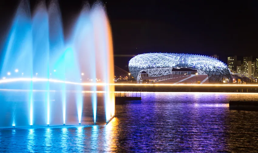
Sejong Lake ParkA park where you can enjoy walking and cycling along the lakeside trails and through the green spaces.
1
Sejong Lake ParkA park where you can enjoy walking and cycling along the lakeside trails and through the green spaces. -
 2
Sejong Central ParkA park where visitors can enjoy outdoor activities in the plaza, sports facilities, and family recreation forest.
2
Sejong Central ParkA park where visitors can enjoy outdoor activities in the plaza, sports facilities, and family recreation forest. -
 3
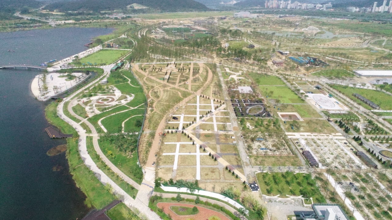
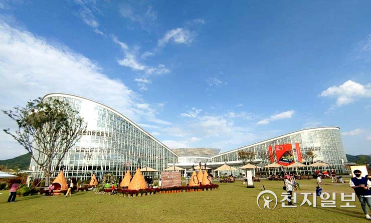
Sejong National ArboretumAn arboretum where you can observe plants while strolling through themed exhibition gardens and gardens.
3
Sejong National ArboretumAn arboretum where you can observe plants while strolling through themed exhibition gardens and gardens.
Food & Dining 3
-
 4
Ahojeong Bangok BranchA modern Chinese restaurant serving jjajangmyeon, jjamppong, tangsuyuk, and more.
4
Ahojeong Bangok BranchA modern Chinese restaurant serving jjajangmyeon, jjamppong, tangsuyuk, and more. -
 5
Bodol Miyeok Bangok BranchA Korean restaurant serving seaweed soup and set meals with flounder and shellfish.
5
Bodol Miyeok Bangok BranchA Korean restaurant serving seaweed soup and set meals with flounder and shellfish. -
 6
Surubae DaebanjeomA Chinese restaurant serving jajangmyeon, jjamppong, sweet-and-sour pork, and more.
6
Surubae DaebanjeomA Chinese restaurant serving jajangmyeon, jjamppong, sweet-and-sour pork, and more.
More Travel Guides in This Area
Korea News
 News
News
‘NewJeans Expulsion’ Danielle Releases Her First YouTube Video… “We Don’t Know What Will Happen Next”
![aespa’s North American Tour Has Remaining Seats Despite ‘$49’ Bargain Prices… A Stark Popularity Gap with KATSEYE [TEN Starfield]](https://kotourlive-images.s3.ap-northeast-1.amazonaws.com/news/1788485037424_a59b1932_naver_rank_thumb_0000774618_1788485037424.jpg) News
News
aespa’s North American Tour Has Remaining Seats Despite ‘$49’ Bargain Prices… A Stark Popularity Gap with KATSEYE [TEN Starfield]
![[Photo] TWICE’s Dahyun attends a film festival red carpet as an actress](https://kotourlive-images.s3.ap-northeast-1.amazonaws.com/news/1788485316508_edd43ecd_news_870a60a6-6f11-4d73-aa7c-48d91318a0f7.jpg) News
News
[Photo] TWICE’s Dahyun attends a film festival red carpet as an actress
![[On-Site Video] “We’re Departing Separately Together”… BIGBANG Begins ‘COSMOS’ World Tour](https://kotourlive-images.s3.ap-northeast-1.amazonaws.com/news/1788485226518_c5719641_news_fdd4764a-0f4e-4968-8e4e-e98a02872f88.jpg) News
News