A Day on Yokjido Island: Connecting Bireonggil and Cheonwangbong Peak, 45 Minutes from Samdeok Port
Yokjido Island is an island region centered around the main island of Yokji-myeon, Tongyeong, and takes about 45 minutes by passenger ferry from Samdeok Port. Using Yokji Port as a base, a realistic itinerary is to explore Samyeodo Island, the 1st, 2nd, and 3rd suspension bridges, Cheonwangbong and Daegibong Peaks, and Deokdong Beach according to your preferred transportation and fitness level.

I’ve been here?
Your check-in helps the next traveler.
No one has checked in yet Be the first
One tap — no writing needed
The Name Yokjido and the Administrative History from Wollyang-myeon in 1914 to Yokji-myeon in 1995
Yokjido is an island belonging to Yokji-myeon, Tongyeong-si, Gyeongsangnam-do. According to the Encyclopedia of Korean Culture, when administrative districts were reorganized in 1914, Wonsam-myeon and neighboring Saryang-myeon were merged and the area was called Wollyang-myeon, Tongyeong-gun. After Tongyeong-gun and Chungmu-si were merged in 1995, it became Yokji-myeon, Tongyeong-si. Today, Yokji-myeon is not limited to Yokjido alone but is an administrative district encompassing several islands, including Yeonhwado, Dumido, and Nodaedo.
As of 2022, Yokji-myeon covered 24.39㎢ and had a registered population of 2,108, including 714 people aged 65 or older. The actual resident population of Yokjido’s main island was 1,407 as of 2022, and about two-thirds of the island’s area is forestland. This is why judging travel routes based only on the harbor and roads can lead to inaccurate assumptions about the island being flat.
- Administrative district: Yokji-myeon, Tongyeong-si, Gyeongsangnam-do
- Area of Yokji-myeon: 24.39㎢ (as of 2022)
- Registered population of Yokji-myeon: 2,108 (as of 2022)
- Actual resident population of Yokjido’s main island: 1,407 (as of 2022)
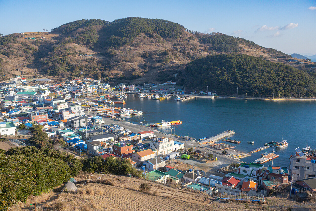
Choosing Your Arrival Route: 11.8 Miles and About 45 Minutes from Samdeok Port, or 13.5 Miles and About 1 Hour 10 Minutes from Junghwa Port
Yokjido has no designated opening hours or island-wide admission fee. However, because the island can only be reached by crossing the sea, ferry operations are the practical condition for visiting. According to route information from the Korea Maritime Transportation Safety Authority, the Samdeok Port–Yokji route is 11.8 miles and takes about 45 minutes, while the Junghwa Port–Yokji route is 13.5 miles and takes about 1 hour 10 minutes. Departure times, fares, and the number of vehicles that can be loaded may vary depending on the season and the ferry operator’s schedule, so reconfirmation on the official booking page before boarding is necessary.
If you want to take a ferry directly from central Tongyeong, Tongyeong Passenger Ferry Terminal is another option. The Yudong Fishing Village Experience Village guide explains that car ferries to Yokjido can be taken from Tongyeong Passenger Ferry Terminal, Samdeok Port, and Junghwa Port. If you bring a vehicle, passenger tickets and vehicle loading procedures must be considered separately, and it is safest to allow plenty of time to arrive at the harbor. Ferry services may also be changed or canceled on days with high waves or storm warnings.
- Samdeok Port–Yokji: 11.8 miles, about 45 minutes
- Junghwa Port–Yokji: 13.5 miles, about 1 hour 10 minutes
- Arrival ports: Tongyeong Passenger Ferry Terminal, Samdeok Port, and Junghwa Port
- Island-wide admission fee: Free
- Reservations: Reconfirm the departure date through ferry operators and official booking channels such as KSA Passenger Ferry Booking
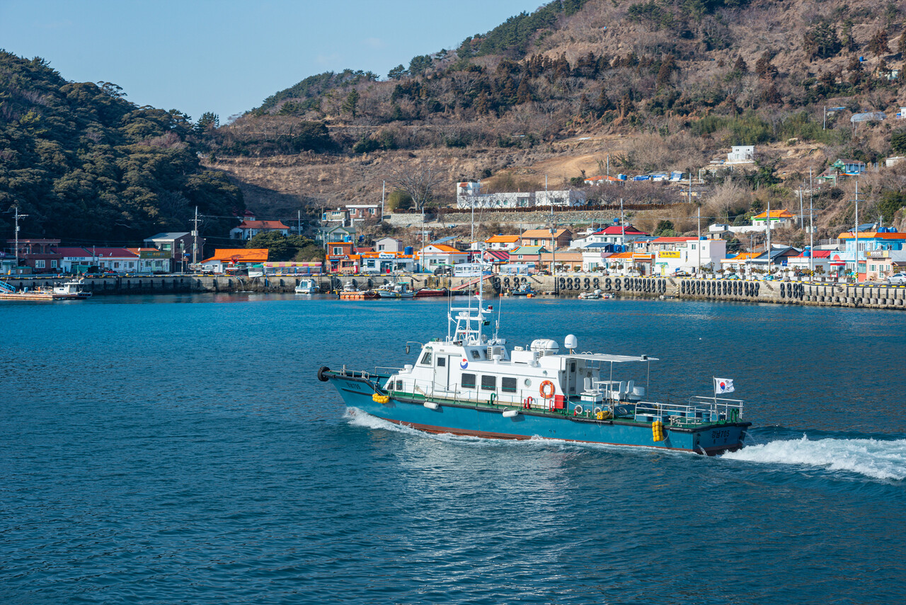
About 4 km from Yokji Port to Samyeodo: The First Viewpoint on the Island Coastal Road
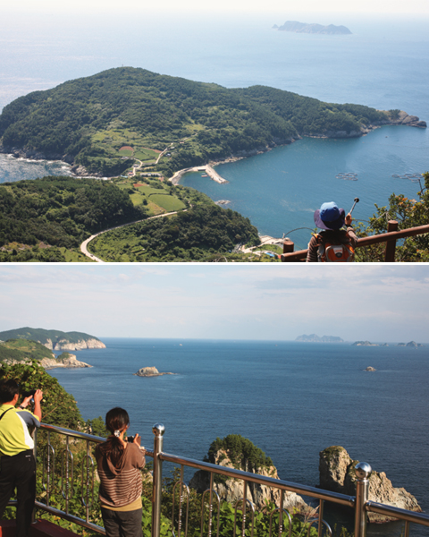
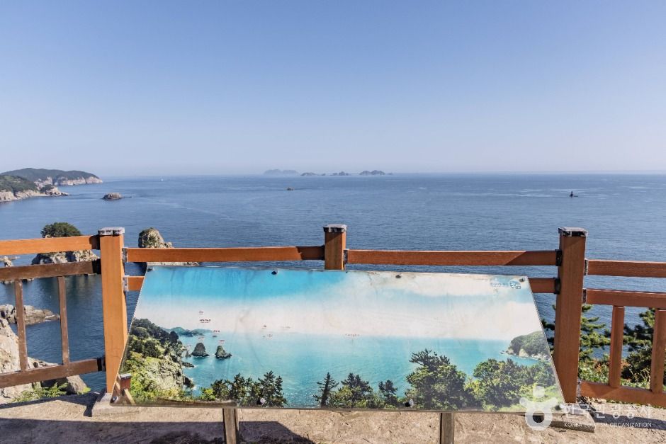
Yokji Port is the central reference point for getting around the island, with accommodations, restaurants, shops, and the ferry landing gathered nearby. Samyeodo Observatory is described as being about 4 km from Yokji Port and offers views of three rocky islets lined up across the sea. If your schedule is short, it is better to prioritize Samyeodo and the Donghang area after getting off the ferry rather than attempting to travel all the way to the opposite end of the island.
The Yokjido Coastal Circumnavigation Road starts at the harbor and crosses both the coast and ridgelines, making transportation more important than the number of stops. A private car, rental car, or taxi makes it easy to combine Samyeodo, Deokdong Beach, and Dodong Observatory, but completing the entire coastal road on foot in one day is not recommended. Bus operations may vary depending on whether they connect with ferry arrival times, so it is best to check the local timetable after arriving at Yokji Port.
- Yokji Port–Samyeodo Observatory: about 4 km
- Main stops: Samyeodo, Deokdong Beach, and Dodong Observatory
- Recommended starting point: Yokji Port Passenger Ferry Terminal
- Driving caution: Coastal roads and uphill sections continue throughout the route
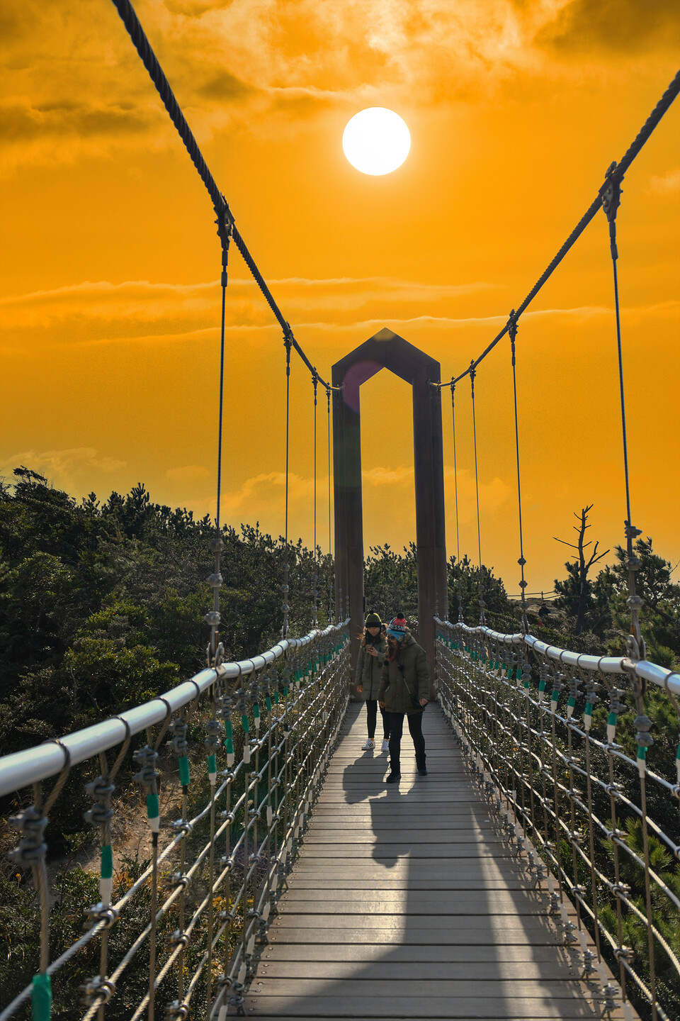
The 1st, 2nd, and 3rd Suspension Bridges Built in 2012, and the Bireonggil Trail Beginning at Jaetgodak
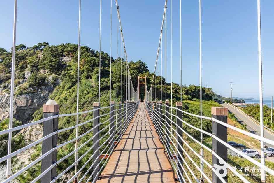
The Yokjido Suspension Bridges form a section of three bridges—the 1st, 2nd, and 3rd—that connect coastal cliff terrain. During Tongyeong’s island tourism development project, the Yokjido Pelican Rock Suspension Bridge was built in 2012. The Bireonggil route, which links all three bridges into one walking course, became known afterward. The 2nd and 3rd suspension bridges are higher than the 1st, so people sensitive to heights should consider the elevation difference before focusing on the number of bridges.
One recently introduced trekking route is about 9.4 km long and takes approximately 4 hours. This estimate excludes time for photography, meals, and waiting for buses. If you need to catch the last ferry of the day, it is better not to include all three bridges and Cheonwangbong in a single outing. Prepare an outer layer to block the sea wind, shoes with slip-resistant soles, and water. Avoid walking along sections with railings when rain or strong winds are forecast.
- Suspension bridge construction: Yokjido Pelican Rock Suspension Bridge, built in 2012
- Composition: 1st, 2nd, and 3rd suspension bridges
- Introduced trekking distance: about 9.4 km
- Introduced duration: about 4 hours
- Travelers requiring caution: Those with a fear of heights or who need ankle support
Cheonwangbong at 392 m and Daegibong at 355 m: Keep Ridge Hiking Separate from the Same-Day Ferry Schedule
Yokjido’s highest peak is Cheonwangbong, at 392 m above sea level, while nearby Daegibong is 355 m above sea level. The elevation change is significant for an island of this size, so the hike should not be considered equivalent to a walk around the harbor. A mountain route from Yapo via Ilchulbong, Mangdaebong, Nojeok, Hongok, Halmaebawi, Daegibong, and Taegoam before returning to the wharf is introduced as taking about 4 hours 30 minutes.
A hike to Cheonwangbong is easier to fit into an overnight itinerary than a plan to arrive on a morning ferry and leave directly on an afternoon ferry. Fog and wind along the ridgeline affect not only the views but also route-finding, so check both the weather and the last-ferry time before departing. If some members of your group are not hiking, splitting into a Yokji Port–Samyeodo–coastal road group and a Cheonwangbong group can reduce actual travel time.
- Cheonwangbong: 392 m above sea level
- Daegibong: 355 m above sea level
- Duration of the representative hiking route: about 4 hours 30 minutes
- Main stops: Yapo, Ilchulbong, Mangdaebong, Daegibong, Taegoam, and Yokji Port
Donghang-ri’s Natural Monument No. 343 Castanopsis cuspidata var. thunbergii Grove and the Passage of Time in a Fishing Village
Donghang Village, near Yokji Port, is home to a grove of Castanopsis cuspidata var. thunbergii, designated Natural Monument No. 343. Monthly Mountain introduces the site as a forest of about 100 trees, 10–20 m tall, growing together with other species, with walking paths established between them. Visitors focused only on the suspension bridges or summit views can easily miss this nearby woodland within the local community.
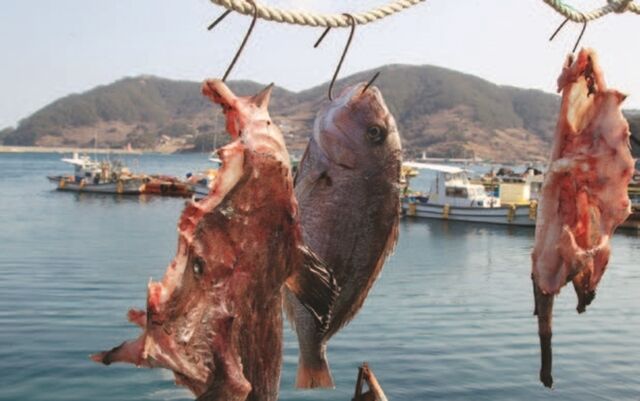
Records indicate that Yokji Port flourished until the 1990s as the most prosperous port in Gyeongsangnam-do after Busan Port. Jwaburanggae preserves the history of the formation of a modern fishing village as well as the history of colonial-era exploitation. Yokjido can therefore be understood not merely as a place for viewing scenery, but as an island where fishing outposts and harbor life shaped its roads, villages, and commercial districts.
- Castanopsis cuspidata var. thunbergii grove: Natural Monument No. 343
- Introduced grove size: about 100 trees
- Introduced tree height: about 10–20 m
- Location: Donghang Village near Yokji Port
A Two-Day, One-Night Itinerary Combining Deokdong Beach, Yokji Port, and the Last Ferry, Plus Packing Essentials
For a first visit to Yokjido, it is safest on the first day to combine Samyeodo, the coastal circumnavigation road, and Deokdong Beach after arriving at Yokji Port, then stay overnight at Yokji Port or in a village accessible from there. On the second day, choose either the 1st, 2nd, and 3rd suspension bridges or Cheonwangbong and Daegibong, then return to Yokji Port. Including two high-elevation or long-distance routes on the same day can make the schedule rushed because of the ferry departure time.
Yokjido is an outdoor nature destination, and no separate official visiting hours, regular closing days, or representative telephone number have been identified. Use Tongyeong City tourism information and ferry-route inquiries as practical contact resources, and contact individual businesses in advance regarding accommodations, restaurants, and vehicle loading. Wheelchair and stroller users should note that, apart from the landing and some coastal roads, slopes, stairs, and unpaved sections make access to the suspension bridges and hiking routes limited.
- Recommended stay: 6–8 hours for the main coastal routes alone; 1 night and 2 days if hiking is included
- Parking: Check in advance according to conditions at the departure port and individual facilities on the island
- What to bring: Identification, boarding pass, windbreaker, water, and slip-resistant shoes
- Accessibility: Mobility for wheelchairs and strollers is limited because there are many slopes and stairs outside the area around the landing
- Foreign-language information: Check the languages offered by each ferry booking and tourism information channel before departure
Before You Go
- Address
- Yokji-myeon, Tongyeong-si, Gyeongsangnam-do
- Hours
- The entire island is open at all times. Ferry operating hours vary according to the departure date, route, and weather, so check the official booking channel
- Closed
- None. However, cancellations may occur because of storm warnings, severe weather, or ferry operator circumstances
- Admission
- Free (there is no admission fee for Yokjido Island). Ferry fares, vehicle loading fees, and individual facility fees are separate
- Phone
- 055-650-3620 (Yokji-myeon Office, Tongyeong-si)
- Official site
- https://www.komsa.or.kr/kor/sub03_020311.do
- Transport
- Samdeok Port–Yokji: about 45 minutes (11.8 miles); Junghwa Port–Yokji: about 1 hour 10 minutes (13.5 miles). Car ferries are available from Tongyeong Passenger Ferry Terminal, Samdeok Port, and Junghwa Port
- Parking
- Conditions vary by departure port and individual facility on the island; check in advance
- Time needed
- 6–8 hours for the main coastal points; 1 night and 2 days recommended if the suspension bridges and Cheonwangbong hike are included
- Accessibility
- Outside Yokji Port and the landing area, coastal and mountain paths with many slopes and stairs make wheelchair access limited. Foreign-language information should be checked through ferry booking and tourism information channels
The information above is current as of the time of writing. Check official information again before visiting.

Places
Nearby Attractions 3
-
 1
1
-
 2
Yokjido Suspension BridgeA place where you can enjoy views of the sea while walking across a swaying bridge spanning coastal cliffs.
2
Yokjido Suspension BridgeA place where you can enjoy views of the sea while walking across a swaying bridge spanning coastal cliffs. -
 3
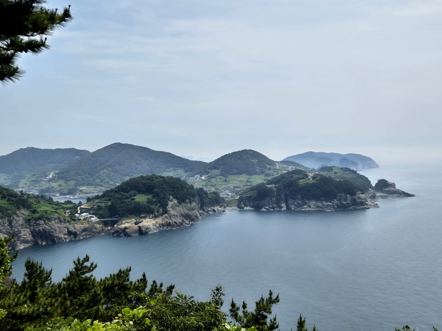
New Millennium Memorial ParkA place to enjoy coastal scenery in a park embodying the hopes of Yokjido’s residents.
3
New Millennium Memorial ParkA place to enjoy coastal scenery in a park embodying the hopes of Yokjido’s residents.
Food & Dining 2
-
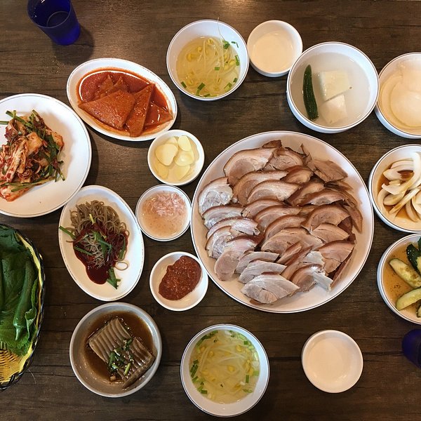 4
Hanyang SikdangA Chinese restaurant where you can enjoy jjajangmyeon and jjamppong made with seafood.
4
Hanyang SikdangA Chinese restaurant where you can enjoy jjajangmyeon and jjamppong made with seafood. -
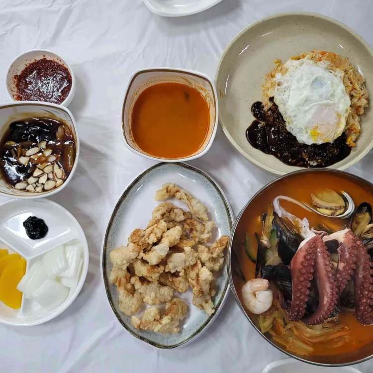 5
Yokji BanjeomA Chinese restaurant where you can enjoy jjampong made with stone octopus and seafood.
5
Yokji BanjeomA Chinese restaurant where you can enjoy jjampong made with stone octopus and seafood.
Events in This Area

Festivals in This Area

More Travel Guides in This Area
 Travel Guide
From 215 m Yeonhwa Peak to Yongmeori: Walking Tongyeong’s Yeonhwa Island Around the Ferry Schedule
 Travel Guide
How to Experience Live Fish Auctions and the South and North Harbors at Mijo Port in Namhae
 Travel Guide
Two Seas Divided by a Sandbar: From Bijindo’s Outer Port to Seonyubong Peak
 Travel Guide
The Orange Roofs Left by the Return of the Overseas Workers: Namhae German Village
Korea News
 News
News
TWS heightens comeback excitement with kitschy charm… Anticipation for “plot twist” rises
 News
News
BTS, Six Months After Its Release… ‘Arirang’ Climbs the U.S. Billboard 200
 News
News
'The Nation's Girl Group' RESCENE, Five Girls Transformed into Guardians… Additional Concept Photos for Their 4th Mini Album Revealed
 News
News