How to Understand Yeongwol’s Korean Peninsula-Shaped Terrain, Formed as the Seogang River Wraps Around Three Sides—and Oganjae Observatory
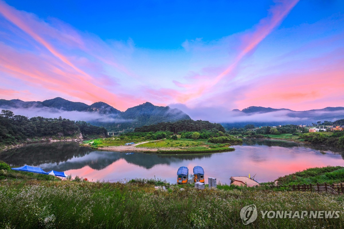
Yeongwol’s Korean Peninsula-shaped terrain was formed by the incised-meander erosion of the Seogang River. From the observatory, visitors can look out over the peninsula-like shape surrounded by water on three sides. Although it can be reached from Yeongwol Station by Bus 37, driving or allowing plenty of time for walking is advisable, given the slopes and stairs along the viewing route.

I’ve been here?
Your check-in helps the next traveler.
13 people viewed this week Be the first
One tap — no writing needed
The Place Where the Incised Meanders of the Seogang Left the Outline of the Korean Peninsula
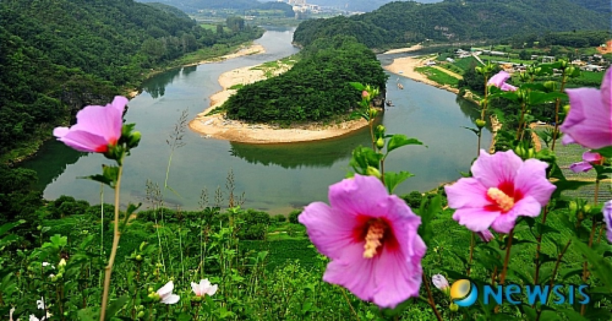
Yeongwol Hanbando Landform was formed where the Seogang, created by the Pyeongchanggang River flowing down from its source in Pyeongchang, makes a broad bend. The Gangwon Paleozoic National Geopark guide explains that this area was created by the erosional processes of an incised meandering river and introduces it as a place where visitors can observe limestone, dolines, the bends of the Seogang, and the process of landform formation together.
The name comes from the resemblance of its outline, seen from above, to the Korean Peninsula, with the east higher than the west and three sides surrounded by water. Yeongwol County introduces it as one of the “Ten Scenic Views of Yeongwol,” and to see the landform itself, visitors must climb to a high viewpoint rather than remain by the riverside.
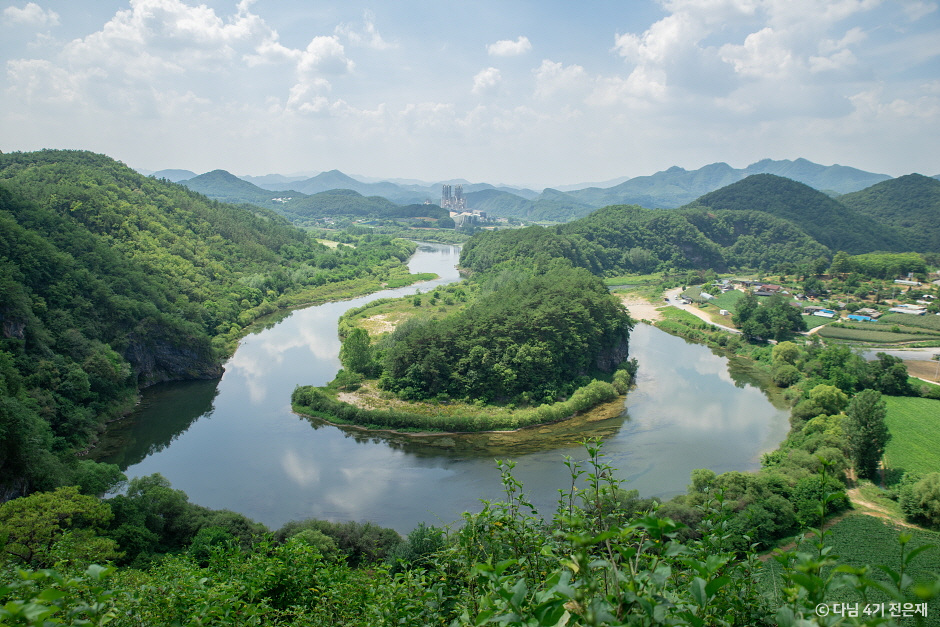
Route to Oganjae Observatory Starting at 555 Hanbando-ro
The address for visits is 555 Hanbando-ro, Hanbando-myeon, Yeongwol-gun, Gangwon Special Self-Governing Province. Tourist information states that visitors must walk approximately 870 m from the Hanbando Landform Observatory parking lot to Oganjae Observatory, so even for an itinerary focused on taking photos and returning immediately, it is safer to allow separate time for the round-trip walk.
The approach to the observatory is outdoors, and the terrain includes slopes and stairs. The Korea Tourism Organization’s Accessible Tourism information states that ramps are available at the main entrance and along the route, and that an accessible parking space, accessible restroom, and Braille information board are provided. However, the walking difficulty along the section offering a complete view should be assessed according to the mobility of each companion.
- Set the navigation destination to “Hanbando Landform Observatory” or “555 Hanbando-ro.”
- Allow 1 to 1.5 hours for the round trip and enjoying the view.
- After rain, first check on site whether the dirt paths and stairs are slippery.
How to Take Bus 37 from Yeongwol Station and Get Off at “Hanbando Landform Entrance”
Public transportation is easy to plan around KTX Yeongwol Station. The Korea Tourism Organization’s recommended Yeongwol course advises taking Bus 37 from Yeongwol Station, passing Deokpo Market Entrance, getting off at the “Hanbando Landform Entrance” stop, and walking for about 1 minute. However, the actual walk from the bus stop to the observatory is separate, so the approximately 870 m uphill section mentioned above must be included in the itinerary.
If traveling by car, tourist information indicates that the trip from Cheongnyeongpo is approximately 15 km and takes about 16 minutes. Cheongnyeongpo is the exile site of King Danjong of Joseon, reached by crossing the waterway by ferry. After checking whether the ferry is operating, combining it with Hanbando Landform allows visitors to compare, on the same day, the places associated with Danjong’s stay in exile in Yeongwol and the geological landscape formed by the Seogang.
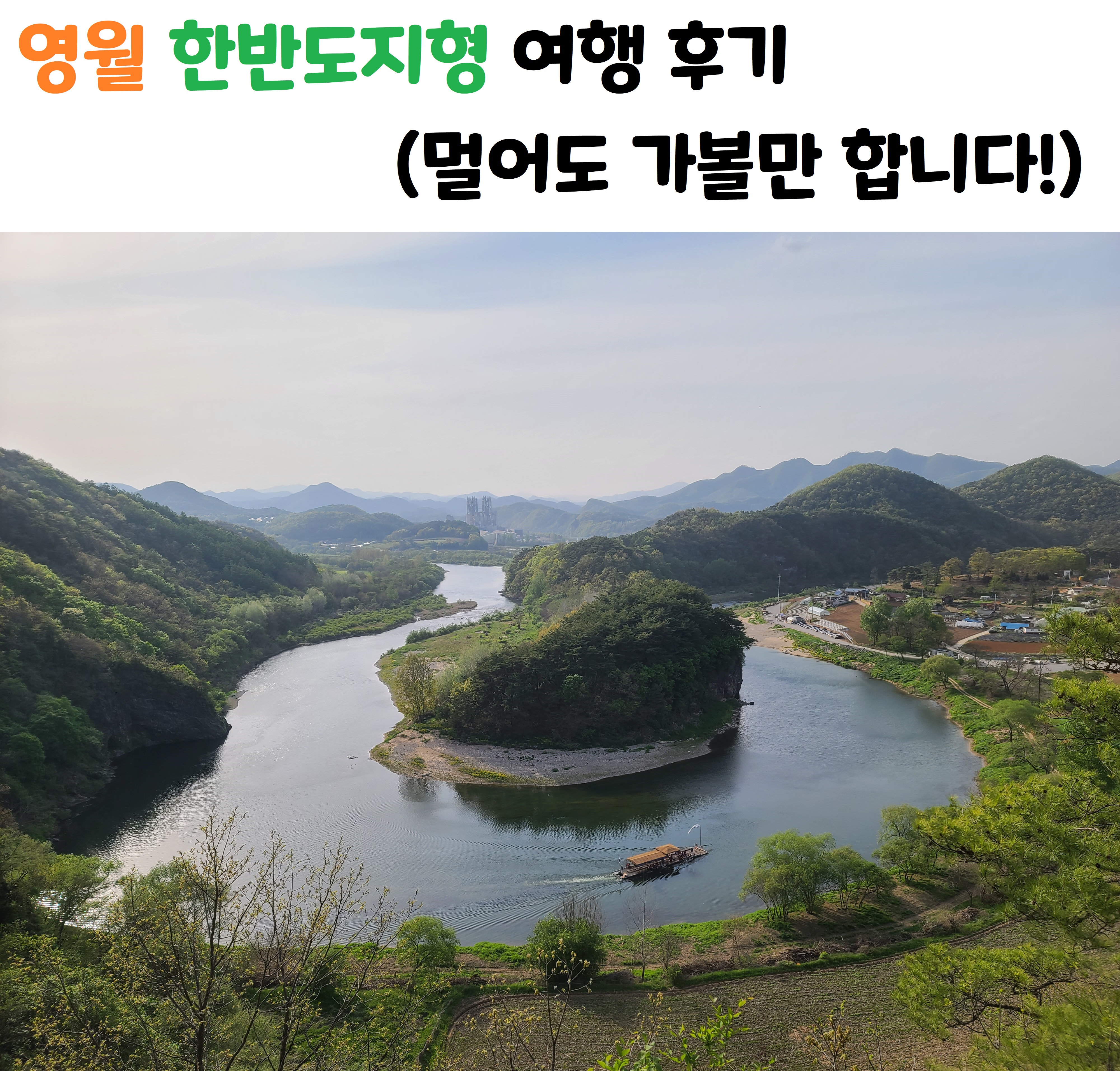
Free Admission from 09:00 to 18:00: Two Things to Check Before Departure
According to publicly available tourism information, the hours are 09:00–18:00, the site is open year-round, and admission is free. Since this is a place where visitors use the observatory and trails rather than a tourist attraction requiring a separate paid ticket, it is best to arrive by the afternoon at the latest so that parking and walking can be completed within the scheduled operating hours.
The listed contact number is 033-370-2531 for a Yeongwol County tourism-related department. The official information source is the Yeongwol County website, and on-site restrictions due to seasonal events, heavy rain, or construction may change. In particular, the Seogang water level and weather can affect riverside access and surrounding plans, so checking Yeongwol County announcements on the day of departure is recommended.
- Hours: 09:00–18:00
- Closed: Open year-round
- Admission: Free
- Inquiries: 033-370-2531
- Parking: Parking is available in the observatory area, with accessible parking spaces indicated
Why You Should Plan Separately for Seonam Village and the Raft Experience
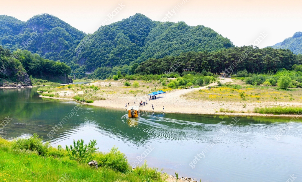
Hanbando Landform is a landscape viewed from the bend of the Seogang in front of Seonam Village. The observatory offers a view of the landform’s overall outline, while the raft experience in the Seonam Village area provides views of the waterway and cliffs from close to the river. Therefore, preparing for only one transfer while treating them as the same destination may result in an impractical route.
Reviews and videos often mention the raft experience together with the landform, but operating status, fares, and operating seasons may vary depending on the season and local conditions. Accordingly, the free-admission information in this article applies to the Hanbando Landform Observatory, while separate operating information must be checked to use the rafts. Travelers who do not plan to participate in riverside activities can see the landform’s essential outline by making only the round trip to the observatory.
Prioritize Daylight Hours When the Outline Is Easy to Read Over Backlighting Around Sunset
The purpose of visiting this site is to read the overall outline known as the “shape of the Korean Peninsula.” The Korea Tourism Organization’s Yeongwol course presents the sunset reflected on the river around dusk as a highlight, but first-time visitors are better off reaching the observatory during daylight, when it is easier to distinguish the eastern and western outlines of the landform and the bends of the waterway.
If visiting solely for photography, bring a lens capable of capturing wide landscapes and follow the basic rule of never stepping beyond the railing. In summer, prepare water and a hat and account for sunlight and insects; in winter, consider the possibility of icy surfaces and wear slip-resistant shoes. Visitors accompanying someone using a stroller or having difficulty with a long uphill walk may find the experience less satisfying because of the slopes and stairs along the viewpoint section.
Following Yeongwol’s Waterways and Exile History Alongside Cheongnyeongpo and Yeongwol Jangneung Within About 15 km
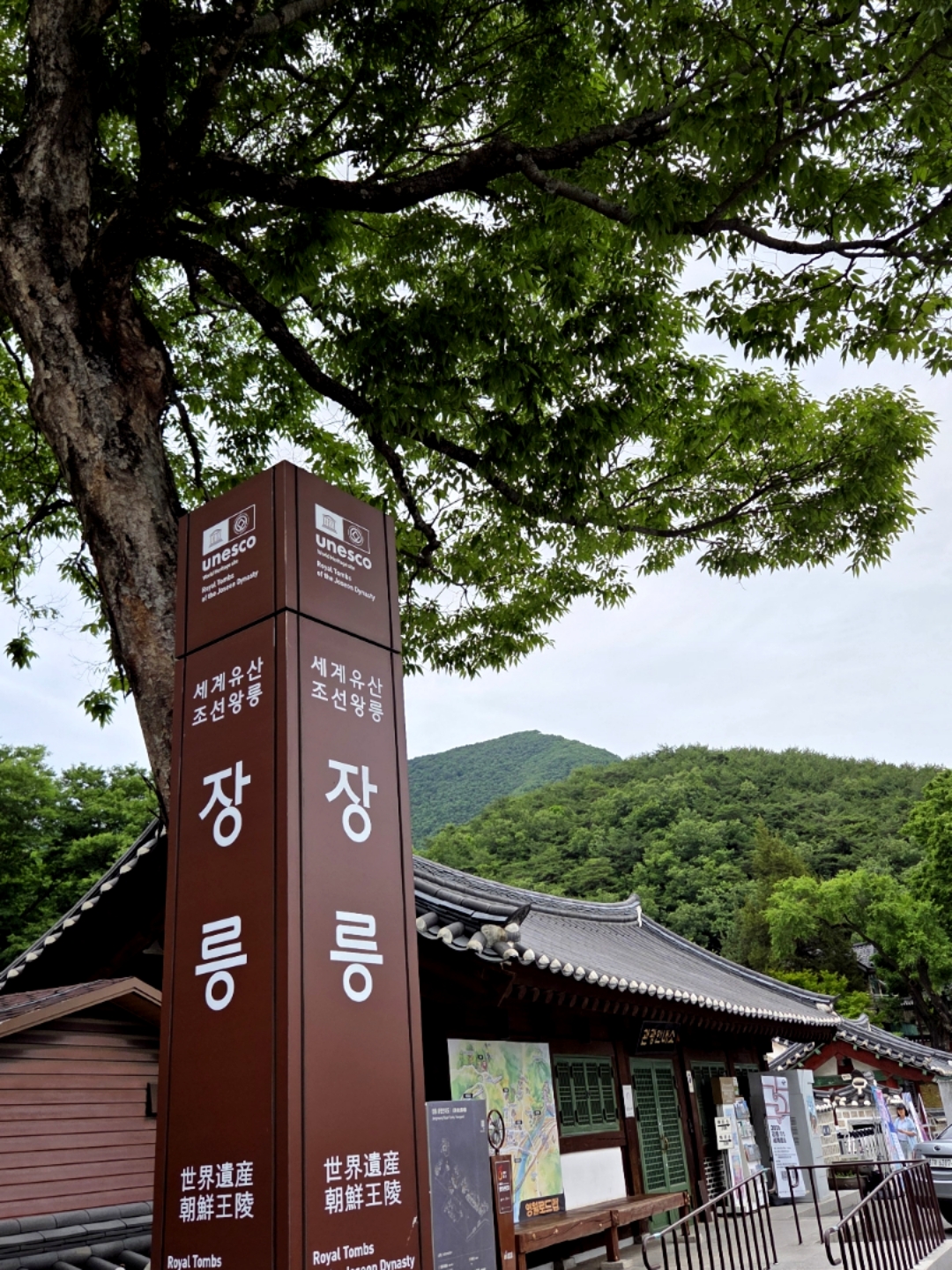
To connect Hanbando Landform with Yeongwol’s history, it is easy to understand the area by visiting Cheongnyeongpo and Yeongwol Jangneung together. Cheongnyeongpo is where Danjong, the sixth king of Joseon, lived in exile, and Yeongwol Jangneung is Danjong’s tomb. The Korea Tourism Organization’s recommended course lists Cheongnyeongpo to Yeongwol Jangneung as 2.4 km and about 3 minutes by car, and Yeongwol Jangneung to Hanbando Landform as 15 km and about 16 minutes by car.
This order involves visiting Danjong’s exile site and tomb first, then moving to Hanbando Landform, created by the Seogang’s long-term erosion. Visiting hours for the historic sites and ferry operations apply separately from Hanbando Landform, so seeing Cheongnyeongpo and Jangneung in the morning and moving to the observatory in the afternoon makes it easier to manage each site’s closing time separately.
Before Visiting by Wheelchair or Stroller, Assess “Convenience Facilities” and “Viewpoint Access” Separately
Accessible Tourism information lists accessible parking, a unisex accessible restroom, a Braille information board, and ramps at the main entrance and along the route. However, it states that wheelchair rental and an automated external defibrillator are not available, so visitors who need mobility aids should bring their own equipment.
No dedicated foreign-language information service was confirmed. Because this is a geopark, visitors who want to read about the landform’s formation should bring a mobile phone capable of translating Korean information boards and a power bank. If someone in the group has difficulty walking, check the slope and ground conditions after arriving at the parking lot before deciding whether to continue to the observatory.
- Accessible parking: Available
- Accessible restroom: Available
- Braille information board: Available
- Wheelchair rental: Not available
- Automated external defibrillator: Not available
Before You Go
- Address
- 555 Hanbando-ro, Hanbando-myeon, Yeongwol-gun, Gangwon Special Self-Governing Province
- Hours
- 09:00–18:00
- Closed
- Open year-round
- Admission
- Free
- Phone
- 033-370-2531
- Official site
- https://www.yw.go.kr/index.jsp
- Transport
- Get off at KTX Yeongwol Station, take Bus 37, then get off at Hanbando Landform Entrance and walk for about 1 minute. Separate from the bus stop, there is an approximately 870 m walking section to the observatory.
- Parking
- Parking is available in the observatory area, with accessible parking spaces.
- Time needed
- About 1 to 1.5 hours for the round trip to the observatory and sightseeing
- Accessibility
- Ramps at the main entrance and along the route, accessible parking, an accessible restroom, and a Braille information board are available. Wheelchair rental and an automated external defibrillator are not available. Foreign-language information was not confirmed.
The information above is current as of the time of writing. Check the official information again before visiting.

Places
Nearby Attractions 4
-
 1
1
-
 2
2
-
 3
3
-
 4
4
Food & Dining 5
-
 5
5
-
 6
6
-
 7
7
-
 8
8
-
 9
9
Events in This Area



Festivals in This Area



![Gyecchon [休] Book & Music Festival](https://kotourlive-images.s3.ap-northeast-1.amazonaws.com/festivals/1785034475211_b0405b05_ecc6a367-4861-4f67-91c1-fd73c11e0052_4.jpg)
More Travel Guides in This Area
 Travel Guide
Danjong’s Place of Isolation, Yeongwol Cheongnyeongpo, Shaped by the Seo River and Yukyukbong
 Travel Guide
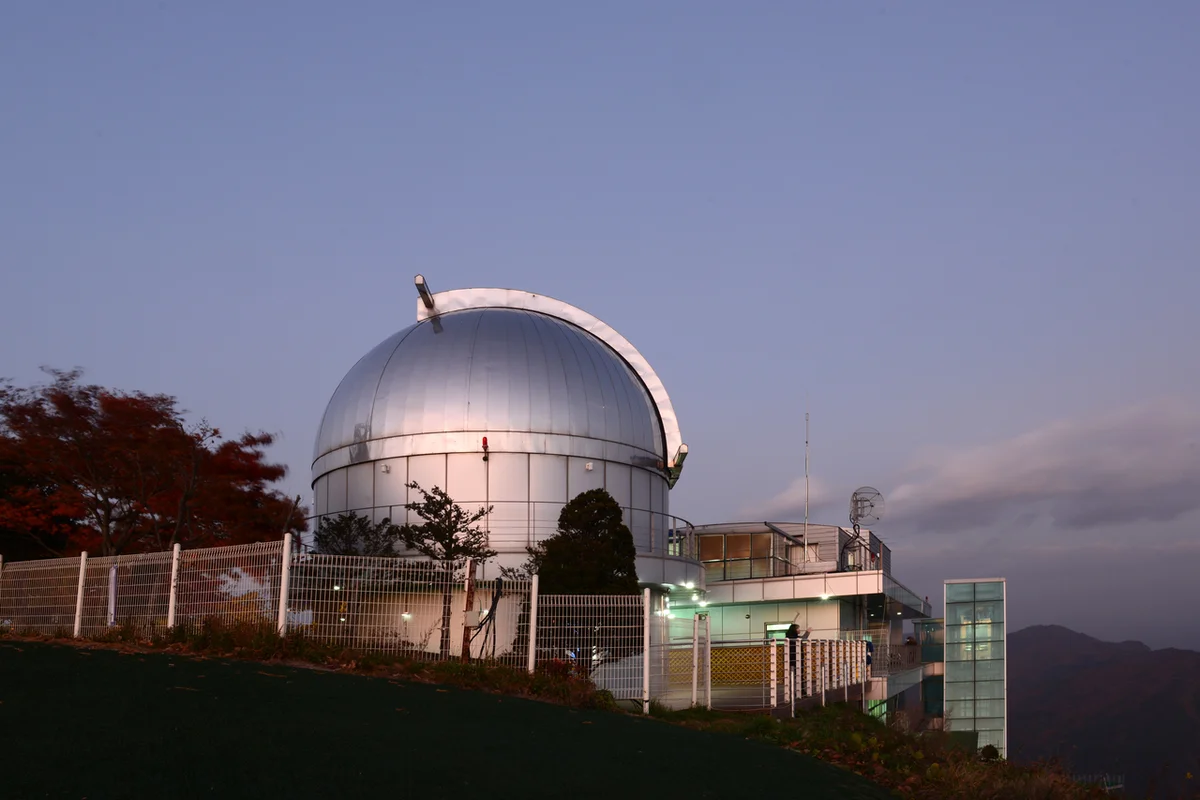
Yeongwol Byeolmaro Observatory, reached by shuttle atop 799.8 m Bongnaesan Mountain
 Travel Guide
A Guide to Jeongseon Arirang Market on the 2nd and 7th, Walking to the Rhythm of the 1966 Market
 Travel Guide
![Han So-hee, Radiant Beauty After Going Blonde… Unmatched Aura [N Shot]](https://kotourlive-images.s3.ap-northeast-1.amazonaws.com/news/1788056981544_83c8b0b3_news_66e33b45-cf84-4724-87d9-d1340820437d.jpg)
![BOYNEXTDOOR’s Sungho selected as the new MC of ‘Show! Music Core’ [Official Statement]](https://kotourlive-images.s3.ap-northeast-1.amazonaws.com/news/1787908108799_a3cc378e_news_9a3cd086-931c-4b58-b977-4a5ac371238a.jpg)
![[Photo] KISS OF LIFE’s Natty Shows Off Her Glamorous Figure](https://kotourlive-images.s3.ap-northeast-1.amazonaws.com/news/1787908133694_557864f4_news_016e92e2-55c1-4838-9702-eb03b2ad56ec.jpg)
![Hyeri “Cute Wink” [★Photo]](https://kotourlive-images.s3.ap-northeast-1.amazonaws.com/news/1787908093800_c9b7529f_news_9274613b-0b8f-4076-a430-25a1545a679d.jpg)